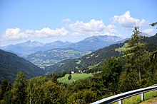
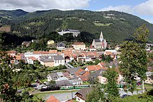
Stolzalpe (mountain group)
| Pride alpe | |
|---|---|
| Highest peak | Stolzalpe ( 1817 m above sea level ) |
| part of | Murau Mountains , Noric Alps (also: Murberge / Schladminger Tauern , Niedere Tauern ) |
| Classification according to | Trimmel 2745 |
| Coordinates | 47 ° 9 ' N , 14 ° 11' E |
| surface | 150 km² |
| particularities | Stolzalpe and Pleschaitz massifs |
The Stolzalpe mountain group is located in the Upper Mur Valley , Styria .
Location and landscape

The mountain group includes the mountains north of Murau , between the Mur valley and the Murparalleltal . They are medium - mountain, island mountain- like mountain stocks that lie between the main ridge of the Niedere Tauern in the north and the Gurktal Alps in the south. The side valleys of the Mur line here in an easterly to south-easterly direction. The group stretches east – west from the Wölztal upstream of the Mur to the Krakau valley , and thus has an extension of almost 30 kilometers, north – south up to 10 km.
Classification, demarcation and neighboring mountain groups
In the mountain group breakdown according to Trimmel , the group has the number 2745, is counted among the Murau mountains (2740), and from Trimmel - for geological reasons - it is already assigned to the Noric Alps (2700; this term includes the mountains from the Nockberge to the West Styria), not to the Lower Tauern (Trimmel 2600).
The group forms a section of the Murberg Mountains . Orographically, it forms part of the Schladminger and Wölzer Tauern , two east-west sections of the Niedere Tauern on both sides of the Sölkpass .
It circumscribes itself:
- in the northwest from Rantenbach near Krakaudorf (approx. km 18) - Scharnigl (saddle approx. 1200 m ) - Künstenbach / Schöderbach via Schöder to the confluence with the Knallstein group (2626, Schladminger Tauern der Niederen Tauern)
- in the north Katschbach to St. Peter am Kammersberg - Kammersberger Höhe (approx. 1060 m above sea level ) - Eselsbergbach to Oberwölz to the Schoberspitze group (2631, Wölzer Tauern of the Niedere Tauern)
- in the northeast of Wölzerbach to the confluence ( 735 m ) with the Mur near Niederwölz / St. Lorenzen to the Bocksruck group (2632, Wölzer Tauern)
- in the southeast of the Mur up to Teufenbach to the Zirbitzkogel group (2763, Seetal Alps )
- in the south of the Mur continue to the mouth of the Laßnitzbach east of Murau / St. Egidi to the group of Kuhalm ( Kuhalpe , 2742)
- in the southwest of Mur continue to Murau to the Prankerhöhe group (2741)
- in the west Rantenbach from the mouth to the Seebach tributary to the Gstoder group (2744)
- in the west of Rantenbach to Krakaudorf to the Preber group (2624, Schladminger Tauern)
Outline and summit
The group is cut into two parts by the Katschbach, which comes from the Sölkpass:
- The eastern part is the Pleschaitz massif (main summit 1797 m above sea level ) between Wölz - and Katschtal , with Eichberg ( 1436 m above sea level ) and Kammersberg ( 1114 m above sea level ) as foothills towards the valley
- The western part is the Stolzalpe massif (main summit 1817 m above sea level ) between Katsch and Rantental , with Nickelberg ( 1528 m above sea level ), Staberkogel (Freiberg, 1468 m above sea level ) and Krakaudorfer Kalvarienberg ( 1306 m above sea level )
Both groups are divided by flat valley and high valley passes, which merge in the west into the wide high valley of Krakow. The two saddles that separate the group from the Niedere Tauern (Scharnigl and Kammersberger Höhe) are orographically inconspicuous pass landscapes .
geology
The group includes rocks that do not belong to the old crystalline of the Central Alps , but rather metamorphic Old Paleozoic of the Gurktal Nappe of the Upper Eastern Alps ( Murau Paleozoic ) . The Gurktal ceiling is divided into the lower Murau ceiling and the Stolzalp ceiling above . It is metamorphic overprinted sediments , such as carbonates ( Pleschaitzkalk , Murauer lime Murau and at Staber Kogel, Devon), phyllite (at Katsch, Staber Kogel), and basic volcanic rocks , such as diabase (Metadiabas of Ordovician-Silurian the Stolzalpe).
The Murau Paleozoic is trough-shaped above the old crystalline of the Middle Eastern Alps , which is found in the form of mica slate ( Wölzer crystalline : garnet- mica slate on the eastern flank of the Pleschaitz, Staberkogel; black mica slate Eichberg – Kammersberg, northern roof of the Stolzalpe). Murau limestone is also deposited here.
The Murparalleltal is part of the Noric Depression . These like the Mur-Mürz furrow are distinctive tectonic fault lines . They were overprinted by the Murtal Glacier .
Individual evidence
- ↑ Lukas Plan, Association of Austrian Cave Researchers: Verbal description of the delimitation of the subgroups of the Austrian cave directory. Status: Jan. 8 2008 ( pdf , hoehle.org, accessed 2012).
- ↑ a b The verbal description here gives Etrachbach from the Seebach confluence, this begins after ÖK / HZB a little above.
- ↑ Before that, Dorfer Bach river crossing near Krakaudorf, orographically insignificant.
- ↑ A. Thurner: Geology of the Stolzalpe near Murau. In: Mitt. Naturwiss. Association for Styria , Volume 64/65, Graz 1929; 2.4 Metamorphic Old Paleozoic of the Stolzalpendecke , pp. 55–58.
- ^ Franz R. Neubauer: The geology of the Murauer area - research status and problems. In: Mitt. Abt. Geol. Palaont. Bergb. Landesmus. Joanneum Heft 41, Graz 1980, pp. 67–79 ( article pdf , opac.geologie.ac.at).

