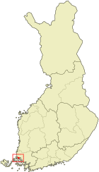
Taivassalo
| coat of arms | map |
|---|---|

|

|
| Basic data | |
| State : |
|
| Landscape : | Varsinais-Suomi |
| Administrative community : | Vakka-Suomi |
| Geographical location | 60 ° 34 ′ N , 21 ° 36 ′ E |
| Surface: | 217.67 km² |
| of which land area: | 140.44 km² |
| of which inland waterways: | 1.64 km² |
| of which sea area: | 75.59 km² |
| Residents : | 1,662 (Dec 31, 2018) |
| Population density : | 11.8 inhabitants / km² |
| Municipality number : | 833 |
| Language (s) : | Finnish |
| Website : | taivassalo.fi |
Taivassalo [ ˈtɑi̯ʋɑsˌsɑlo ] ( Swedish. Tövsala ) is a municipality on the southwest coast of Finland . Taivassalo is the landscape Finland Proper 40 km from Turku center. The municipality extends over an area of 218 km², of which 140 km² is land. Taivassalo also includes over 180 archipelagos in addition to the municipal area on the mainland . The length of the coastline is over 300 kilometers.
Many of Taivassalo's 1,778 residents commute to Turku for work. In addition, there is fishing and granite is mined. In summer, the population of the municipality quadruples due to the large number of holiday guests. The Church of Taivassalo was built in the period 1425-1440. Like the Holy Cross Church of Hattula, it is one of the Holy Cross Churches ( Finnish Pyhän Ristin kirkko ) in Finland and, like this one, is worth seeing in terms of art history because of its frescoes , which were not destroyed during the Reformation, but only painted over and have now been restored.
Villages
Ahainen, Hakkeenpää, Halesmäki, Helsinki, Hilloinen, Huitila, Hurunkorpi, Huukanen, Hylkilä, Hyövelä, Inkeranta, Isokorpi, Isosärkilä, Järppilä, Järvenperä, Kahiluoto, Kaitainen, Karhiluoto, Kaitainen, Kurhäsula, Kaummiustio, Koivetjäsula, Kouvetarsalouila, Koivetarsalouila, Kouvetarsala Kyrö, Lahdenperä, Leikluoto, Lemmetyinen, Lempoinen, Liittinen, Marjunen, Mierla, Mussalo, Onnikmaa, Palai, Pallila, Paltvuori, Punttinen, Rouhu, Rytsälä, Sannainen, Santala, Sarsala, Taipale, Tammisto, Toroinen, Tuainen, Tuainoupa Uskainen, Uurna, Vainionperä, Vehanen, Viianen, Vuorenpää, Vuorte, Vähäsärkilä.
Individual evidence
- ↑ Maanmittauslaitos (Finnish land surveying office): Suomen pinta-alat kunnittain January 1, 2010 . (PDF; 199 kB)
- ↑ Statistical Office Finland: Table 11ra - Key figures on population by region, 1990-2018
