Pöytyä
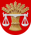
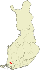
| coat of arms | map |
|---|---|

|

|
| Basic data | |
| State : |
|
| Landscape : | Varsinais-Suomi |
| Administrative community : | Loimaa |
| Geographical location | 60 ° 46 ′ N , 22 ° 40 ′ E |
| Surface: | 773.81 km² |
| of which land area: | 750.14 km² |
| of which inland waterways: | 23.67 km² |
| Residents : | 8,333 (Dec 31, 2018) |
| Population density : | 11.1 inhabitants / km² |
| Municipality number : | 636 |
| Language (s) : | Finnish |
| Website : | poytya.fi |
Pöytyä [ ˈpœy̯tyæ ] is a municipality in southwest Finland with 8333 inhabitants (as of December 31, 2018).
Pöytyä is located in the Varsinais-Suomi countryside 44 kilometers northeast of Turku. The municipality has an area of 773.8 square kilometers (of which 23.7 square kilometers inland water). Pöytyä is located on the upper reaches of the Aurajoki River. The Yläneenjoki flows through the western part of the municipality and flows into Lake Pyhäjärvi . Pöytyä has three settlement centers ( taajama ): Kyrö, Riihikoski and Yläne.
Pöytyä was first mentioned in 1319. In 2005 the municipality of Karinainen was incorporated, followed by the incorporation of Yläne in 2009 .
Sons and daughters of the church
- Jalmari Eskola (1886–1958), Finnish cross-country runner, Olympic competitor 1912
Web links
Commons : Pöytyä - collection of images, videos and audio files
Individual evidence
- ↑ Maanmittauslaitos (Finnish land surveying office): Suomen pinta-alat kunnittain January 1, 2010 . (PDF; 199 kB)
- ↑ Statistical Office Finland: Table 11ra - Key figures on population by region, 1990-2018