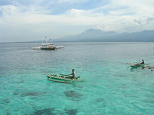
Tanon Street
| Tanon Street | ||
|---|---|---|
| View of Tanon Straits from Cebu Island | ||
| Connects waters | Visayas lake | |
| with water | Boholsee | |
| Separates land mass | Negros (Philippines) | |
| of land mass | Cebu (Philippines) | |
| Data | ||
| Geographical location | 10 ° 12 ' N , 123 ° 24' E | |
|
|
||
| length | 280 km | |
| Smallest width | 8 kilometers | |
| Greatest depth | 509 m | |
| Coastal towns | Toledo City , San Carlos City , Bais City | |
| Islands | Sipaway , Badian Island, Green Island | |
The Tanon Strait (also Tañon Strait) is a strait in the Philippine archipelago and connects the Visayan Sea in the northeast with the Boholsee in the southwest.
geography
The Tanon Strait separates the island of Negros in the west from the island of Cebu in the southeast . It covers an area of 3,995 km² and has a coastline of 452.7 km. There are few islands in the Strait, such as Sipaway Island , and its greatest depth is 509 meters below sea level. The coasts of both islands are relatively straight, with no large sea bays, such as Bais Bay , which cut deeper into the land mass. The road is approx. 280 km long, at its southern end it is over 8 km, at its northern end 40 km wide. The southern border of the Tanon Strait to the Strait of Cebu is the strait between the two places Dumaguete City and Santander . The northern border is the line between San Remigio and Sagay City .
ecology
The Tanon Strait is an important marine sanctuary for whales , whale sharks and dolphins . The Strait of the Sea is an important passage for whale sharks on their way to Tayabas Bay and the Ragay Gulf . Rare marine mammals such as the small sperm whale ( Kogia simus ) and the broad-billed dolphin ( Peponocephala electra ) live in the strait . The marine reserve is known as Tanon Strait Protected Landscape / Seascape and extends to Bantayan Island . The nautilus is said to still occur in the waters. Due to the very straight coast of the Tanon Strait, only 6.5 km² of mangrove forests cover the coastal fringes, the largest area is in Bais Bay and is under nature protection as the Talabong Mangrove Reserve . Coral reefs cover an area of 188.2 km² in the strait and are popular diving waters, such as around the islands of Badian Island and Green Island. Some of them are protected areas like in Ginatilan .
Economical meaning
The Tanon Strait is an important strait vessel traffic from Dumaguete City in the region Western Visayas and the island of Luzon . It is of great importance for local fisheries and aquacultures have been established on an area of 2.9 km². Tourism is limited to a few places along the coast, boats for whale watching can be rented in Bais City , for example .


