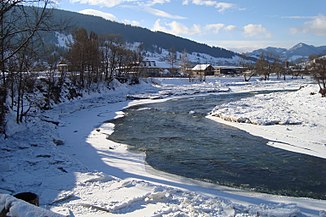
Cheremosh
|
Cheremosh Черемош, Чере́мош, Черемошель, Ceremuş |
||
|
Cheremosh near the village of Rostoky |
||
| Data | ||
| location | Ivano-Frankivsk Oblast , Chernivtsi Oblast ( Ukraine ) | |
| River system | Danube | |
| Drain over | Prut → Danube → Black Sea | |
| confluence | from Tschornyj Tscheremosch and Bilyj Tscheremosch near Usteriky , Verkhovyna Raion 48 ° 7 ′ 10 ″ N , 24 ° 59 ′ 32 ″ E |
|
| muzzle | near Nepolokiwzi , Rajon Kizman in the Prut coordinates: 48 ° 22 '44 " N , 25 ° 37' 14" E 48 ° 22 '44 " N , 25 ° 37' 14" E
|
|
| length | 80 km | |
| Catchment area | 2560 km² | |
| Discharge at the gauge below the confluence of the two source rivers |
MQ |
26.6 m³ / s |
| Right tributaries | Putyla | |
| Small towns | Vyshnytsia , Vashkivtsi , Kuty | |
| Communities | Holoschyna (Verkhovyna) , Holoschyna (Putyla) , Ust-Putyla , Marynytschi , Biloberiska , Kuty , Stari Kuty , Tschornohusy , Ispas , Kobaky , Banyliw , Sloboda-Banyliw , Chortoryja , Sawallja , Nepolokiwzi | |
|
Tschornyj Tscheremosch Чо́рний Чере́мош, Чёрный Черемош |
||
| Data | ||
| location | Ivano-Frankivsk Oblast ( Ukraine ) | |
| River system | Danube | |
| Drain over | Cheremosh → Prut → Danube → Black Sea | |
| source | in the Eastern Carpathians 47 ° 46 ′ 0 ″ N , 24 ° 51 ′ 31 ″ E |
|
| Union | with Bilyj Cheremosch to Cheremosh 48 ° 7 ′ 10 ″ N , 24 ° 59 ′ 32 ″ E
|
|
| length | 87 km | |
| Catchment area | 1680 km² | |
| Right tributaries | Richka | |
| Small towns | Verkhovyna | |
| Rafting | ||
|
Bilyj Cheremosh Білий Черемош, Белый Черемош |
||
| location | Ivano-Frankivsk Oblast , Chernivtsi Oblast ( Ukraine ) | |
| River system | Danube | |
| Drain over | Cheremosh → Prut → Danube → Black Sea | |
| source | in the Eastern Carpathians 47 ° 47 ′ 10 ″ N , 24 ° 56 ′ 37 ″ E |
|
| Union | with Tschornyj Tscheremosch to Tscheremosch 48 ° 7 ′ 10 ″ N , 24 ° 59 ′ 32 ″ E
|
|
| length | 51 km | |
| Catchment area | 632 km² | |
The Cheremosh (German also Czeremosch or Czeremosz , Ukrainian Черемош ; Russian Чере́мош, Черемошель ; Polish Czeremosz ; Romanian Ceremuş ) is a right tributary of the Prut in western Ukraine in the Ivano-Frankivsk Oblast and Oblast .
The river is created by the confluence of the Chornyj Cheremosh (left, "Black Cheremosh") and Bilyj Cheremosh (right, "White Cheremosh") in the village of Usteriky and then flows in a north-easterly direction as a border river between the Ivano-Frankivsk Oblast on the left and the Chernivtsi Oblast right side. It flows through the places Kuty , Wyschnyzja and Waschkiwzi and finally flows into the Prut at the urban-type settlement Nepolokiwzi .
The length of the river is 80 kilometers, the entire catchment area covers 2560 km².
The Cheremosh forms one of the historical borders between Galicia and Bukovina , between 1919 and 1939 the river formed the border between Romania and Poland.
On the Chorny Cheremosh be rafting -tours offered. The level of difficulty is 2-3.

