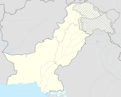
Turbat
|
Turbat تُربت |
||
| State : |
|
|
| Province : | Balochistan | |
| Coordinates : |
26 ° 0 ' N , 63 ° 3' E
|
|
| Height : |
129 m
|
|
| Residents : | 214,000 (2017) | |
| Time zone : |
PST ( UTC + 5 )
|
|
|
|
||
Turbat ( Urdu تُربت) is a city in southwestern Balochistan Province , Pakistan . Turbat is the administrative seat of the Kech district and, with more than 200,000 inhabitants, is the second largest city in the province after Quetta .
Geographical location
Turbat is located in the southwest of the province in the desert region of Makran and was the administrative seat of the Makran Division until the dissolution of the third administrative level of Pakistan in 2000. The city is located on the south bank of the river Ketsch , which runs here from east to west , which joins about 40 km further west at the northern end of the Mirani reservoir with the "Nihing Kaur" coming from the west, both of which now go south through the reservoir and from there rise to the Arabian Sea draining Dascht . The valley of the Ketch is bordered along its north side by the mountain chain of the Central Makran Range , the peaks of which are up to 3000 m high.
Transport links
Turbat is a little off the sides lane highway M-8 (Ratodero-Gwadar-Motorway) by Hoshab runs east along the north bank of the ketch, the river then about 10 km west of Turbat crossing and from there south to the coast Makran Coastal Highway ( national road N-10 ) running along the Arabian Sea . From the M-8 to the city it is about 15 km on the Mand Road with its bridge over the ketch immediately north of the city or around 12 km on the Mirani Dam Road, that from the west and the local M-8 bridge over the ketch leads to Turbat. Via the M-8 and the N-10, it is about 160 km to Gwadar , located southwest of the Arabian Sea . To the southeast on the coast, Pasni is 125 km via Turbat-Pasni-Road, and to Hoshab in the east it is 115 km via M-8. Karachi is around 450 km to the east, Quetta around 700 km to the northeast (as the crow flies).
The Airport of Turbat ( IATA code TUK) located immediately southwest of the city. It is served by Pakistan International Airlines , with flights to Karachi, Quetta, Gwadar and Dalbandin in Pakistan and to Abu Dhabi , Sharjah and Muscat on the Arabian Peninsula . The connections to Oman and the UAE primarily serve the many Baluch people who work there .
Population development
The population has increased enormously, especially since the turn of the 21st century:
| year | 1972 | 1981 | 1998 | 2017 |
| Residents | 27,671 | 52,337 | 68,603 | 213,557 |
economy
The local economy is based on the processing and marketing of the agricultural products produced in the valley of the Ketsch, partly with the help of irrigation . Turbat is particularly well-known as a transshipment point for the dates produced in the area and is also the location of a factory for date processing. Other important products in the area are sorghum , barley , wheat and rice, as well as cattle, goats and sheep.
climate
In Turbat there is a pronounced desert climate, referred to as "BWh" in the Köppen and Geiger climate classification . The annual rainfall is only 123 mm and average maximum temperatures reach 44.4 degrees Celsius in June .
| Turbat | ||||||||||||||||||||||||||||||||||||||||||||||||
|---|---|---|---|---|---|---|---|---|---|---|---|---|---|---|---|---|---|---|---|---|---|---|---|---|---|---|---|---|---|---|---|---|---|---|---|---|---|---|---|---|---|---|---|---|---|---|---|---|
| Climate diagram | ||||||||||||||||||||||||||||||||||||||||||||||||
| ||||||||||||||||||||||||||||||||||||||||||||||||
|
Average monthly temperatures and rainfall for Turbat
Source: en.climate-data.org
|
||||||||||||||||||||||||||||||||||||||||||||||||||||||||||||||||||||||||||||||||||||||||||
After heavy rains such as the occasional huge winter rainstorms or when a cyclone rains over Makran, the ketch, like all mountain streams and rivers in Balochistan, can quickly mutate into a torrential, flood-leading river and overflow its banks. Turbat and other settlements in the Ketch Valley were largely flooded in June 2007 when cyclone “Yemyin” swept over Makran, and thousands had to leave their homes.
history
Turbat was the capital of the princely state of Makran, founded in the 18th century , which was under British sovereignty from 1876 to 1947 and formally joined Pakistan on March 17, 1948 after the division of British India in 1947 and the simultaneous establishment of Pakistan. The Nawab of Makran resided in the near Shahi Tump, immediately west of the city. When the princely state was dissolved in October 1955 in the course of the formation of the province of West Pakistan, Turbat became the administrative seat of the Makran district. With the administrative reform of 1970 Turbat remained within the province of Baluchistan the administrative seat of the district, which was renamed the Makran Division in 1977. Since the administrative reform of 2000, in which the divisions were eliminated, Turbat has been the seat of the Kech district.
Footnotes
- ↑ http://www.citypopulation.de/Pakistan-Balochistan.html
- ↑ Turbat in en.climate-data.org
- ↑ 250,000 in distress: Turbat situation critical Mirani Dam in danger , Dawn, Pakistan
- ^ Election Commission of Pakistan: Divisions / Districts of Pakistan
