Our Lady Churchyard
| Our Lady Churchyard | |
|---|---|
| Place in Bremen | |
 View of the Liebfrauenkirche from the west southwest, from Obernstrasse |
|
| Basic data | |
| city | Bremen |
| district | Bremen-center |
| Created | 13th century |
| Newly designed | after 1813, around 1890, after 1946 |
| Confluent streets | Sögestraße , Katharinenstraße, Domshof , Bremen market square , Hakenstraße, Obernstraße |
| Buildings | Liebfrauenkirche , Moltke monument |
| use | |
| User groups | Pedestrian traffic , bicycle traffic , public transport |
| Space design | Marcus fountain |
Our Lieben Frauen Kirchhof is a central square in Bremen between the Bremen market square , Obernstrasse , Sögestrasse and the Domshof . The square is used as a flower market. The design of the square is quite uniformly characterized by the materials sandstone (including church) and dark brick (including town hall) or clinker .
history

To the left of the center in front the market square , behind it the town hall and to the left of it the (old) stock exchange , behind both our Church of Our Lady with churchyard. To the right of this, the bishop's palace protrudes into the (large) cathedral courtyard . On its right front corner the cathedral and in front of its west facade the fenced-in Small Domshof, in front of it the Wilhadikapelle , which has now disappeared . Right in front of the cathedral is the Domsheide .

The square takes its name from the second oldest church in Bremen, the Gothic Liebfrauenkirche from the Middle Ages. The square was shaped by the parish church.
The cemetery was next to the church until the end of the 13th century. The first Bremen town hall from the 13th century was located on the west side, on the corner of Obernstraße and Sögestraße and the square. During this time, the square increasingly served as a marketplace, and the Liebfrauenkirche was the market church. With the new construction of the town hall around 1405, the Bremen market also relocated. In the 17th century the old stock exchange stood on the south side of today's Obernstrasse ; at first it was just a covered, plain surface over a wine cellar. In 1687, a one-story building in the style of the Baroque style, which is still unusual in Bremen, was built above the basement according to plans by the Bremen councilor Jean Baptiste Broëbes, who had fled Paris . From 1734 to 1736, a second floor followed according to plans by Giselher von Warneck .
After the old graves were kept in the small church cemetery around 1813, the area increased so that the Bremen Freimarkt could also take place here in the 19th century . In Old Stock Exchange, the first was in 1825-1845 Comptoir of the Sparkasse Bremen . In 1888 the old stock exchange burned down.
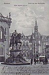
The Kaiser Wilhelm Memorial was erected here in 1890/93 , which was used around 1942 - like many other monuments - as a metal donation for armaments. The square was now called Kaiser-Wilhelm-Platz until 1919 .
Today the square is bordered by shops and commercial buildings in the west and north; to the east is the Liebfrauenkirche with the rectory. The decagonal Marcus Fountain , donated by Mayor Marcus, was inaugurated on the square in November 1909 . In 1909 the Moltke memorial for Helmuth von Moltke was attached to the Liebfrauenkirche .
The east side is bounded by the New Town Hall , which was built on the grounds of the old bishop's palace according to plans by Gabriel von Seidl in the neo-renaissance style and inaugurated in 1913.
Today there are two food stalls on the square - just next to the area of the Old Stock Exchange.
Monument protection
The entire system with the following buildings is a listed building :
- The ensemble of houses 6, 8–15, 17–24, 26–30
- The Liebfrauenkirche from 1230
- The Marcus Fountain from 1909
- Kirchhof 6: German National Bank from 1896
- Kirchhof 15: Commercial building from around 1900
- Kirchhof 17: Herms office building from 1909
- Kirchhof 26: Haus Rohlandseck residential and commercial building from 1914 and 1959
→ See the list of cultural monuments in Bremen-Mitte
Individual evidence
Coordinates: 53 ° 4 ′ 37 ″ N , 8 ° 48 ′ 27 ″ E


