Lower Pulsnitz valley
|
Lower Pulsnitz valley
|
||
|
Lower Pulsnitz Lowland Nature Reserve (August 2008) |
||
| location | Brandenburg , Germany | |
| surface | 6.67 km² | |
| Identifier | 1375 | |
| WDPA ID | 378373 | |
| Geographical location | 51 ° 25 ' N , 13 ° 33' E | |
|
|
||
| Setup date | May 31, 2006 | |
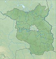
The nature reserve Untere Pulsnitzniederung is located in the Elbe-Elster district in Brandenburg .
The area with the identification number 1375, which consists of two sub-areas, was placed under nature protection by ordinance of May 4, 2006 . The approximately 667 hectare nature reserve extends north and northwest of the core town of Val Gardena and north and south of the Pulsnitz . The B 101 runs to the west, the L 592 state road to the east and the L 59 to the south. The Schwarze Elster flows to the north, and the state border with Saxony runs not far to the southwest .
See also
- List of nature reserves in the Elbe-Elster district
- Schraden (landscape) #Nature reserves in the Schraden
Web links
Commons : Untere Pulsnitzniederung - Collection of pictures, videos and audio files
- World Database on Protected Areas - Untere Pulsnitzniederung (English)
- Ordinance on the "Untere Pulsnitzniederung" nature reserve of May 4, 2006 at bravors.brandenburg.de, accessed on October 21, 2019


