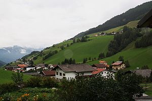
Unterweg (municipality of Navis)
|
On the way locality ( capital of the municipality )
|
||
|---|---|---|
|
|
||
| Basic data | ||
| Pole. District , state | Innsbruck-Land (IL), Tyrol | |
| Judicial district | Innsbruck (country) | |
| Pole. local community | Navis ( KG Navis) | |
| Coordinates | 47 ° 7 '49 " N , 11 ° 32' 24" E | |
| height | 1300 m above sea level A. | |
| Residents of the village | 380 (January 1, 2020) | |
| Building status | 117 (2001) | |
| Post Code | 6143 | |
| prefix | + 43/5278 | |
| Statistical identification | ||
| Locality code | 16523 | |
| Counting district / district | Navis (70333 000) | |
 On the way (out of the valley from Navis : Kohlstatt , behind Kopfers , above Oberweg ) |
||
| official capital of the municipality Source: STAT : index of places ; BEV : GEONAM ; TIRIS |
||
Unterweg im Navistal in North Tyrol is a village in the municipality of Navis in the Innsbruck-Land district , in the state of Tyrol .
geography
The village is around 1300 m above sea level. A. and is spread over three kilometers. The local area includes around 120 buildings with around 430 residents in the localities of Koatzet , Kopfers , Kohlstatt and the village of Navis (village) itself - Unterweg is the official statistical capital of the municipality.
The local area also includes the alpine pastures in Weitichbachtal , the Weirichalm , the Blasigleralm, Blasigleralm-Hochleger, Stoffenalm and Möslalm towards the Hohe Warte ( 2398 m above sea level ), Weirichalm-Oberleger and Poltenalm on the Weirichegg, and the Stroblalm on the southern slope of the Mislkopfs ( 2623 m above sea level ), and the Klammalm in the Klammbachtal under the Knappenkuchl .
- Neighborhoods
| Oberweg | ||
| Out of the way |

|
|
Place name
The place name is literal: A road runs from Matrei into Navisertal, today's Naviser Landesstraße L 228, as a high-altitude path that bypasses the Hölltal , the outer valley floor. It separates at Bacher (Wegscheid) , leads to the bottom of the valley at Navis , rises again towards the Hintertal at Häuserer , and then returns as a high-altitude trail to Bacher. The localities on the three sections are called Ausserweg , Unterweg and Oberweg .
Individual evidence
- 70333 - GPS. Community data, Statistics Austria .
- ↑ Navis Unterweg + Oberweg Kerschbaumsiedlung , Photo, navis.tirol.gv.at
- ↑ Klamm Alm , Photo, haben.at
- ↑ See Navis inwards , view out of the valley , Navis in summer - a beautiful valley (Unterweg and Oberweg), Navis in summer - a beautiful valley (by Häuserer / Grün), photos, navis.tirol.gv.at

