
Calanca valley


The Calancatal (Italian and Lombard language Val Calanca ) is a tributary of the Misox . The five municipalities in the Calanca Valley belong to the Moesa region .
Like the Misox , the Puschlav , the Bergell and the village of Bivio on the Julier Pass, the Calanca valley is part of the Italian-speaking area of the canton of Graubünden .
geography

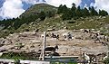
The Calanca valley begins at Grono (332 m above sea level) and runs parallel to the Misox in the east and the Ticino Riviera in the west, 27 km north to the highest point, the Puntone di Fracion (3202 m above sea level). The Calancasca , which flows into the Moësa at Grono, flows in the valley floor . The climate in the lower part is rather mild with chestnut trees, further up it becomes very alpine. Rockslides are part of the history of the wild valley. The causes are the sloping foliation of the rocks on the slopes and the calancasca, which erodes parts of the valley floor and thus destabilizes the rock masses. In June 2007, 400,000 cubic meters of rock fell into the valley near the Arvigo quarry. Around 400 people in the rear valley were trapped because the only road had to be closed.
history
The valley was populated from the north (San Bernardino, Misox) because it had no passable access in the south. The name Calanca (sloping, steep) refers to Ligurian immigrants (approx. 8th century BC ). The initially scattered farm settlements were given up with the transition to alpine farming based on the division of labor. From the 15th century, individual villages formed where the population carried out complex work together (community work). This included creating and maintaining water pipes and alpine paths, clearing the alpine pastures of stones and rubble, accompanying and tending the cattle on the various alpine levels, the production of alpine cheese, etc.
Since the 12th century, the Calanca valley with the Misox belonged to the rule of the von Sax (de Sacco) who resided in the castle Mesocco . In 1480 the rule passed to the Milanese Count Trivulzio . In 1496 the valley community joined the Gray Bund as a protective alliance together with the Misox . At this time there was a spirit of optimism in the small Alpine republic of the Three Leagues . In addition to the republican sovereignty of full political maturity, the Reformation also wanted liberation from the supremacy and political participation of the Catholic Church.
In 1549 the Calanca valley gained its political independence through the ransom of Trivulzio. With the cantonalization in 1851 and the division into eleven political communities, the Calanca valley lost part of this independence.
Most recently (2005) the Calanca valley hit the headlines as part of the so-called emptying strategy of the New Regional Policy. A study by Basel architects believes that giving up “unprofitable” mountain areas would be financially advantageous. However, critics such as the Organizzazione Regionale della Calanca point to the diverse tasks of the peripheral valleys in the interests of the entire country (recreational space for urban populations, production of renewable energies, water reserves, protection from natural hazards such as flooding of deeper valleys, etc.).
Until 2015, all municipalities in the Calanca valley belonged to the district of Calanca (Circolo di Calanca). Together with Misox County and Roveredo County, these belonged to the Moesa District , which was replaced by the Moesa Region in 2016.
population
With Arvigo as the main town, the villages of the Calanca Valley are grouped into five political communities (order from south to north):
- Castaneda
- Sta. Maria
- Buseno including Molina
-
Calanca , merged in 2015 with:
- Arvigo including Landarenca (merger 1980)
- Braggio
- Selma
- Cauco including Bodio
- Rossa incl. Augio and Sta. Domenica (merger 1982)
The Calanca valley has had a decreasing population since 1733. Attempts to stop depopulation have resulted in stabilization in recent years.
| Population development | |||||||
|---|---|---|---|---|---|---|---|
| year | 1733 | 1773 | 1850 | 1950 | 1990 | 2000 | 2010 |
| Residents | 2900 | 2246 | 1595 | 1287 | 740 | 809 | 796 |
economy
In the Calanca valley there is mainly cattle, alpine and timber farming, as the steep slopes and the high altitude only allow little arable farming (rye, wheat and later potatoes). Numerous emigrants who worked in neighboring countries as basket weavers, glaziers, pitch sellers and people from the Harz region brought welcome additional income to the valley. The largest employer in the valley and the only industrial company is the Polti company quarry in Arvigo. The calanchiner gneiss (gneiss) is valued for its quality and half of it is exported abroad. The rare minerals babingtonite and hedenbergite were also found here. Above Cauco, soapstone (Lavez, steatite) used to be extracted and made into vessels. Today tourism (holiday apartments) plays an important role in summer.
Transport and tourism

The Calanca valley can only be reached by car from the south from Grono. The canton road ends in Rossa. There is a post bus connection from Grono to Rossa and Santa Maria.
The Calanca Valley is a wild, still very untouched landscape. Mountain lovers will find numerous mountain and hiking trails here. The Sentiero Alpino Calanca is particularly well known . On the left side of the valley are the crossings into the Misox: the Pass de Omenit and the Pass di Passit (from Rossa to San Bernardino), the Bocchetta di Trescolmen (from Valbella / Rossa to Mesocco), and the Passo Buffalora (from Rossa via Capanna Buffalora after Soazza). On the right side of the valley are the crossings into the Riviera and Blenio valleys: the Bocchetta di Pianca Geneura (from Landarenca via Capanna Cava to Biasca) and the Giümela Pass (from Rossa via Val Pontirone to Malvaglia ). The famous panoramic mountain in southern Switzerland , the Pizzo di Claro (2727 m above sea level), can be climbed from Landarenca (Selma-Landarenca cable car) or from the Capanna Brogoldone (Pizzo di Claro cable car: Lumino TI - Monti Saurù). There are several bouldering areas throughout the valley .
Tourist accommodation is available in the La Cascata cultural hotel in Augio, in guest houses and in the village hostels of Landarenca, Selma, Sta. Maria and Cauca as well as in the Buffalora hut located directly on the Sentiero .
The radio program Voci del Grigione italiano reports on events and topics from the valley .

The Alp de Cascinarsa above Rossa

Pass de Buffalora (2261 m above sea level), transition to Soazza in Misox

Sentiero Alpino Calanca - west ridge of the Cima del Nomnom
Milking goats on Alp Naucal


literature
- LJ: Calanca In: Historisch-Biographisches Lexikon der Schweiz , Volume 2, Brusino – Caux , Attinger, Neuenburg 1921, p. 473. (accessed on July 13, 2017).
- Silvia Fantacci, Ueli Hintermeister: Val Calanca. 21 hikes in a pristine southern alpine valley. Rotpunktverlag, Zurich 2009, ISBN 978-3-85869-238-2 .
- Oliver Gemperle: Calanca. Abandoned places in an alpine valley. Benteli Verlag, Bern 2010, ISBN 978-3-7165-1639-3 .
- René Seiffert: On the geomorphology of the Calancatal series: Basler contributions to geography and ethnology (Volume 1), Basel 1960.
- Cesare Santi: Calanca (valley). In: Historical Lexicon of Switzerland . 2017 .
Web links
- Calancatal on the ETHorama platform
- Sentiero Alpino
- Working group Val Calanca
- Girl Scout Foundation Calancatal
Coordinates: 46 ° 20 '8.6 " N , 9 ° 7' 7.8" E ; CH1903: seven hundred twenty-nine thousand three hundred sixty-one / 132978