Verbandsgemeinde Rhens
| coat of arms | Germany map | |
|---|---|---|

|
Coordinates: 50 ° 17 ' N , 7 ° 37' E |
|
| Basic data (as of 2014) | ||
| Existing period: | 1970-2014 | |
| State : | Rhineland-Palatinate | |
| County : | Mayen-Koblenz | |
| Area : | 28.76 km 2 | |
| Residents: | 8567 (Dec. 31, 2012) | |
| Population density : | 298 inhabitants per km 2 | |
| License plate : | MYK, MY | |
| Association key : | 07 1 37 5005 | |
| Association structure: | 4 municipalities | |
| Association administration address : |
Am Viehor 2 56321 Rhens |
|
| Website : | ||
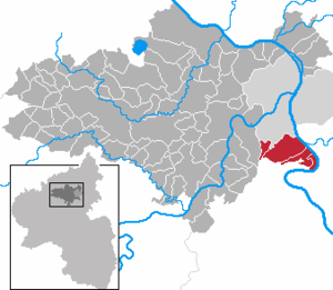
| Location of the Verbandsgemeinde Rhens in the Mayen-Koblenz district | ||
The Verbandsgemeinde Rhens was an administrative unit in the legal form of a regional authority in the district of Mayen-Koblenz in Rhineland-Palatinate . The Verbandsgemeinde included three independent local communities and the city of Rhens . The administrative seat was in the eponymous city.
On July 1, 2014, the Verbandsgemeinde merged with the Associated Community of Untermosel into the newly established Rhein-Mosel community .
Association members communities
| Local parish, city | Area (km²) | Residents |
|---|---|---|
| Brey | 6.42 | 1,561 |
| Rhens , city | 16.30 | 2,882 |
| Spay | 2.70 | 1,899 |
| Waldesch | 3.34 | 2,225 |
| Verbandsgemeinde Rhens | 28.76 | 8,567 |
(Resident on December 31, 2012)
history
The origins of the Verbandsgemeinde Rhens go back to the time of the French annexation of the Left Bank of the Rhine after 1794, when the Mairie Rhens, an administrative unit encompassing the surrounding municipalities with Rhens as the center, was set up for the first time in the canton of Boppard . In addition to Rhens, this also included Waldesch , Brey , the municipalities of Niederpay and Oberspay , which today belong to Spay , as well as Udenhausen and Capellen .
After the Rhineland was slammed into Prussia at the Congress of Vienna , these French administrative structures were dissolved. Rhens, Waldesch and Capellen became part of the Koblenz-Land mayor in the Koblenz-Land district , Brey and Spay became part of the Boppard-Land mayor in the St. Goar district . Udenhausen became part of the mayor's office in Halsenbach . In 1927 the term mayor's office was changed to office.
By order of the Koblenz district president on June 28, 1937, the Koblenz-Land office was dissolved at the end of June 30, 1937 and the Rhens office was formed from the municipalities of Rhens, Waldesch and Kapellen-Stolzenfels, with its official seat in Rhens. Brey and Spay remained part of the Boppard office.
As part of the regional and administrative reform in 1969 - since 1968 the term "Amtsverwaltung" was replaced by " Verbandsgemeindeverwaltung " - was replaced by the Fifth State Law on Administrative Simplification in Rhineland-Palatinate of February 14, 1969 with effect from June 7 1969 the municipality of Kapellen-Stolzenfels dissolved and incorporated into the area of the city of Koblenz . Likewise, with the dissolution of the St. Goar district , the municipalities of Brey and Spay were released from the Boppard district and incorporated into the Koblenz district.
By the eighth state law of July 28, 1970, the Verbandsgemeinde Rhens was newly formed from the communities Brey, Rhens, Spay and Waldesch with effect from November 7, 1970.
The seat of the municipal administration was in the city of Rhens, which is designated as a basic center for spatial planning .
Since the Verbandsgemeinde Rhens, with its population of less than 9,000, was affected by the new municipal and administrative reform of September 2010, which provided for the dissolution of Verbandsgemeinde of less than 12,000 inhabitants, the Verbandsgemeinde Rhens began merger talks with the Association of Untermosel in order to anticipate a forced merger. The merger to form the new Rhein-Mosel community was completed on July 1, 2014. Its main administrative headquarters are in Kobern-Gondorf , and a separate administrative office has been set up in Rhens.
Before the merger with the Lower Mosel community was decided, a connection to the city of Koblenz or the city of Boppard was discussed. However, both would have affected county boundaries and impaired the ability of local churches to make sovereign decisions.
Population development
The development of the number of inhabitants in relation to the area of the Verbandsgemeinde Rhens at the time of dissolution; the values from 1871 to 1987 are based on censuses:
|
|
Association municipal council
The Verbandsgemeinderat Rhens consisted of 24 honorary council members, who were last elected in the local elections on June 7, 2009 in a personalized proportional representation, and the full-time mayor as chairman.
The distribution of seats in the municipal council:
| choice | SPD | CDU | FWG 1 | FWG 2 | total |
|---|---|---|---|---|---|
| 2009 | 5 | 9 | 7th | 3 | 24 seats |
| 2004 | 6th | 11 | 7th | - | 24 seats |
Individual evidence
- ↑ Official municipality directory (= State Statistical Office of Rhineland-Palatinate [Hrsg.]: Statistical volumes . Volume 407 ). Bad Ems February 2016, p. 168 (PDF; 2.8 MB).
- ↑ Official municipality directory (= State Statistical Office of Rhineland-Palatinate [Hrsg.]: Statistical volumes . Volume 407 ). Bad Ems February 2016, p. 152 (PDF; 2.8 MB; see footnote 2).
- ^ First State Law on Local and Administrative Reform of September 28, 2010, Law and Ordinance Gazette for the State of Rhineland-Palatinate of October 5, 2010 , page 272
- ^ State law on the voluntary formation of the new Rhein-Mosel association. In: Landesrecht online. May 8, 2013, accessed July 22, 2020 .
- ↑ State Statistical Office Rhineland-Palatinate - regional data
- ^ The Regional Returning Officer Rhineland-Palatinate: Local elections 2009, Verbandsgemeinderatswahlen

