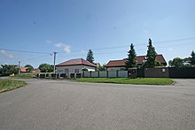
Vrcha
| Vrcha | ||||
|---|---|---|---|---|
|
||||
| Basic data | ||||
| State : |
|
|||
| Region : | Pardubický kraj | |||
| District : | Chrudim | |||
| Municipality : | Sobětuchy | |||
| Geographic location : | 49 ° 57 ' N , 15 ° 46' E | |||
| Height: | 300 m nm | |||
| Residents : | 429 (2011) | |||
| Postal code : | 537 01 | |||
| License plate : | E. | |||
| traffic | ||||
| Street: | Markovice - Slatiňany | |||
Vrcha is a part of the municipality of Sobětuchy in the Czech Republic . It is located two and a half kilometers southwest of the city center of Chrudim on the city limits and belongs to the Okres Chrudim .
geography
Vrcha is located on the right side above the valley of the Markovický potok or Bělina on the Heřmanoměstecká tabule ( Hermannstädtler Tafel ). The Skřivánky hill rises to the east, and the Chrudim airfield (LKCR) is located in the southeast.
Neighboring towns are Markovice and Chrudim IV in the north, Chrudim III in the east, Píšťovy, Riste, Slatiňany and Podhůra the southeast, Kometa and Rabštejnská Lhota in the south, Sobětuchy and Pouchobrady in the southwest, Zavadilka, Červenec and V Kozojedech the west and Kozojedy and Bylany in Northwest.
history
On the Skřivánky behind the Chrudimer Katharinenvorstadt there used to be strong viticulture. The vineyards were extended to the adjacent corridors of Lány and Sobětuchy. At the end of the 18th century, several vineyard houses were built along the road leading from Markovice to Slatiňany via the Zavadilka spans . After Chrudim viticulture was given up in the first third of the 19th century except for two vineyards on Baumberg and Vlčí hora, small farms were built in the middle of the 19th century instead of the vineyard houses on the Sobietucher area. The name of the relaxation area Zavadilka on the Pochobrader Flur was transferred to the loose courtyard row .
After the abolition of patrimonial the yard row belonged from 1849 to the district Sobětuchy of the municipality of Stolany in the judicial district of Chrudim . From 1868 the Hofzeile belonged to the political district of Chrudim . Even after the Sobětuchy commune was formed in 1914, the courtyard row, which is located away from the actual village, did not receive the status of a district. In the second half of the 20th century, the line was condensed with the construction of new apartment buildings.
When in 1961 the municipalities of Sobětuchy and Stolany were merged to form a municipality of Sobětuchy-Stolany, the row of houses was separated from the Sobětuchy district as a new district of Vrcha . Vrcha had 148 inhabitants at that time. Since then, the district has been expanded to the east through the construction of new housing developments. In 1980 Vrcha consisted of 39 houses and had 165 inhabitants. At the 2001 census, there were 212 people living in the 60 houses in Vrcha.
Local division
The district of Vrcha is part of the Sobětuchy cadastral district.
literature
- Historický lexikon obcí České republiky 1869–2005 , part 1, p. 516
Individual evidence
- ^ Johann Gottfried Sommer : The Kingdom of Bohemia; Represented statistically and topographically. Volume 5: Chrudimer Kreis. Prague 1837, pp. 2–3
- ↑ http://www.uir.cz/casti-obce/410080/Vrcha


