Weidach (Weitramsdorf)
|
Weidach
Community Weitramsdorf
Coordinates: 50 ° 15 ′ 54 ″ N , 10 ° 54 ′ 18 ″ E
|
|
|---|---|
| Height : | 370 m |
| Area : | 2.61 km² |
| Residents : | 1813 (2007) |
| Population density : | 695 inhabitants / km² |
| Incorporation : | May 1, 1978 |
| Postal code : | 96479 |
| Area code : | 09561 |
Weidach is a district of the Upper Franconian community of Weitramsdorf in the Coburg district .
Geography and geology
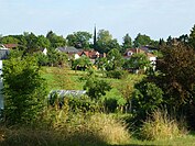
Weidach is five kilometers west of Coburg, on the road from Ummerstadt to Coburg . The highest point is the so-called Breite Rain at 398 meters. The geology is shaped by the Keuper period with sandy soils in the Weidacher Flur.
history
There are traces of settlement from the Carolingian period . The first documentary mention comes from 1149. The Würzburg Bishop Siegfried von Truhendingen confirmed the foundation of the Benedictine monastery Mönchröden after Hermann Sterker, Burgrave of Meissen , had transferred his property to the Diocese of Würzburg. In the deed of donation, Weidach is mentioned as Gut Widahe. In addition to Mönchröden, the Benedictine monastery Banz , the Cistercian monastery Langheim and the noble free zu Callenberg owned goods in Weidach. For a long time Langheim administered its farms from Tambach , where it had a monastery office. At least five larger farms existed at the time.
As part of the Coburg country, the settlement belonged to the Henneberg rulership in the 13th century , which passed to the Wettins in the 14th century . Weidach was assigned to the Lauter district court . In the fief book of the office of Coburg from 1536 three farms and three Sölden are listed. Weidach was owned by well-known noble families from the Coburg region, including the Gornizer, von Brandenstein and Bach, von Rosenau, von Sternberg and von Heldritt families. At the beginning of the 17th century, almost all of the fiefdoms were owned by the princely monastery office of Mönchröden, which in 1595 owned three farms, three estates and seven soelden in Weidach. The place formed a hamlet . After the Thirty Years War , ten of the 17 houses were destroyed.
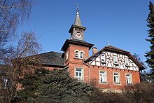
At first, the Weidachers were looked after by the original parish of Meeder . After Neuses near Coburg was raised to its own parish in 1535, the settlement belonged to their catchment area. In 1839 the parish was changed to Scheuerfeld , which also took in their school children against payment of Weidach contributions. In 1861 Weidach built its own school for its 40 students, which was replaced by a new building in 1899 and expanded to 71 students in 1936 due to an increase. The community has had its own cemetery since 1921.
In 1884 the municipality covered 261 hectares . 291 inhabitants lived in 48 buildings with 73 households. Weidach was the seat of the Callenberg forestry and had three restaurants. At the First World War 86 men from Weidach participated, fell 29th In World War II, 42 were killed and went missing.
The strong immigration of expellees tripled the number of inhabitants after 1945. In 1954, this led to the construction of the first 47 hectare section of the “am Vogelherd” estate on the eastern corridor border, directly adjacent to Scheuerfeld , which resulted in an extensive expansion of the water supply. For this purpose, among other things, a 55 meter deep well was drilled and a 30 meter high water tower with 200 cubic meters of water was built as the new landmark of the town by 1959 . In 1960, 149 children were taught shifts in two classrooms in the old school building. Therefore, the community also built a new school, which opened on January 8, 1963. In 1965 the Catholic parish consecrated its church to St. Michael. In the same year, the construction of a sewerage system with a sewage treatment plant began in the old village center and lasted until 1968. The 1970 census showed 1,077 residents in the old village center and 621 in the Vogelherd district. In 1972 the community center of the Protestant parish was inaugurated.
On May 1, 1978 Weidach was incorporated into Weitramsdorf. Due to the low number of students, the school in Weidach was closed. The students are now being taught in Weitramdorf. In 2016, supermarkets were built at the eastern entrance to Weidach.
Place name
Widahe (1149), Widehe (1180), Widech (1340) and Weyda (1516) are documented as spelling of Weidachs. Wida means willow tree in Old High German and is interpreted with the syllable ahi as a settlement on willow trees.
Population development
|
literature
- Festival Committee 850 Years Weidach (Ed.): Memories of the community Weidach Review of 850 years of a community . Weidach 1999, OCLC 163297840 .
Web links
Individual evidence
- ^ Federal Statistical Office (ed.): Historical municipality directory for the Federal Republic of Germany. Name, border and key number changes in municipalities, counties and administrative districts from May 27, 1970 to December 31, 1982 . W. Kohlhammer, Stuttgart / Mainz 1983, ISBN 3-17-003263-1 , p. 680 .
- ↑ Horst GRASSMUCK: Place names of the county Coburg . Inaugural dissertation from the University of Erlangen 1955, p. 71.


