
White flue
| White flue | ||
|---|---|---|
 Weissflue over Sapün |
||
| height | 2843.3 m above sea level M. | |
| location | Canton of Graubünden , Switzerland | |
| Mountains | Plessur Alps | |
| Dominance | 11.6 km → Pischahorn | |
| Notch height | 493 m ↓ Strela Pass | |
| Coordinates | 779 672 / 189821 | |
|
||
| rock | Penninic | |
| First ascent | unknown | |
| Development | Cable car of the Davos Klosters Bergbahnen | |
| Normal way | Over the east side | |
 Weissflue taken from the Weissfluhjoch . |
||

The Weissflue (also common: Weissfluh or Weissfluhgipfel ) is 2843 m above sea level. M. high mountain in the Plessur Alps north-west of the better-known, albeit somewhat smaller, Weissfluhjoch .
Location and surroundings

The Weissflue, which used to be called Gablerflue , is the highest point in the former municipality of Langwies (now Arosa ) in Schanfigg and the highest point in the Davos Parsenn ski area . It belongs to the area of the Arosa shed zone and thus to the Penninic deposit area ( Penninic ).
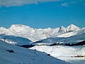
Geologically, the Weissflue is one of the Arosa Dolomites . Its highest point is on the southwestern edge of an extensive rubble plateau. About 300 m northwest of the main summit is the north summit, 2834 m , from which the west ridge starts. The municipal boundary between Arosa and Klosters-Serneus runs over the northern summit, while the main summit is entirely within the municipality of Arosa. The main summit offers the visitor a comprehensive panoramic view and a deep view towards Arosertal-Schanfigg.
The Weissflue forms a watershed between Prättigau and Schanfigg , the point 2623 between Weissflue and Weissfluhjoch is actually called "Wasserscheidi". At the foot of the Weissflue, the Casannapass leads past, which connects the inner Fondei with the Alp Casanna . The closest localities are Davos in the southeast and Langwies in the southwest, each seven kilometers apart.
Access and use

A cable car leads from the Weissfluhjoch to the Weissflue summit plateau.
The Weissflue is crossed with various buildings, in addition to a panorama restaurant, these are above all the measuring stations of the WSL Institute for Snow and Avalanche Research SLF as well as military and radio systems.
In the summer of 2014, the Meteo Schweiz weather service set up a weather radar in the summit area .
Routes to the summit
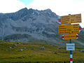
Over the east side
- Starting point: Weissfluhjoch ( 2693 m ), Stn. Gotschnagrat ( 2281 m ), Wolfgang ( 1631 m ), Langwies ( 1377 m ), Schatzalp ( 1861 m ), Davos ( 1560 m ), Klosters ( 1206 m ) or Serneus ( 995 m )
- Via: Wasserscheidi ( 2629 m )
- From the Weissfluhjoch to the Wasserscheidi
- From Stn. Gotschnagrat via Parsennhütte ( 2200 m ) to Wasserscheidi
- From Wolfgang via Parsennhütte or Meierhofer Tälli to Wasserscheidi
- From Davos via Schatzalp, Strelapass, Felsenweg to Wasserscheidi
- From Langwies via Sapün, Haupter Tälli, Strelapass, Felsenweg to Wasserscheidi
- From Langwies via Strassberg (Fondei), Casannapass to Wasserscheidi
- From Klosters or Serneus via Kreuzweg to Wasserscheidi
- Difficulty: T2 , B , marked as a white-red-white hiking trail .
- Time required:
- ¾ hours from the Weissfluhjoch
- 2½ hours from the Stn. Gotschnagrat
- 3¾ hours from Wolfgang
- 4¼ hours from Davos or 3¼ hours from Schatzalp
- 5¼ hours from Langwies via Haupter Tälli
- 5½ hours from Langwies via Fondei
- 6 hours from Klosters or Serneus
Over the west ridge
- Starting point: Langwies ( 1377 m ), Klosters ( 1206 m ) or Serneus ( 995 m )
- Via: Schwerzi ( 2568 m )
- From Langwies via Sapün to Schwerzi
- From Langwies via Strassberg (Fondei) to Schwerzi
- From Klosters or Serneus via Kreuzweg, Casannapass to Schwerzi
- Difficulty: T6 , WS , to Schwerzi as trail white-red-white highlighted
- 4¾ hours from Langwies via Sapün
- 5¼ hours from Langwies via Fondei
- 7¼ hours from Klosters or Serneus
Through the north flank
- Starting point: Stn. Gotschnagrat ( 2281 m ), Langwies ( 1377 m ), Klosters ( 1206 m ) or Serneus ( 995 m )
- Via: Obersasställi ( 2441 m )
- From Stn. Gotschnagrat via Parsennhütte ( 2200 m ), Parsennfurgga ( 2435 m ) to Obersasställi
- From Langwies via Strassberg (Fondei), Casannapass to Obersäßälli
- From Klosters or Serneus via the Kreuzweg to the Obersäßälli
- Difficulty: T4 , EB , to Obersasställi marked as a white-red-white hiking trail .
- 2¼ hours from the stn. Gotschnagrat
- 5¼ hours from Langwies
- 5¾ hours from Klosters or Serneus
panorama

photos

Cable car from Weissfluhjoch to Weissfluhjoch summit

Weissflue with Hauptertälli

Weissfluegruppe / Arosa Dolomites

View from the Strela Pass with the Strela-Hauptertälli cable car
View from the Casannapass
Weissfluegruppe via Tschuggen

View from the Schiahorn

Weissflue from Mattjisch Horn

View from the Weissflue to Arosa


swell
- Manfred Hunziker: Ringelspitz / Arosa / Rätikon, Alpineouren / Bündner Alpen , Verlag des SAC 2010, ISBN 978-3-85902-313-0 , p. 395.
- The mountains of the canton of Graubünden , Verlag Rüegger, Chur / Zurich 2003, ISBN 3-7253-0742-3 , p. 404.
- SAC Club Guide, Bündner Alpen 1, Tamina and Plessur Mountains , Verlag des SAC, 4th edition 1988, pp. 27 ff., 272 f.
Web links
- Panorama from the Weissflue
- Tour reports and photographs of the Weissflue on hikr
- Tourist office Langwies
- Mountain railways Parsenn
Individual evidence
- ^ Die Südostschweiz, October 18, 2013, p. 7.