Zacapa Department
| Zacapa | |
|---|---|
| Location of Zacapa in Guatemala | |
| Data | |
| Capital | Zacapa |
| population | 240,600 (Ber. 2016) |
| surface | 2,690 km² |
| Population density | 89 people / km² |
| Highest elevation | Raxon (3,015 m) |
| ISO 3166-2 | GT-ZA |
| Website | Inforpressca.com |
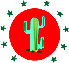
| Coat of arms of the Zacapa department | |
Zacapa is a department of Guatemala and is located in the east of the country (Region III). It covers almost 2,700 square kilometers and has over 240,600 inhabitants. The capital is the Zacapa of the same name .
The department of Zacapa borders in the north with the departments Alta Verapaz and Izabal , in the east with Honduras , in the south with Chiquimula and Jalapa and in the west with El Progreso .
National nature
The northern part of Zacapa lies in the Sierra de las Minas , over whose peaks, up to 3,000 m high, the border of the department runs. From there, the land, crossed by numerous rivers and streams, slopes down to the valley of the Río Motagua , which crosses the department from southwest to northeast. This longest river in Guatemala drains large parts of the central highlands and also the entire Zacapa department and flows into the Caribbean in neighboring Izabal . The highlands south of the river only reach heights of around 1,700 meters. The Motagua Valley is one of the hottest and driest regions in Guatemala. The Motagua and its various tributaries, however, allow the artificial irrigation of large parts of the valley. The climate is more moderate at higher altitudes. In the mountains of the Sierra de las Minas, efforts have been made since 1990 to save numerous animal species from extinction through extensive nature conservation measures.
population
The original indigenous population mixed heavily with Spaniards during the colonial period. However, there are still smaller Chortí communities. The population lives in ten Municipios ( large communities or districts ):
| Zacapa | Estanzuela |
| Río Hondo | Gualan |
| Teculután | Usumatlán |
| Cabañas | San Diego |
| La Unión | Huité |
As a state administrative district , the department is headed by a governor sent by the central government . The Municipios are independent regional authorities with elected mayors and representatives of the people and are subdivided into Aldeas (rural communities) and Caseríos, Parajes or Fincas ( hamlets and farms ).
economy
Traditionally the most important branch of the economy is agriculture. The mostly artificially irrigated agricultural land belongs to large landowners who grow maize , grain , fruit and vegetables . Zacapa is best known for its tobacco and sugar cane schnapps . Livestock and the milk processing industry also play a role. A large part of these agricultural products has also been exported abroad for a long time. Thanks to the trunk road running along the Motagua from Guatemala City to Puerto Barrios (CA 9), Zacapa was able to develop into a trading center. As early as 1898, the capital of the department became a railway junction , where the connection from the Atlantic to the Pacific met that to El Salvador . Since rail traffic has now been discontinued, freight traffic is now concentrated on the congested CA 9 highway, which connects the Caribbean ports with Guatemala City.
Jadeite and marble are mined to a small extent in the Zacapa department .
Attractions
Zacapa is not considered one of the major tourist destinations in Guatemala. The Estanzuela Paleontological Museum has sculptures and tools from the Mayan period and prehistoric finds from the Motagua Valley. La Vega del Cobán, near Teculután, as well as Río Hondo and Sunzapote have a similar facility. Between Teculután and Río Hondo is the Balneario Pasabién , a bathing and recreation area located on a wild water stream . A little further downstream, the Valle Dorado water park with its slides offers additional swimming and entertainment opportunities . The Doña María caves are also on Motagua, but almost on the border with Izabal . Around 500 different species of mammals and around 75 species of birds, including the quetzal, live in the Reserva de la Biosfera de la Sierra de las Minas nature reserve .
history
After independence from Spain , the area of Zacapa and the area of Acasaguastlán ( El Progreso ) belonged to the department of Chiquimula from 1825 to 1871 . Zacapa was elevated to the department on November 10, 1871. The place of the same name of the administrative headquarters only received city rights in 1896 .
The name of the department probably comes from the Nahuatl words zacalt ("straw") and pan (place name suffix), which means something like "straw place". The name probably goes back to Mexican mercenaries who were in Spanish service.
Web links
- Overview of the department (Spanish)
Coordinates: 14 ° 58 ′ N , 89 ° 32 ′ W


