Nagyvisnyó: Difference between revisions
Content deleted Content added
Seacactus 13 (talk | contribs) No edit summary |
Seacactus 13 (talk | contribs) No edit summary |
||
| (3 intermediate revisions by 3 users not shown) | |||
| Line 1: | Line 1: | ||
{{unreferenced|date=February 2014}} |
|||
{{Infobox settlement |
{{Infobox settlement |
||
| Line 5: | Line 5: | ||
|name = Nagyvisnyó |
|name = Nagyvisnyó |
||
|settlement_type = Village (község) |
|settlement_type = Village (község) |
||
|total_type = |
|total_type = |
||
| image_skyline = Nagyvisnyó,_Dózsa_utcai_népi_lakóházak_2021_01.jpg |
|||
<!-- images and maps -----------> |
|||
| image_caption = Traditional houses in Nagyvisnyó |
|||
<!-- Location ------------------> |
|||
|subdivision_type = [[Countries of the world|Country]] |
|subdivision_type = [[Countries of the world|Country]] |
||
|subdivision_name = {{HUN}} |
|subdivision_name = {{HUN}} |
||
|subdivision_type2 = [[Counties of Hungary|County]] |
|subdivision_type2 = [[Counties of Hungary|County]] |
||
|subdivision_name2 = [[Heves county|Heves]] |
|subdivision_name2 = [[Heves county|Heves]] |
||
| subdivision_type3 = [[Districts of Hungary|District]] |
|||
| subdivision_name3 = [[Bélapátfalva District|Bélapátfalva]] |
|||
|image_shield = Coa_Hungary_Town_Nagyvisnyó.svg |
|image_shield = Coa_Hungary_Town_Nagyvisnyó.svg |
||
<!-- Politics -----------------> |
<!-- Politics -----------------> |
||
| Line 30: | Line 32: | ||
|elevation_ft = |
|elevation_ft = |
||
<!-- Population -----------------------> |
<!-- Population -----------------------> |
||
|population_as_of = |
|population_as_of = 2015 |
||
|population_footnotes = |
|population_footnotes = |
||
|population_note = |
|population_note = |
||
|population_total = |
|population_total = 913 |
||
|population_est = |
|population_est = |
||
|pop_est_as_of = |
|pop_est_as_of = |
||
| Line 48: | Line 50: | ||
|postal_code = 3349 |
|postal_code = 3349 |
||
|area_code = +36 36 |
|area_code = +36 36 |
||
|website = |
|website = [https://www.nagyvisnyo.hu/ www.nagyvisnyo.hu] |
||
|footnotes = |
|footnotes = |
||
}} |
}} |
||
| Line 63: | Line 65: | ||
{{Heves}} |
{{Heves}} |
||
{{Bélapátfalva District}} |
{{Bélapátfalva District}} |
||
{{authority control}} |
|||
{{DEFAULTSORT:Nagyvisnyo}} |
{{DEFAULTSORT:Nagyvisnyo}} |
||
[[Category:Populated places in Heves County]] |
[[Category:Populated places in Heves County]] |
||
{{ |
{{Heves-geo-stub}} |
||
Latest revision as of 02:49, 28 December 2022
Nagyvisnyó | |
|---|---|
Village (község) | |
 Traditional houses in Nagyvisnyó | |
| Coordinates: 47°55′26″N 20°02′3″E / 47.92389°N 20.03417°E | |
| Country | |
| County | Heves |
| District | Bélapátfalva |
| Area | |
| • Total | 43.02 km2 (16.61 sq mi) |
| Population (2015) | |
| • Total | 913 |
| • Density | 21/km2 (55/sq mi) |
| Time zone | UTC+1 (CET) |
| • Summer (DST) | UTC+2 (CEST) |
| Postal code | 3349 |
| Area code | +36 36 |
| Website | www.nagyvisnyo.hu |
48°08′N 20°26′E / 48.133°N 20.433°E
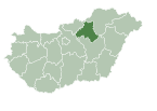
Nagyvisnyó is a village and municipality in northern Hungary, in Heves county, northwest of the Bükk Mountains, in the valley of Bán-patak. Until 1950, the village was part of Borsod county.
Popular ski resort Bánkút is situated within municipality limits.
Monuments[edit]
The Baroque Protestant church was built around 1800; its cassetted ceiling was made in 1804.


