Nagyvisnyó: Difference between revisions
Content deleted Content added
m →Monuments: add authority control |
Removed {{Lead too short}} tag: inappropriate for stubs per template documentation |
||
| Line 1: | Line 1: | ||
{{unreferenced|date=February 2014}} |
|||
{{Infobox settlement |
{{Infobox settlement |
||
Revision as of 18:05, 9 February 2022
Nagyvisnyó | |
|---|---|
Village (község) | |
| Coordinates: 47°55′26″N 20°02′3″E / 47.92389°N 20.03417°E | |
| Country | |
| County | Heves |
| Area | |
| • Total | 43.02 km2 (16.61 sq mi) |
| Population (2013) | |
| • Total | 968 |
| • Density | 23/km2 (58/sq mi) |
| Time zone | UTC+1 (CET) |
| • Summer (DST) | UTC+2 (CEST) |
| Postal code | 3349 |
| Area code | +36 36 |
48°08′N 20°26′E / 48.133°N 20.433°E
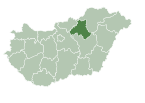
Nagyvisnyó is a village and municipality in northern Hungary, in Heves county, northwest of the Bükk Mountains, in the valley of Bán-patak. Until 1950, the village was part of Borsod county.
Popular ski resort Bánkút is situated within municipality limits.
Monuments
The Baroque Protestant church was built around 1800; its cassetted ceiling was made in 1804.


