County
|
FIPS code[3]
|
County seat[4]
|
#
|
Established[4][5]
|
Formed from[6]
|
Etymology[5]
|
Population[4]
|
Area[4]
|
Map
|
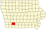
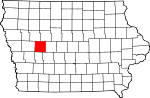
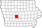
| Adair County
|
001
|
Greenfield |
69 |
Template:Dts2 |
Cass County |
John Adair (1757–1840), sixth governor of Kentucky
|
8,243
|
569 mi²
(916 km²) |

|
| Adams County
|
003
|
Corning |
81 |
Template:Dts2 |
Taylor County |
John Adams, second president of the United States (1797–1801)
|
4,482
|
424 mi²
(682 km²) |
|
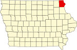
| Allamakee County
|
005
|
Waukon |
11 |
Template:Dts2 |
Clayton County |
Allen Magee (or Allan Makee), an early Indian trader
|
14,675
|
640 mi²
(1,030 km²) |
|
| Appanoose County
|
007
|
Centerville |
96 |
Template:Dts2 |
Davis County |
Appanoose, Native American who headed peace party in the Black Hawk War
|
13,721
|
496 mi²
(798 km²) |
|
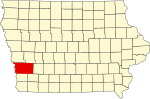
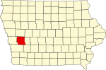
| Audubon County
|
009
|
Audubon |
57 |
Template:Dts2 |
Black Hawk County and Cass County |
John James Audubon (1785–1851), ornithologist and artist
|
6,830
|
443 mi²
(713 km²) |
|
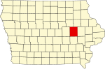
| Benton County
|
011
|
Vinton |
51 |
Template:Dts2 |
Native American lands and Wisconsin Territory |
Thomas Hart Benton, United States Senator (1821–1851)
|
25,308
|
716 mi²
(1,152 km²) |
|
| Black Hawk County
|
013
|
Waterloo |
39 |
Template:Dts2 |
Delaware County |
Black Hawk (1767–1838), chief of Fox and Sac Indians and leader in the Black Hawk War
|
128,012
|
567 mi²
(912 km²) |

|
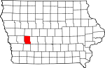
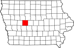
| Boone County
|
015
|
Boone |
47 |
Template:Dts2 |
Polk County |
Nathan Boone (1781–1863), one of the first to survey Iowa
|
26,224
|
572 mi²
(921 km²) |
|
| Bremer County
|
017
|
Waverly |
30 |
Template:Dts2 |
Native American lands and Winnebago County |
Fredrika Bremer (1801–1865), Swedish poet and author
|
23,325
|
428 mi²
(689 km²) |

|
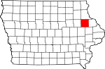
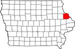
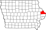
| Buchanan County
|
019
|
Independence |
40 |
Template:Dts2 |
Delaware County and Wisconsin Territory |
James Buchanan, fifteenth president (1857–1861)
|
21,093
|
571 mi²
(919 km²) |
|
| Buena Vista County
|
021
|
Storm Lake |
24 |
Template:Dts2 |
Clay County and Sac County |
Battle of Buena Vista, a battle during the Mexican-American War
|
20,411
|
575 mi²
(925 km²) |

|
| Butler County
|
023
|
Allison |
29 |
Template:Dts2 |
Black Hawk County and Buchanan County |
William Orlando Butler (1791–1880), unsuccessful Democratic candidate for Vice President
|
15,305
|
580 mi²
(933 km²) |
|
| Calhoun County
|
025
|
Rockwell City |
34 |
Template:Dts2 |
Fox County (renamed) |
John Caldwell Calhoun, Vice President (1825–1832)
|
11,115
|
570 mi²
(917 km²) |

|
| Carroll County
|
027
|
Carroll |
45 |
Template:Dts2 |
Guthrie County |
Charles Carroll (1737–1832), longest lived signer of the Declaration of Independence
|
21,421
|
569 mi²
(916 km²) |
|
| Cass County
|
029
|
Atlantic |
68 |
Template:Dts2 |
Pottawattamie County |
Lewis Cass, United States Senator from Michigan and unsuccessful candidate for president (1848)
|
14,684
|
564 mi²
(908 km²) |

|
| Cedar County
|
031
|
Tipton |
65 |
Template:Dts2 |
Wisconsin Territory |
Red Cedar River, river which runs through county
|
18,187
|
580 mi²
(933 km²) |

|
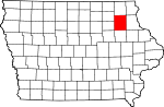
| Cerro Gordo County
|
033
|
Mason City |
17 |
Template:Dts2 |
Floyd County |
Battle of Cerro Gordo, battle during the Mexican-American War
|
46,447
|
568 mi²
(914 km²) |

|
| Cherokee County
|
035
|
Cherokee |
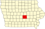
23 |
Template:Dts2 |
Crawford County |
Cherokee Native American tribe
|
13,035
|
577 mi²
(929 km²) |
|
| Chickasaw County
|
037
|
New Hampton |
19 |
Template:Dts2 |
Fayette County |
Chickasaw Native American tribe
|
13,095
|
505 mi²
(813 km²) |
|
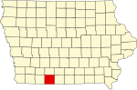
| Clarke County
|
039
|
Osceola |
83 |
Template:Dts2 |
Lucas County |
James Clarke, third Governor of Iowa Territory (1845–1846)
|
9,133
|
431 mi²
(694 km²) |
|
| Clay County
|
041
|
Spencer |
14 |
Template:Dts2 |
Native American lands |
Henry Clay, Jr. (1807–1847), officer in the Mexican-American War
|
17,372
|
569 mi²
(916 km²) |

|
| Clayton County
|
043
|
Elkader |
21 |
Template:Dts2 |
Dubuque County and Wisconsin Territory |
John M. Clayton (1796–1856), United States Senator from Delaware
|
18,678
|
779 mi²
(1,254 km²) |

|
| Clinton County
|
045
|
Clinton |
66 |
Template:Dts2 |
Dubuque County and Wisconsin Territory |
DeWitt Clinton (1769–1828), Governor of New York
|
50,149
|
695 mi²
(1,118 km²) |

|
| Crawford County
|
047
|
Denison |
44 |
Template:Dts2 |
Shelby County |
William Harris Crawford (1772–1834), United States Senator from Georgia
|
16,942
|
714 mi²
(1,149 km²) |

|
| Dallas County
|
049
|
Adel |
59 |
Template:Dts2 |
Polk County |
George Mifflin Dallas (1792–1864), eleventh Vice President
|
40,750
|
586 mi²
(943 km²) |
|
| Davis County
|
051
|
Bloomfield |
97 |
Template:Dts2 |
Van Buren County |
Garrett Davis (1801–1872), congressman
|
8,541
|
503 mi²
(810 km²) |
|
| Decatur County
|
053
|
Leon |
94 |
Template:Dts2 |
Appanoose County |
Stephen Decatur (1779–1820), naval officer in the War of 1812
|
8,689
|
532 mi²
(856 km²) |

|
| Delaware County
|
055
|
Manchester |
41 |
Template:Dts2 |
Dubuque County and Wisconsin Territory |
Delaware, United States state, or Delaware County, New York
|
18,404
|
578 mi²
(930 km²) |
|
| Des Moines County
|
057
|
Burlington |
89 |
Template:Dts2 |
Michigan Territory and Wisconsin Territory |
Des Moines River, river that runs through the county
|
42,351
|
416 mi²
(669 km²) |

|
| Dickinson County
|
059
|
Spirit Lake |
3 |
Template:Dts2 |
Kossuth County |
Daniel Stevens Dickinson (1800–1866), United States Senator from New York
|
16,424
|
381 mi²
(631 km²) |

|
| Dubuque County
|
061
|
Dubuque |
42 |
Template:Dts2 |
Michigan Territory and Wisconsin Territory |
Julien Dubuque (1762–1810), first permanent white settler in Iowa
|
89,143
|
608 mi²
(978 km²) |
|
| Emmet County
|
063
|
Estherville |
4 |
Template:Dts2 |
Dickinson County and Kossuth County |
Robert Emmet (1778–1803), Irish revolutionary
|
11,027
|
396 mi²
(637 km²) |

|
| Fayette County
|
065
|
West Union |
20 |
Template:Dts2 |
Clayton County and Wisconsin Territory |
Marquis de Lafayette (1757–1834), Frenchman who helped the American Colonies in the Revolutionary War
|
22,008
|
731 mi²
(1,176 km²) |
|
| Floyd County
|
067
|
Charles City |
18 |
Template:Dts2 |
Chickasaw County |
Charles Floyd (1782–1804), member of the Lewis and Clark Expedition who died in Iowa
|
16,900
|
501 mi²
(806 km²) |
|
| Franklin County
|
069
|
Hampton |
28 |
Template:Dts2 |
Chickasaw County |
Benjamin Franklin (1706–1790), statesman
|
10,704
|
582 mi²
(937 km²) |

|
| Fremont County
|
071
|
Sidney |
90 |
Template:Dts2 |
Pottawattamie County |
John Charles Fremont (1813–1890), officer in Mexican-American War
|
8,010
|
511 mi²
(822 km²) |
|
| Greene County
|
073
|
Jefferson |
46 |
Template:Dts2 |
Dallas County |
Nathanael Greene (1742–1786), Revolutionary War hero
|
10,366
|
568 mi²
(914 km²) |
|
| Grundy County
|
075
|
Grundy Center |
38 |
Template:Dts2 |
Black Hawk County |
Felix Grundy (1777–1840), United States Senator
|
12,369
|
503 mi²
(810 km²) |
|
| Guthrie County
|
077
|
Guthrie Center |
58 |
Template:Dts2 |
Jackson County |
Edwin B. Guthrie, officer in Mexican-American War
|
11,353
|
591 mi²
(951 km²) |

|
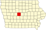
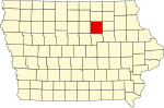
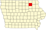
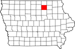
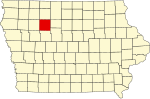
| Hamilton County
|
079
|
Webster City |
36 |
Template:Dts2 |
Webster County |
William W. Hamilton, president of the Iowa Senate (1856–1857)
|
16,438
|
577 mi²
(929 km²) |

|
| Hancock County
|
081
|
Garner |
16 |
Template:Dts2 |
Wright County |
John Hancock (1737–1793), President of the First Continental Congress
|
12,100
|
571 mi²
(919 km²) |
|
| Hardin County
|
083
|
Eldora |
37 |
Template:Dts2 |
Black Hawk County |
John J. Hardin (1810–1847), prominent soldier in the Black Hawk War
|
18,812
|
569 mi²
(916 km²) |

|
| Harrison County
|
085
|
Logan |
55 |
Template:Dts2 |
Pottawattamie County |
William Henry Harrison (1773–1841), ninth President of the United States
|
15,666
|
697 mi²
(1,122 km²) |

|
| Henry County
|
087
|
Mount Pleasant |
88 |
Template:Dts2 |
Wisconsin Territory |
Henry Dodge (1782–1867), governor of Wisconsin Territory, or James Dougherty Henry, General in the Black Hawk War
|
20,336
|
434 mi²
(698 km²) |
|
| Howard County
|
089
|
Cresco |
9 |
Template:Dts2 |
Chickasaw County |
Tilghman Ashurst Howard (1797–1844), congressman
|
9,932
|
473 mi²
(761 km²) |

|
| Humboldt County
|
091
|
Dakota City |
26 |
Template:Dts2 |
Webster County |
Alexander von Humboldt (1769–1859), German scientist
|
10,381
|
434 mi²
(698 km²) |

|
| Ida County
|
093
|
Ida Grove |
32 |
Template:Dts2 |
Cherokee County |
Mount Ida in Greece or the woman's name Ida
|
7,837
|
432 mi²
(695 km²) |
|
| Iowa County
|
095
|
Marengo |
63 |
Template:Dts2 |
Washington County |
Iowa River, river that flows through the county, or Ioway Native American tribe
|
15,671
|
586 mi²
(943 km²) |
|
| Jackson County
|
097
|
Maquoketa |
54 |
Template:Dts2 |
Wisconsin Territory |
Andrew Jackson (1767–1845), seventh President of the United States
|
20,296
|
636 mi²
(1,024 km²) |
|
| Jasper County
|
099
|
Newton |
61 |
Template:Dts2 |
Mahaska County |
William Jasper (1750–1779), sergeant in the Revolutionary War
|
37,213
|
730 mi²
(1,175 km²) |
|
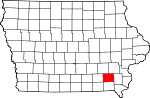
| Jefferson County
|
101
|
Fairfield |
87 |
Template:Dts2 |
Native American lands |
Thomas Jefferson (1743–1826), third President of the United States
|
16,181
|
435 mi²
(700 km²) |
|
| Johnson County
|
103
|
Iowa City |
64 |
Template:Dts2 |
Des Moines County, Iowa and Wisconsin Territory |
Richard Mentor Johnson (1780–1850), Vice President of the United States
|
111,006
|
614 mi²
(988 km²) |

|
| Jones County
|
105
|
Anamosa |
53 |
Template:Dts2 |
Wisconsin Territory |
George Wallace Jones (1804–1896), United States Senator from Iowa
|
20,221
|
575 mi²
(925 km²) |

|
| Keokuk County
|
107
|
Sigourney |
74 |
Template:Dts2 |
Washington County |
Keokuk (1767–1848), chief of the Sac Native American tribe
|
11,400
|
579 mi²
(932 km²) |

|
| Kossuth County
|
109
|
Algona |
5 |
Template:Dts2 |
Webster County |
Lajos Kossuth (1802–1894), Hungarian patriot
|
17,163
|
973 mi²
(1,566 km²) |

|
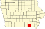
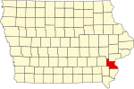
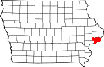
| Lee County
|
111
|
Fort Madison and Keokuk |
99 |
Template:Dts2 |
Des Moines County |
William Elliott Lee, businessman, or Robert E. Lee (1807–1870), Confederate general
|
38,052
|
517 mi²
(832 km²) |

|
| Linn County
|
113
|
Cedar Rapids |
52 |
Template:Dts2 |
Wisconsin Territory |
Lewis Fields Linn (1795–1843), doctor and United States Senator from Missouri
|
191,701
|
718 mi²
(1,156 km²) |

|
| Louisa County
|
115
|
Wapello |
76 |
Template:Dts2 |
Des Moines County |
Louisa Massey, woman who avenged the death of her brother, or Louisa County, Virginia
|
12,183
|
402 mi²
(647 km²) |
|
| Lucas County
|
117
|
Chariton |
84 |
Template:Dts2 |
Monroe County |
Robert Lucas (1781–1853), first Governor of Iowa Territory
|
9,422
|
431 mi²
(694 km²) |
|
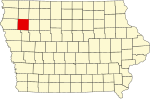
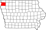
| Lyon County
|
119
|
Rock Rapids |
1 |
Template:Dts2 |
Woodbury County, Iowa |
Nathaniel Lyon (1818–1861), first Union general to be killed in the American Civil War, (formerly named Buncombe County)
|
11,763
|
588 mi²
(946 km²) |

|
| Madison County
|
121
|
Winterset |
70 |
Template:Dts2 |
Polk County |
James Madison (1751–1836), fourth President of the United States
|
14,019
|
561 mi²
(903 km²) |

|
| Mahaska County
|
123
|
Oskaloosa |
73 |
Template:Dts2 |
Fox and Sac Indian lands |
Mahaska (1784–1834), chief of the Ioway Native American tribe
|
22,335
|
571 mi²
(919 km²) |

|
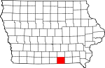
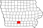
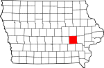
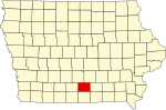
| Marion County
|
125
|
Knoxville |
72 |
Template:Dts2 |
Washington County |
Francis Marion (1732–1795), general in the Revolutionary War
|
32,052
|
554 mi²
(892 km²) |

|
| Marshall County
|
127
|
Marshalltown |
49 |
Template:Dts2 |
Jasper County |
John Marshall (1755–1835), fourth Chief Justice of the United States Supreme Court
|
39,311
|
572 mi²
(921 km²) |

|
| Mills County
|
129
|
Glenwood |
79 |
Template:Dts2 |
Pottawattamie County |
Frederick Mills, major killed during the Battle of Churubusco in the Mexican-American War
|
14,547
|
437 mi²
(703 km²) |

|
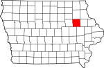
| Mitchell County
|
131
|
Osage |
8 |
Template:Dts2 |
Chickasaw County |
John Mitchel (1815–1875), Irish patriot
|
10,874
|
469 mi²
(755 km²) |

|
| Monona County
|
133
|
Onawa |
43 |
Template:Dts2 |
Harrison County |
Word of Native American origin or Monona, Iowa
|
10,020
|
693 mi²
(1,115 km²) |

|
| Monroe County
|
135
|
Albia |
85 |
Template:Dts2 |
Wapello County |
James Monroe (1758–1831), fifth President of the United States
|
8,016
|
433 mi²
(697 km²) |

|
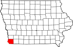
| Montgomery County
|
137
|
Red Oak |
80 |
Template:Dts2 |
Polk County |
Richard Montgomery (1738–1775), general in the Revolutionary War
|
11,771
|
424 mi²
(682 km²) |

|
| Muscatine County
|
139
|
Muscatine |
77 |
Template:Dts2 |
Des Moines County |
Muscatine Native American tribe or Muscatine Island in the Mississippi River
|
41,722
|
439 mi²
(707 km²) |

|
| O'Brien County
|
141
|
Primghar |
13 |
Template:Dts2 |
Cherokee County |
William Smith O'Brien (1803–1864), Irish revolutionary
|
15,102
|
573 mi²
(922 km²) |

|
| Osceola County
|
143
|
Sibley |
2 |
Template:Dts2 |
Woodbury County |
Osceola (1804–1838), Native American leader
|
7,003
|
399 mi²
(642 km²) |

|
| Page County
|
145
|
Clarinda |
91 |
Template:Dts2 |
Pottawattamie County |
John Page, officer killed in Battle of Palo Alto in the Mexican-American War
|
16,976
|
535 mi²
(861 km²) |

|
| Palo Alto County
|
147
|
Emmetsburg |
15 |
Template:Dts2 |
Kossuth County |
Battle of Palo Alto in the Mexican-American War
|
10,147
|
564 mi²
(908 km²) |

|
| Plymouth County
|
149
|
Le Mars |
22 |
Template:Dts2 |
Woodbury County |
Landing place of the Pilgrims who came to America on the Mayflower
|
24,849
|
864 mi²
(1,390 km²) |

|
| Pocahontas County
|
151
|
Pocahontas |
25 |
Template:Dts2 |
Greene County and Humboldt County |
Pocahantas (1595–1618), famous Native American woman
|
8,662
|
578 mi²
(930 km²) |
|
| Polk County
|
153
|
Des Moines |
60 |
Template:Dts2 |
Native American lands |
James K. Polk (1795–1849), eleventh President of the United States
|
374,601
|
570 mi²
(917 km²) |

|
| Pottawattamie County
|
155
|
Council Bluffs |
67 |
Template:Dts2 |
Native American lands |
Pottawattamie Native American tribe
|
87,704
|
954 mi²
(1,535 km²) |
|
| Poweshiek County
|
157
|
Montezuma |
62 |
Template:Dts2 |
Mesquakie Indian lands |
Poweshiek, chief of the Fox tribe
|
18,815
|
585 mi²
(941 km²) |

|
| Ringgold County
|
159
|
Mount Ayr |
93 |
Template:Dts2 |
Taylor County |
Samuel Ringgold (1796–1846), major killed in the Mexican-American War
|
5,469
|
538 mi²
(866 km²) |
|
| Sac County
|
161
|
Sac City |
33 |
Template:Dts2 |
Greene County |
Sac Native American tribe
|
11,529
|
576 mi²
(927 km²) |

|
| Scott County
|
163
|
Davenport |
78 |
Template:Dts2 |
Wisconsin Territory |
Winfield Scott (1786–1866), U.S. Army General during the War of 1812
|
158,668
|
458 mi²
(737 km²) |
|
| Shelby County
|
165
|
Harlan |
56 |
Template:Dts2 |
Cass County |
Isaac Shelby (1750–1826), general in the Revolutionary War and the War of 1812
|
13,173
|
591 mi²
(951 km²) |
|
| Sioux County
|
167
|
Orange City |
12 |
Template:Dts2 |
Plymouth County |
Sioux Native American tribe
|
31,589
|
768 mi²
(1,236 km²) |
|
| Story County
|
169
|
Nevada |
48 |
Template:Dts2 |
Boone County, Jasper County, and Polk County |
Joseph Story (1779–1845), United States Supreme Court justice
|
79,981
|
573 mi²
(922 km²) |

|
| Tama County
|
171
|
Toledo |
50 |
Template:Dts2 |
Benton County and Boone County |
Taimah, Fox chief, or Taomah, wife of Poweshiek, or Potama, Native American chief
|
18,103
|
721 mi²
(1,160 km²) |

|
| Taylor County
|
173
|
Bedford |
92 |
Template:Dts2 |
Page County |
Zachary Taylor (1784–1850), twelfth President of the United States
|
6,958
|
534 mi²
(859 km²) |

|
| Union County
|
175
|
Creston |
82 |
Template:Dts2 |
Clarke County |
"The Union", name for the northern states during the American Civil War
|
12,309
|
424 mi²
(682 km²) |
|
| Van Buren County
|
177
|
Keosauqua |
98 |
Template:Dts2 |
Des Moines County |
Martin Van Buren (1782–1862), eighth President of the United States
|
7,809
|
485 mi²
(781 km²) |

|
| Wapello County
|
179
|
Ottumwa |
86 |
Template:Dts2 |
Native American lands |
Wapello, chief of the Fox Native American tribe
|
36,051
|
432 mi²
(695 km²) |

|
| Warren County
|
181
|
Indianola |
71 |
Template:Dts2 |
Polk County |
Joseph Warren (1741–1775), General in the Revolutionary War
|
40,671
|
572 mi²
(921 km²) |

|
| Washington County
|
183
|
Washington |
75 |
Template:Dts2 |
Wisconsin Territory |
George Washington (1732–1799), first President of the United States
|
20,670
|
569 mi²
(916 km²) |

|
| Wayne County
|
185
|
Corydon |
95 |
Template:Dts2 |
Appanoose County |
Anthony Wayne (1745–1796), General in the Revolutionary War
|
6,730
|
526 mi²
(847 km²) |

|
| Webster County
|
187
|
Fort Dodge |
35 |
Template:Dts2 |
Risley County and Yell County (defunct counties)[7] |
Daniel Webster (1782–1852), statesman
|
40,235
|
715 mi²
(1,151 km²) |

|
| Winnebago County
|
189
|
Forest City |
6 |
Template:Dts2 |
Kossuth County |
Winnebago Native American tribe
|
11,723
|
400 mi²
(644 km²) |

|
| Winneshiek County
|
191
|
Decorah |
10 |
Template:Dts2 |
Native American lands |
Winneshiek, chief of the Winnebago Native American tribe
|
21,310
|
690 mi²
(1,110 km²) |
|
| Woodbury County
|
193
|
Sioux City |
31 |
Template:Dts2 |
Polk County |
Levi Woodbury (1789–1851), Governor of New Hampshire, (formerly named Wahkaw County)
|
103,877
|
873 mi²
(1,405 km²) |

|
| Worth County
|
195
|
Northwood |
7 |
Template:Dts2 |
Mitchell County |
William Jenkins Worth (1794–1849), officer in the Black Hawk War and the Mexican-American War
|
7,909
|
400 mi²
(644 km²) |
|
| Wright County
|
197
|
Clarion |
27 |
Template:Dts2 |
Webster County and Kossuth County |
Silas Wright (1795–1847), Governor of New York, and Joseph Albert Wright (1810–1867), Governor of Indiana
|
14,334
|
581 mi²
(935 km²) |

|


