Mratín: Difference between revisions
Content deleted Content added
No edit summary |
m →External links: Task 15: language icon template(s) replaced (2×); |
||
| Line 80: | Line 80: | ||
==External links== |
==External links== |
||
* [http://www.mratin.cz/ Village website] {{ |
* [http://www.mratin.cz/ Village website] {{in lang|cs}} |
||
* [http://www.mratin.info/ Unofficial website] {{ |
* [http://www.mratin.info/ Unofficial website] {{in lang|cs}} |
||
{{-}} |
{{-}} |
||
[[File:Mratín, Saint Michael church.jpg|thumb|[[Saint Michael]] church, Mratin|left]] |
[[File:Mratín, Saint Michael church.jpg|thumb|[[Saint Michael]] church, Mratin|left]] |
||
Revision as of 21:35, 1 January 2020
Mratín | |
|---|---|
Municipality and village | |
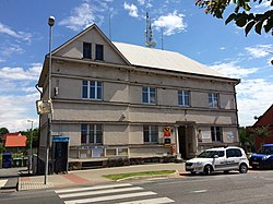
 Mratín (municipal office) | |
 | |
| Country | |
| Region | Central Bohemian Region |
| District | Prague-East District |
| Area | |
| • Total | 1.88 sq mi (4.87 km2) |
| Elevation | 630 ft (192 m) |
| Population (2010) | |
| • Total | 1,144 |
| Time zone | UTC+1 (CET) |
| • Summer (DST) | UTC+2 (CEST) |
Mratín is a village in the Prague-East District, Central Bohemian Region of the Czech Republic. On the date August 28, 2006 it has 760 inhabitants. First written notice about village is from year 1379. It is a member of Mikroregion Povodí Mratínského potoka.
External links
- Village website (in Czech)
- Unofficial website (in Czech)

50°12′16″N 14°33′08″E / 50.20444°N 14.55222°E
Wikimedia Commons has media related to Mratín.


