Herink
| Herink | ||||
|---|---|---|---|---|
|
||||
| Basic data | ||||
| State : |
|
|||
| Region : | Středočeský kraj | |||
| District : | Praha-východ | |||
| Area : | 273 ha | |||
| Geographic location : | 49 ° 58 ' N , 14 ° 34' E | |||
| Height: | 362 m nm | |||
| Residents : | 740 (Jan. 1, 2019) | |||
| Postal code : | 251 70 | |||
| License plate : | S. | |||
| traffic | ||||
| Street: | Dobřejovice - Radějovice | |||
| Next international airport : | Prague airport | |||
| structure | ||||
| Status: | local community | |||
| Districts: | 1 | |||
| administration | ||||
| Mayor : | Jaroslav Zima (as of 2008) | |||
| Address: | Herink 28 251 01 Říčany u Prahy |
|||
| Municipality number: | 564915 | |||
| Website : | www.obecherink.cz | |||
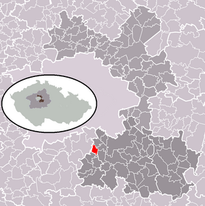
| Location of Herink in the Praha-východ district | ||||

|
||||
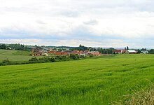
Herink (German Häring , formerly also Hering ) is a municipality in the Czech Republic . It is located seven kilometers southwest of Říčany and belongs to the Okres Praha-východ .
geography
Herink is located at the transition from the Central Bohemian Table to the Central Bohemian Highlands on a right tributary to the Botič . State road 101 runs north from Jesenice to the D 1 motorway and to Říčany .
Neighboring towns are Dobřejovice in the north, Modletice in the east, Popovičky and Chomutovice in the southeast, Nebřenice, Čenětice, Olešky and Radějovice in the south, Kršovice and Horní Jirčany in the southwest, Osnice in the west and Průhonice in the northwest.
history
The Herink farm, which belonged to the Prague citizens, was first mentioned in writing in 1422. Later various noble families owned the village. In 1622, Mikuláš Beřkovský from Šebířov on Horky and Košetice from Christoph Wratislaw from Mitrowitz on Dírná together with Lojovice also acquired part of Herinky. Wilhelm Vok Vit von Rzava joined Herinky in 1654 to the Dobřejovice rule. In 1829 the owner of the Modletice estate, Ignác Vyšína, bought a share of the village.
After the abolition of patrimonial Herinky formed a municipality in the Říčany district from 1850. From 1869 it belonged to the Český Brod District , from 1890 to the Žižkov District and from 1921 back to the Říčany District. At this time the name of the community was changed to Herink .
In 1930, when the village brook was being prepared at the Tvrzce square, a double stone rampart of unknown origin was excavated. The archaeologist and writer Eduard Štorch wrote in his novel “Hrdina Nik” about an Avar camp “Hrynk”, which is said to have been located south of Prague in the 7th century.
1961 was incorporated into Dobřejovice, at the same time the village was assigned to Okres Praha-východ . The community has existed again since 1990. Herink consists of 35 residential buildings.
The village has a coat of arms that shows a white half of a lily on the left on a red background and three white herrings on the right on a blue background.
Community structure
No districts are shown for the municipality of Herink.
Attractions
- chapel
- former inn
- Crucifix and village bell
- listed linden tree


