Pauini
Pauini | |
|---|---|
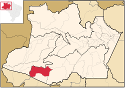
 Location of the municipality inside Amazonas | |
| Coordinates: 7°42′50″S 66°58′33″W / 7.71389°S 66.97583°W | |
| Country | |
| Region | North |
| State | |
| Area | |
| • Total | 43,263 km2 (16,704 sq mi) |
| Population (2020) | |
| • Total | 19,522 |
| • Density | 0.45/km2 (1.2/sq mi) |
| Time zone | UTC−4 (AMT) |
Pauini is a municipality located in the Brazilian state of Amazonas.
The population of Pauini was 19,522 in 2020.[1] Its area is 43,263 square kilometres (16,704 sq mi).[2] The municipality contains the 256,000 hectares (630,000 acres) Purus National Forest, created in 1988.[3] It holds 8% of the 311,000 hectares (770,000 acres) Mapiá-Inauini National Forest, created in 1989.[4] It also contains 8% of the 604,209 hectares (1,493,030 acres) Médio Purus Extractive Reserve, created in 2008.[5]
References
- ^ IBGE 2020
- ^ IBGE - [1]
- ^ FLONA do Purus (in Portuguese), ISA: Instituto Socioambiental, retrieved 2016-09-08
- ^ FLONA Mapiá-Inauini (in Portuguese), ISA: Instituto Socioambiental, retrieved 2016-09-08
- ^ RESEX Médio Purus (in Portuguese), ISA: Instituto Socioambiental, retrieved 2016-09-03

