Anamã
| Anamã | ||
|---|---|---|
|
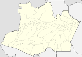
Coordinates: 3 ° 35 ′ S , 61 ° 24 ′ W Anamã on the map of the Amazon
|
||
| Basic data | ||
| Country | Brazil | |
| State | Amazon | |
| City foundation | 2nd July 1981 | |
| Residents | 10,214 (2010) | |
| City insignia | ||
| Detailed data | ||
| surface | 2454 km 2 | |
| Population density | 4 people / km 2 | |
| height | 29 m | |
| Waters | Rio Solimões | |
| Post Code | 69445-000. | |
| Time zone | UTC −4 | |
| City Presidency | Raimundo Pinheiro da Silva (PMDB) (2017-2020) | |
| Central Amazon mesoregion | ||
| Location of Anamã in the state of Amazonas | ||
Anamã , officially Município de Anamã , is a Brazilian municipality in the state of Amazonas in the mesoregion Centro Amazonense (Central Amazonia) in the microregion Coari . Neighboring cities are Manacapuru , Caapiranga , Codajás , Anori and Beruri . The population on July 1st, 2016 was estimated at 12,653 inhabitants, which corresponds to a population density of 4 people per km².
Before emancipation, the municipality was the dependent Distrito de Anamã within Anori, where it was spun off on July 2, 1981 and made an independent city. As of 2017, there are 22 other smaller settlements in the municipality, which are referred to as Comunidade , including the Comunidades Arixi, Cuia, Novo Brasil, Mato Rosso, Nossa Senhora de Nazaré and in the indigenous settlement area São José, Eware (Tikunas), Bom Jesus , Nova Esperança and Santa Luzia (Kokamas) on the Ilha do Camaleão.
City prefect (executive) has been Raimundo Pinheiro da Silva of the Partido do Movimento Democrático Brasileiro (PMDB) since the local elections in 2016 . President of the Munizipkammer or City Council (Legislative) is the City Councilor Benedito Soares Bastos of the Democratas (DEM).
geography
location
The city is located 129 km from the capital of the state ( Manaus ).
climate
The city has a tropical rainforest climate ( monsoon ), according to the effective climate classification of Köppen and Geiger Af . The annual average temperature is 27.0 ° C. About 2251 mm of precipitation falls annually. There is heavy rainfall during most months of the year. The dry season is short.
|
Climate in Anamã
Source: de.climate-data.org
|
|||||||||||||||||||||||||||||||||||||||||||||||||||||||||||||||||||||||||||||||||||||||||||||||||||||
Waters
The city lies on the Rio Solimões . Lake Anamã is located in the municipality .
Average Income and HDI
The median income in 2011 was 5,017 real and the human development index (HDI) was 0.594.
Web links
- Website of the Municipal Chamber of Anamã (Portuguese)
Individual evidence
- ↑ a b IBGE : Cidades @ Amazonas: Anamã. Retrieved May 19, 2017 (Portuguese).
- ↑ Mesa diretoria , site Câmara Municipal Anama. Retrieved May 19, 2017 (Portuguese).
- ↑ Climate information , accessed on October 17, 2015
- ↑ IBGE , accessed October 17, 2015


