Urucará
| Urucará | ||
|---|---|---|
|
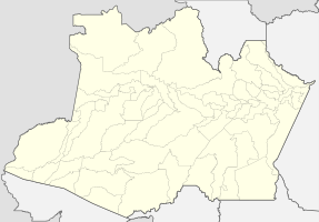
Coordinates: 2 ° 32 ′ S , 57 ° 46 ′ W Urucará on the map of the Amazon
|
||
| Basic data | ||
| Country | Brazil | |
| State | Amazon | |
| City foundation | May 12, 1887 | |
| Residents | 17,163 (2010) | |
| City insignia | ||
| Detailed data | ||
| surface | 27,904 km 2 | |
| Population density | 1 inhabitant / km 2 | |
| height | 24 m | |
| Waters | Rio Uatumã | |
| Post Code | 69130-000 | |
| prefix | +55 92 5711-283 | |
| Time zone | UTC −4 | |
| City Presidency | Enrico de Souza Falabella ( PMDB ) (2017-2020) | |
| Central Amazon mesoregion | ||
| Location of Urucará in Amazonas | ||
Urucará , officially Município de Urucará , is a Brazilian municipality in the state of Amazonas in the mesoregion Centro Amazonense (Central Amazonia) in the microregion Parintins . Neighboring cities are Presidente Figueiredo and São Sebastião do Uatumã in the west, São João da Baliza ( Roraima ) in the north, Nhamundá in the east, Silves and Itacoatiara in the south-east, Urucurituba in the south . In terms of area, the city is the 32nd largest in Brazil and larger than Hesse .
geography
location
The city is located 281 km from the state capital ( Manaus ).
climate
The city has a tropical climate ( monsoon ), according to the effective climate classification of Köppen and Geiger Am . The annual average temperature is 27.4 ° C. About 2089 mm of precipitation falls annually. There is heavy rainfall during most months of the year. The dry season is short.
|
Average monthly temperatures and rainfall for Urucará
Source: de.climate-data.org
|
|||||||||||||||||||||||||||||||||||||||||||||||||||||||||||||||||||||||||||||||||||||||||||||||||||||
economy
Cassava , cocoa , passion fruit , bananas, guarana , corn and beans are the main agricultural products. Cattle and pigs are bred for local consumption. The area around Urucará is rich in mineral resources: tin , cryolite , niobium , tantalum , bauxite , thorium , uranium , xenotime , limestone (mined in the Jatapu mine), gypsum and iron .
Average Income and HDI
The median income in 2011 was 7,391 real and the human development index (HDI) was 0.620.
Web links
Individual evidence
- ↑ IBGE : Urucará. Retrieved October 12, 2015 (Portuguese).
- ↑ Enrico Falabella 15 , website Eleições 2016. Retrieved May 22, 2017 (Portuguese).
- ↑ Climate information , accessed on October 12, 2015
- ↑ Mining market study , accessed on October 12, 2015
- ↑ Brazil portal , accessed on October 12, 2015
- ↑ IBGE , accessed October 12, 2015


