Manaquiri
| Manaquiri | ||
|---|---|---|
|
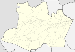
Coordinates: 3 ° 26 ′ S , 60 ° 28 ′ W Manaquiri on the map of the Amazon
|
||
| Basic data | ||
| Country | Brazil | |
| State | Amazon | |
| City foundation | December 10, 1981 | |
| Residents | 28,413 (2010) | |
| Detailed data | ||
| surface | 3975 km 2 | |
| Population density | 7 people / km 2 | |
| height | 48 m | |
| Post Code | 69435-000 | |
| prefix | +55 92 3631-207 | |
| Time zone | UTC −4 | |
| City Presidency | Jair Aguiar Souto ( PMDB ) (2017-2020) | |
| Central Amazon mesoregion | ||
| Location of Manaquiri in Amazon | ||
Manaquiri , officially Município de Manaquiri , is a Brazilian municipality in the state of Amazonas . The city is located directly on the Rio Solimões and is part of the metropolitan area of Manaus .
geography
location
The city is 60 km southwest of the state's capital, Manaus , and borders Manacapuru in the northwest , Iranduba in the northeast, Careiro in the southeast and Beruri in the southwest .
climate
The city has a tropical rainforest climate, Af according to the Köppen and Geiger climate classification . The average temperature is 27.3 ° C. The average rainfall is 2218 mm per year.
traffic
The state road AM-354 leads to the city.
Average income and standard of living
The monthly average income in 2017 was 1.6 times the Brazilian minimum wage ( Salário mínimo ) of R $ 880.00 (converted for 2019: around € 312). The Human Development Index (HDI) is rated low at 0.596 for 2010.
The gross national product per capita in 2016 was R $ 8,518.37, the gross national product of the entire municipality was R $ 249,818,300 (about € 55.41 million).
Web links
Individual evidence
- ↑ IBGE : Manaquiri. Retrieved September 21, 2015 (Portuguese).
- ↑ Jair Souto 15 , website Eleições 2016. Retrieved on May 21, 2017 (Portuguese).
- ↑ Climate Manaquiri: Weather, average temperature, weather forecast for Manaquiri. In: climate-data.org. de.climate-data.org, accessed on September 15, 2019 .


