| Rank | map
|
local community
|
Municipality
number
|
2000
census |
2010
census |
2019 estimate
|
Area
km 2 (2018)
|
|
050
|

|
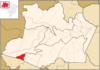
Alvarães
3 ° 13 ′ 15 ″ S, 64 ° 48 ′ 15 ″ W
( Q1808573 )
|
1300029
|
000000000012150.000000000012,150
|
000000000014088.000000000014,088 ▲
|
000000000016041.000000000016,041
|
5,923,461
|
|
058
|

|
Amaturá
3 ° 21 ′ 50 ″ S, 68 ° 11 ′ 52 ″ W
( Q1772609 )
|
1300060
|
000000000007308.00000000007,308
|
000000000009467.00000000009,467 ▲
|
000000000011536.000000000011,536
|
4,754.109
|
|
056
|
|
Anamã
3 ° 34 ′ 48 ″ S, 61 ° 24 ′ 14 ″ W
( Q974915 )
|
1300086
|
000000000006563.00000000006,563
|
000000000010214.000000000010,214 ▲
|
000000000013614.000000000013,614
|
2,446.121
|
|
037
|
|
Anori
3 ° 46 ′ 22 ″ S, 61 ° 38 ′ 39 ″ W
( Q931090 )
|
1300102
|
000000000011320.000000000011,320
|
000000000016317.000000000016,317 ▲
|
000000000021010.000000000021,010
|
6,036,380
|
|
035
|

|
Apuí
7 ° 11 ′ 49 ″ S, 59 ° 53 ′ 27 ″ W
( Q1112525 )
|
1300144
|
000000000013864.000000000013,864
|
000000000018007.000000000018.007 ▲
|
000000000021973.000000000021,973
|
54,240,556
|
|
041
|
|
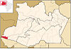
Atalaia do Norte
4 ° 22 ′ 19 ″ S, 70 ° 11 ′ 31 ″ W
( Q1793319 )
|
1300201
|
000000000010049.000000000010,049
|
000000000015153.000000000015,153 ▲
|
000000000019921.000000000019,921
|
76,435.093
|
|
016
|

|
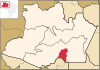
Autazes
3 ° 34 ′ 48 ″ S, 59 ° 7 ′ 51 ″ W
( Q1772695 )
|
1300300
|
000000000024345.000000000024,345
|
000000000032135.000000000032,135 ▲
|
000000000039565.000000000039,565
|
7,652,852
|
|
030th
|
|
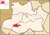
Barcelos
0 ° 58 ′ 30 ″ S, 62 ° 55 ′ 26 ″ W
( Q807939 )
|
1300409
|
000000000024197.000000000024,197
|
000000000025718.000000000025,718 ▲
|
000000000027502.000000000027.502
|
122,461,086
|
|
024
|
|
Barreirinha
2 ° 47 ′ 34 ″ S, 57 ° 4 ′ 12 ″ W
( Q1772565 )
|
1300508
|
000000000022579.000000000022,579
|
000000000027355.000000000027,355 ▲
|
000000000032041.000000000032,041
|
5,751,765
|
|
014th
|

|
Benjamin Constant
4 ° 22 ′ 58 ″ S, 70 ° 1 ′ 51 ″ W
( Q1767926 )
|
1300607
|
000000000023219.000000000023,219
|
000000000033411.000000000033,411 ▲
|
000000000042984.000000000042,984
|
8,695,392
|
|
042
|

|
Beruri
3 ° 53 ′ 54 ″ S, 61 ° 22 ′ 23 ″ W
( Q584172 )
|
1300631
|
000000000011038.000000000011,038
|
000000000015486.000000000015,486 ▲
|
000000000019679.000000000019,679
|
17,472,785
|
|
046
|

|
Boa Vista do Ramos
2 ° 58 ′ 12 ″ S, 57 ° 35 ′ 24 ″ W
( Q940548 )
|
1300680
|
000000000010482.000000000010,482
|
000000000014979.000000000014,979 ▲
|
000000000019207.000000000019.207
|
2,589,407
|
|
022nd
|

|
Boca do Acre
8 ° 45 ′ 7 ″ S, 67 ° 23 ′ 52 ″ W
( Q1793334 )
|
1300706
|
000000000026959.000000000026,959
|
000000000030632.000000000030,632 ▲
|
000000000034308.000000000034,308
|
21,938,591
|
|
015th
|

|
Borba
4 ° 23 ′ 16 ″ S, 59 ° 35 ′ 38 ″ W
( Q2089660 )
|
1300805
|
000000000028619.000000000028,619
|
000000000034961.000000000034,961 ▲
|
000000000041161.000000000041,161
|
44,236.184
|
|
057
|

|
Caapiranga
3 ° 19 ′ 39 ″ S, 61 ° 12 ′ 32 ″ W
( Q945469 )
|
1300839
|
000000000008803.00000000008,803
|
000000000010975.000000000010,975 ▲
|
000000000013081.000000000013,081
|
9,455,539
|
|
052
|

|
Canutama
6 ° 32 ′ 2 ″ S, 64 ° 22 ′ 58 ″ W
( Q1807050 )
|
1300904
|
000000000010737.000000000010,737
|
000000000012738.000000000012,738 ▲
|
000000000015629.000000000015,629
|
33,642,597
|
|
027
|
|
Carauari
4 ° 52 ′ 58 ″ S, 66 ° 53 ′ 45 ″ W
( Q1794236 )
|
1301001
|
000000000023421.000000000023,421
|
000000000025774.000000000025,774 ▲
|
000000000028294.000000000028,294
|
25,778.658
|
|
018th
|

|
Careiro
3 ° 46 ′ 4 ″ S, 60 ° 22 ′ 8 ″ W
( Q1751325 )
|
1301100
|
000000000027554.000000000027,554
|
000000000032734.000000000032,734 ▲
|
000000000037869.000000000037,869
|
6,096,210
|
|
026th
|
|
Careiro da Várzea
3 ° 13 ′ 15 ″ S, 59 ° 49 ′ 33 ″ W
( Q1807045 )
|
1301159
|
000000000017267.000000000017,267
|
000000000023930.000000000023,930 ▲
|
000000000030225.000000000030,225
|
2,627,474
|
|
005
|

|
Coari
4 ° 5 ′ 6 ″ S, 63 ° 8 ′ 27 ″ W
( Q645204 )
|
1301209
|
000000000067096.000000000067.096
|
000000000075965.000000000075,965 ▲
|
000000000085097.000000000085.097
|
57,970.768
|
|
029
|

|
Codajás
3 ° 50 ′ 13 ″ S, 62 ° 3 ′ 25 ″ W
( Q1762074 )
|
1301308
|
000000000017507.000000000017,507
|
000000000023206.000000000023.206 ▲
|
000000000028637.000000000028,637
|
18,700.713
|
|
021st
|
|
Eirunepé
6 ° 39 ′ 36 ″ S, 69 ° 52 ′ 26 ″ W
( Q1646910 )
|
1301407
|
000000000026074.000000000026,074
|
000000000030665.000000000030,665 ▲
|
000000000035273.000000000035,273
|
14,966.244
|
|
040
|
|
Envira
7 ° 25 ′ 58 ″ S, 70 ° 1 ′ 22 ″ W
( Q1750090 )
|
1301506
|
000000000019060.000000000019,060
|
000000000016338.000000000016,338 ▼
|
000000000020033.000000000020,033
|
7,505,807
|
|
038
|

|
Fonte Boa
2 ° 30 ′ 50 ″ S, 66 ° 5 ′ 30 ″ W
( Q1793768 )
|
1301605
|
000000000031509.000000000031,509
|
000000000022817.000000000022,817 ▼
|
000000000017609.000000000017,609
|
12,155,427
|
|
049
|
|
Guajará
7 ° 32 ′ 45 ″ S, 72 ° 35 ′ 2 ″ W
( Q1808440 )
|
1301654
|
000000000013220.000000000013,220
|
000000000013974.000000000013,974 ▲
|
000000000016678.000000000016,678
|
7,583,720
|
|
010
|
|
Humaitá
7 ° 30 ′ 22 ″ S, 63 ° 1 ′ 15 ″ W
( Q1025760 )
|
1301704
|
000000000032796.000000000032,796
|
000000000044227.000000000044,227 ▲
|
000000000055080.000000000055,080
|
33,111,143
|
|
028
|

|
Ipixuna
7 ° 3 ′ 3 ″ S, 71 ° 41 ′ 42 ″ W
( Q1794374 )
|
1301803
|
000000000014759.000000000014,759
|
000000000022254.000000000022,254 ▲
|
000000000029689.000000000029,689
|
12,109.777
|
|
011
|

|
Iranduba
3 ° 17 ′ 6 ″ S, 60 ° 11 ′ 9 ″ W
( Q1761947 )
|
1301852
|
000000000032303.000000000032,303
|
000000000040781.000000000040,781 ▲
|
000000000048296.000000000048,296
|
2,216.817
|
|
003
|

|
Itacoatiara
3 ° 8 ′ 34 ″ S, 58 ° 26 ′ 38 ″ W
( Q1750426 )
|
1301902
|
000000000072105.000000000072.105
|
000000000086839.000000000086,839 ▲
|
000000000101337.0000000000101,337
|
8,891,906
|
|
061
|
|
Itamarati
6 ° 25 ′ 30 ″ S, 68 ° 15 ′ 10 ″ W
( Q1102558 )
|
1301951
|
000000000008406.00000000008,406
|
000000000008038.00000000008,038 ▼
|
000000000007851.00000000007,851
|
25,260,429
|
|
060
|
|
Itapiranga
2 ° 44 ′ 56 ″ S, 58 ° 1 ′ 19 ″ W
( Q1808448 )
|
1302009
|
000000000007309.00000000007,309
|
000000000008211.00000000008.211 ▲
|
000000000009148.00000000009,148
|
4,335,075
|
|
062
|

|
Japurá
1 ° 49 ′ 34 ″ S, 66 ° 35 ′ 56 ″ W
( Q1757955 )
|
1302109
|
000000000010285.000000000010,285
|
000000000007326.00000000007,326 ▼
|
000000000002755.00000000002,755
|
55,827.207
|
|
053
|

|
Juruá
3 ° 28 ′ 51 ″ S, 66 ° 4 ′ 8 ″ W
( Q1008285 )
|
1302207
|
000000000006584.00000000006,584
|
000000000010802.000000000010.802 ▲
|
000000000014712.000000000014,712
|
19,442,548
|
|
051
|
|
Jutaí
2 ° 44 ′ 49 ″ S, 66 ° 46 ′ 1 ″ W
( Q684641 )
|
1302306
|
000000000022500.000000000022,500
|
000000000017992.000000000017,992 ▼
|
000000000014317.000000000014,317
|
69,457,415
|
|
012
|

|
Lábrea
7 ° 15 ′ 32 ″ S, 64 ° 47 ′ 52 ″ W
( Q386631 )
|
1302405
|
000000000028956.000000000028,956
|
000000000037701.000000000037,701 ▲
|
000000000046069.000000000046,069
|
68,262,696
|
|
004th
|

|
Manacapuru
3 ° 17 ′ 59 ″ S, 60 ° 37 ′ 14 ″ W
( Q983526 )
|
1302504
|
000000000073695.000000000073,695
|
000000000085141.000000000085.141 ▲
|
000000000097377.000000000097.377
|
7,336,579
|
|
025th
|
|
Manaquiri
3 ° 25 ′ 41 ″ S, 60 ° 27 ′ 34 ″ W
( Q1807976 )
|
1302553
|
000000000012711.000000000012,711
|
000000000022801.000000000022.801 ▲
|
000000000032105.000000000032,105
|
3,973.259
|
|
001
|

|
Manaus
3 ° 6 ′ 0 ″ S, 60 ° 1 ′ 0 ″ W
( Q40236 )
|
1302603
|
000000001405835.00000000001,405,835
|
000000001802014.00000000001,802,014 ▲
|
000000002182763.00000000002,182,763
|
11,401,092
|
|
009
|

|
Manicoré
5 ° 48 ′ 32 ″ S, 61 ° 18 ′ 0 ″ W
( Q43490 )
|
1302702
|
000000000038038.000000000038.038
|
000000000047017.000000000047.017 ▲
|
000000000055751.000000000055,751
|
48,315,021
|
|
045
|

|
Maraã
1 ° 51 ′ 21 ″ S, 65 ° 34 ′ 51 ″ W
( Q1763270 )
|
1302801
|
000000000017079.000000000017,079
|
000000000017528.000000000017,528 ▲
|
000000000018224.000000000018,224
|
16,830,827
|
|
007th
|

|
Maués
3 ° 23 ′ 1 ″ S, 57 ° 43 ′ 7 ″ W
( Q1808581 )
|
1302900
|
000000000040036.000000000040,036
|
000000000052236.000000000052,236 ▲
|
000000000063905.000000000063.905
|
39,991,066
|
|
036
|

|
Nhamundá
2 ° 11 ′ 9 ″ S, 56 ° 42 ′ 46 ″ W
( Q1793306 )
|
1303007
|
000000000015355.000000000015,355
|
000000000018278.000000000018,278 ▲
|
000000000021173.000000000021,173
|
14,107,040
|
|
019th
|
|
Nova Olinda do Norte
3 ° 53 ′ 16 ″ S, 59 ° 5 ′ 38 ″ W
( Q1772535 )
|
1303106
|
000000000023725.000000000023,725
|
000000000030696.000000000030,696 ▲
|
000000000037378.000000000037,378
|
5,578.132
|
|
044
|

|
Novo Airão
2 ° 37 ′ 15 ″ S, 60 ° 56 ′ 38 ″ W
( Q1750332 )
|
1303205
|
000000000009651.00000000009,651
|
000000000014723.000000000014,723 ▲
|
000000000019454.000000000019,454
|
37,776.770
|
|
031
|
|
Novo Aripuanã
5 ° 8 ′ 0 ″ S, 60 ° 22 ′ 30 ″ W
( Q1793549 )
|
1303304
|
000000000017119.000000000017,119
|
000000000021451.000000000021,451 ▲
|
000000000025644.000000000025,644
|
41,179.656
|
|
002
|
|
Parintins
2 ° 37 ′ 40 ″ S, 56 ° 44 ′ 9 ″ W
( Q926713 )
|
1303403
|
000000000090150.000000000090,150
|
000000000102033.0000000000102.033 ▲
|
000000000114273.0000000000114.273
|
5,956,047
|
|
039
|
|
Pauini
7 ° 42 ′ 50 ″ S, 66 ° 58 ′ 33 ″ W
( Q1793494 )
|
1303502
|
000000000017092.000000000017.092
|
000000000018166.000000000018,166 ▲
|
000000000019426.000000000019,426
|
41,624,668
|
|
020th
|
|
Presidente Figueiredo
2 ° 3 ′ 4 ″ S, 60 ° 1 ′ 30 ″ W
( Q655097 )
|
1303536
|
000000000017394.000000000017,394
|
000000000027175.000000000027,175 ▲
|
000000000036279.000000000036,279
|
25,459,099
|
|
023
|
|
Rio Preto da Eva
2 ° 41 ′ 56 ″ S, 59 ° 42 ′ 0 ″ W
( Q1793560 )
|
1303569
|
000000000017582.000000000017,582
|
000000000025719.000000000025,719 ▲
|
000000000033347.000000000033,347
|
5,815.622
|
|
032
|

|
Santa Isabel do Rio Negro
0 ° 24 ′ 50 ″ S, 65 ° 1 ′ 8 ″ W
( Q1754543 )
|
1303601
|
000000000010561.000000000010,561
|
000000000018146.000000000018,146 ▲
|
000000000025156.000000000025,156
|
62,800,079
|
|
033
|
|
Santo Antônio do Içá
3 ° 6 ′ 7 ″ S, 67 ° 56 ′ 24 ″ W
( Q970224 )
|
1303700
|
000000000028213.000000000028,213
|
000000000024481.000000000024,481 ▼
|
000000000021602.000000000021,602
|
12,366,143
|
|
013
|

|
São Gabriel da Cachoeira
0 ° 7 ′ 48 ″ S, 67 ° 5 ′ 20 ″ W
( Q694840 )
|
1303809
|
000000000029947.000000000029,947
|
000000000037896.000000000037,896 ▲
|
000000000045564.000000000045,564
|
109,181,240
|
|
017th
|
|
São Paulo de Olivença
3 ° 22 ′ 40 ″ S, 68 ° 52 ′ 22 ″ W
( Q1794983 )
|
1303908
|
000000000023113.000000000023,113
|
000000000031422.000000000031,422 ▲
|
000000000039299.000000000039,299
|
19,658.502
|
|
055
|
|
São Sebastião do Uatumã
2 ° 34 ′ 20 ″ S, 57 ° 52 ′ 20 ″ W
( Q1793440 )
|
1303957
|
000000000007160.00000000007.160
|
000000000010705.000000000010,705 ▲
|
000000000014020.000000000014,020
|
10,647,463
|
|
059
|

|
Silves
2 ° 50 ′ 20 ″ S, 58 ° 12 ′ 33 ″ W
( Q2089673 )
|
1304005
|
000000000007785.00000000007,785
|
000000000008444.00000000008,444 ▲
|
000000000009171.00000000009,171
|
3,723,382
|
|
006th
|

|
Tabatinga
4 ° 15 ′ 9 ″ S, 69 ° 56 ′ 17 ″ W
( Q22060342 )
|
1304062
|
000000000037919.000000000037,919
|
000000000052272.000000000052.272 ▲
|
000000000065844.000000000065,844
|
3,266,062
|
|
047
|

|
Tapauá
5 ° 37 ′ 40 ″ S, 63 ° 10 ′ 58 ″ W
( Q1794336 )
|
1304104
|
000000000020595.000000000020,595
|
000000000019077.000000000019,077 ▼
|
000000000017156.000000000017,156
|
84,946,166
|
|
008th
|

|
Tefé
3 ° 21 ′ 14 ″ S, 64 ° 42 ′ 39 ″ W
( Q975545 )
|
1304203
|
000000000064457.000000000064,457
|
000000000061453.000000000061,453 ▼
|
000000000059849.000000000059,849
|
23,692.223
|
|
043
|

|
Tonantins
2 ° 52 ′ 22 ″ S, 67 ° 48 ′ 7 ″ W
( Q1793355 )
|
1304237
|
000000000015512.000000000015,512
|
000000000017079.000000000017,079 ▲
|
000000000018755.000000000018,755
|
6,446,894
|
|
054
|

|
Uarini
2 ° 59 ′ 24 ″ S, 65 ° 6 ′ 28 ″ W
( Q517607 )
|
130426
|
000000000010254.000000000010,254
|
000000000011891.000000000011,891 ▲
|
000000000013540.000000000013,540
|
10,274.677
|
|
048
|
|
Urucará
2 ° 32 ′ 9 ″ S, 57 ° 45 ′ 36 ″ W
( Q1816370 )
|
1304302
|
000000000018372.000000000018,372
|
000000000017094.000000000017.094 ▼
|
000000000016256.000000000016,256
|
27,901,962
|
|
034
|

|
Urucurituba
3 ° 7 ′ 51 ″ S, 58 ° 9 ′ 18 ″ W
( Q1793833 )
|
1304401
|
000000000012264.000000000012,264
|
000000000017837.000000000017,837 ▲
|
000000000023065.000000000023,065
|
2,886,494
|


.PNG)


