Parintins
| Parintins | ||
|---|---|---|
|
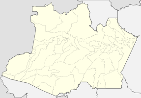
Coordinates: 2 ° 38 ′ S , 56 ° 44 ′ W Parintins on the map of the Amazon
|
||
| Basic data | ||
| Country | Brazil | |
| State | Amazon | |
| City foundation | 1796 | |
| Residents | 102,033 (2010) | |
| City insignia | ||
| Detailed data | ||
| surface | 5,952.333 km 2 | |
| Population density | 17.14 inhabitants / km 2 | |
| height | 50 m | |
| Time zone | UTC −4 | |
| City Presidency | Frank Luiz da Cunha Garcia ( PSDB ) (2017-2020) | |
| City patron | Nossa Senhora do Carmo | |
| Central Amazon mesoregion | ||
| Aerial view of Parintins | ||
| Location of Parintins in the state of Amazonas | ||
Parintins , officially Município de Parintins , is the second largest city in the Brazilian state of Amazonas with 102,033 inhabitants and an area of 5,952 km² . It is located on the island of Tupinambarana , 461 km (by water, 371 km as the crow flies) from Manaus , the capital of the state. In 2019, an estimated 114,273 people lived in Parintins.
Tupinambarana Island was first mentioned in 1795 when the Portuguese Carmelite José das Chagas built the Church of São Benedito. The region was then inhabited by several Indian peoples and was previously part of the sphere of influence of Spanish missionaries from Peru and Colombia . In 1796 Brazilian militiamen and settlers under Captain José Pedro Cordovil came to the area, which had previously only been visited by missionaries, and occupied the island. In 1803 Cordovil founded a settlement on the island called Vila Nova da Rainha ("Queen's New City"). In 1833 the name was changed to Nossa Senhora do Carmo de Tupinambarana (" Our Lady on Mount Carmel of Tupinambarana"). On October 24, 1848, the place was constituted as a municipality and renamed Vila Bela da Imperatriz ("Beautiful City of the Empress"). On October 15, 1852, the community became independent and spun off from the previously superior city of Maués . On March 14, 1853, the parish of Parintins was founded. On October 30, 1880, the town was granted city rights and the name Parintins was officially introduced. Since 1881, districts of Parintins have been removed from Parintins and declared to be independent communities, most recently on December 19, 1956, the then district of Ilha das Cotias , which is also on an island today, the neighboring community of Nhamundá .
In 1945 the Church of the Sacred Heart of Jesus was built in Parintins.
Parintins is best known for the annual folk festival that takes place at the end of June around the popular dramatic dance cycle Bumba-meu-boi ("Stand up, my ox!"), Which addresses the resurrection of an ox. In a fantastic competition, the two parties, the Blue (Boi Caprichoso) and the Red (Boi Garantido) compete for the most successful performance of the dance game in a parade that has been prepared by the whole city for months. The performance of the parties, combined with colorful dances and sumptuous costumes, is judged by a jury. For this festival there is a separate, large stadium in Parintins, which is called Bumbódromo after the Sambódromo in the carnival in Rio .
Web links
Individual evidence
- ↑ IBGE : Cidades @ Amazonas: Parintins. Retrieved September 10, 2019 (Brazilian Portuguese).
- ^ Bi Garcia 45 , website Eleições 2016. Retrieved May 22, 2017 (Portuguese).
- ↑ IBGE : Estimativas da população residente no Brasil e unidades da federação com data de referência em 1 ° de julho de 2019. (PDF) Retrieved on September 10, 2019 (Brazilian Portuguese).
- ↑ Projetos buscam melhorar infraestrutura da cidade (newspaper report from Gazeta Mercantil of June 24, 1999 with basic historical information, accessed on December 29, 2015).
- ↑ Boi-Bumba-Festival Parintins on gatewaybrazil (travel portal), accessed on December 26, 2015


