Careiro da Várzea
| Careiro da Várzea | ||
|---|---|---|
|
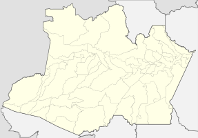
Coordinates: 3 ° 13 ′ S , 59 ° 50 ′ W Careiro da Várzea on the map of the Amazon
|
||
| Basic data | ||
| Country | Brazil | |
| State | Amazon | |
| City foundation | December 30, 1987 | |
| Residents | 27,981 (2010) | |
| City insignia | ||
| Detailed data | ||
| surface | 2631 km 2 | |
| Population density | 11 people / km 2 | |
| height | 41 m | |
| Post Code | 69255 | |
| prefix | ++ 55 92 3692-203 | |
| Time zone | UTC −4 | |
| City Presidency | Ramiro Gonçalves de Araújo ( PMDB ) (2017-2020) | |
| Website | ||
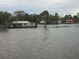
| Houses on the river | ||
| Location of Careiro da Várzea in the Amazon | ||
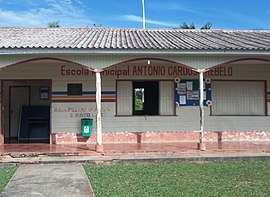
| School of the community | ||
Careiro da Várzea , officially Município de Careiro da Várzea , is a Brazilian municipality in the state of Amazonas . The city is located on the southern bank of the Amazon across from Manaus and belongs to the metropolitan area of Manaus .
geography
location
The city is 25 km from the state capital ( Manaus ). Neighboring cities are Manaus, Careiro , Iranduba , Manacapuru and Autazes .
climate
The city has a tropical climate ( monsoon ).
traffic
Careiro da Várzea is the end point of the BR-319 federal road , which comes from southern Brazil. There is a ferry connection to Manaus.
Average income, GDP per capita and HDI
The average income in 2017 was 1.6 times the minimum wage of R $ 880. The gross national product per capita was 10,730.33 real in 2017 , the human development index (HDI) in 2010 was 0.569.
Web links
Commons : Careiro da Várzea - collection of images, videos and audio files
- Website about the city
- Careiro da Várzea - Informações sobres o município ea prefeitura. In: com.br. www.cidade-brasil.com.br(Brazilian Portuguese).
Individual evidence
- ↑ a b Careiro da Várzea - Panorama , updated statistical information from the Instituto Brasileiro de Geografia e Estatística , accessed on April 1, 2020.
- ↑ Ramiro 15 , website Eleições 2016. Retrieved May 20, 2017 (Portuguese).


