Caapiranga
| Caapiranga | ||
|---|---|---|
|
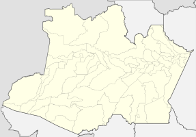
Coordinates: 3 ° 20 ′ S , 61 ° 13 ′ W Caapiranga on the Amazon map
|
||
| Basic data | ||
| Country | Brazil | |
| State | Amazon | |
| City foundation | October 12, 1981 | |
| Residents | 12,214 (2010) | |
| Detailed data | ||
| surface | 9454 km 2 | |
| Population density | 1 inhabitant / km 2 | |
| height | 32 m | |
| Post Code | 69410 | |
| prefix | +55 92 3641 | |
| Time zone | UTC −4 | |
| City Presidency | Antonio Ferreira Lima ( PMDB ) (2017-2020) | |
| Website | ||
| Central Amazon mesoregion | ||
| Location of Caapiranga in the state of Amazonas | ||
Caapiranga , officially Município de Caapiranga , is a Brazilian municipality in the state of Amazonas in the mesoregion Centro Amazonense (Central Amazonia) in the microregion Coari .
geography
The city is 133 km from the state capital ( Manaus ). Neighboring communities are Novo Airão north, Codajás south-west, Anamã south and Manacapuru east.
Average Income and HDI
The median income in 2011 was 9,266 real and the human development index (HDI) was 0.569.
Web links
Commons : Caapiranga - collection of images, videos and audio files
Individual evidence
- ↑ IBGE : Caapiranga. Retrieved January 1, 2016 (Portuguese).
- ↑ Information about the city , accessed on January 1, 1916.
- ↑ Antonio Lima 15 , website Eleições 2016. Retrieved May 20, 2017 (Portuguese).
- ↑ IBGE , accessed January 1, 2016


