-9 -70Coordinates: 9 ° 0 ′ S , 70 ° 0 ′ W
The list of municipalities in Acre by population reflects the results of the 2010 census for the Brazilian state of Acre , as published by the Instituto Brasileiro de Geografia e Estatística (IBGE). As of 2017, Acre had a total of 22 cities and municipalities, the municípios .
More recent estimates of the population were published by the IBGE on July 1, 2019. The next census is scheduled for 2020 every 10 years.
The total number of residents of the state of Acre was 733,559 according to the 2010 census, and 881,935 according to an estimate as of July 1, 2019.
In 2017, the Instituto Brasileiro de Geografia e Estatística changed the assignment of micro- and mesoregions to new geostatistical regions and assigned the municipalities to a Região geográfica imediata and a Região geográfica intermediária .
Communities
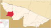
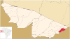
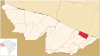
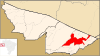
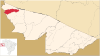
f1 Map with all the coordinates of the municipalities section : OSM
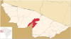
| Rank | map
|
local community
|
Municipality
number
|
Population
2000
|
Residents
2010
|
Residents
2019
|
Area
km²
|
Mesoregion (
1989-2017)
|
Microregion (
1989-2017)
|
| 15th
|

|
Acrelândia
9 ° 49 ′ 40 ″ S, 66 ° 52 ′ 58 ″ W.
|
1200013
|
7,935
|
000000000012538.000000000012,538 ▲
|
15,256
|
1,807.948
|
Vale do Acre
|
Rio Branco
|
| 21st
|

|
Assis Brasil
10 ° 56 ′ 27 ″ S, 69 ° 34 ′ 1 ″ W.
|
1200054
|
3,490
|
000000000006072.00000000006,072 ▲
|
7,417
|
4,974.175
|
Vale do Acre
|
Brasiléia
|
| 6th
|

|
Brasiléia
11 ° 0 ′ 36 ″ S, 68 ° 44 ′ 52 ″ W.
|
1200104
|
17,013
|
000000000021398.000000000021,398 ▲
|
26,278
|
3,916.502
|
Vale do Acre
|
Brasiléia
|
| 18th
|

|
Bujari
9 ° 49 ′ 51 ″ S, 67 ° 57 ′ 7 ″ W.
|
1200138
|
5,826
|
000000000008471.00000000008,471 ▲
|
10,266
|
3,034,868
|
Vale do Acre
|
Rio Branco
|
| 17th
|

|
Capixaba
10 ° 34 ′ 22 ″ S, 67 ° 40 ′ 33 ″ W.
|
1200179
|
5,206
|
000000000008798.00000000008,798 ▲
|
11,733
|
1,701.974
|
Vale do Acre
|
Rio Branco
|
| 2
|

|
Cruzeiro do Sul
7 ° 37 ′ 51 ″ S, 72 ° 40 ′ 12 ″ W.
|
1200203
|
67,441
|
000000000078507.000000000078.507 ▲
|
88,376
|
8,779,403
|
Vale do Juruá
|
Cruzeiro do Sul
|
| 11
|

|
Epitaciolândia
11 ° 1 ′ 44 ″ S, 68 ° 44 ′ 27 ″ W
|
1200252
|
11,028
|
000000000015100.000000000015,100 ▲
|
18,411
|
1,654.768
|
Vale do Acre
|
Brasiléia
|
| 5
|

|
Feijó
8 ° 9 ′ 50 ″ S, 70 ° 21 ′ 14 ″ W.
|
1200302
|
26,722
|
000000000032412.000000000032,412 ▲
|
34,780
|
27,975,427
|
Vale do Juruá
|
Tarauacá
|
| 20th
|

|
Jordão
9 ° 26 ′ 2 ″ S, 71 ° 53 ′ 2 ″ W.
|
1200328
|
4,454
|
000000000006577.00000000006,577 ▲
|
8,317
|
5,357,282
|
Vale do Juruá
|
Tarauacá
|
| 10
|

|
Mâncio Lima
7 ° 36 ′ 50 ″ S, 72 ° 53 ′ 45 ″ W.
|
1200336
|
11,095
|
000000000015206.000000000015.206 ▲
|
18,977
|
5,452,853
|
Vale do Juruá
|
Cruzeiro do Sul
|
| 19th
|

|
Manoel Urbano
8 ° 50 ′ 20 ″ S, 69 ° 15 ′ 36 ″ W
|
1200344
|
6.374
|
000000000007981.00000000007,981 ▲
|
9,459
|
10,633,136
|
Vale do Acre
|
Sena Madureira
|
| 14th
|
|
Marechal Thaumaturgo
8 ° 56 ′ 27 ″ S, 72 ° 47 ′ 31 ″ W
|
1200351
|
8,295
|
000000000014227.000000000014,227 ▲
|
18,867
|
8,191,692
|
Vale do Juruá
|
Cruzeiro do Sul
|
| 8th
|
|
Plácido de Castro
10 ° 16 ′ 33 ″ S, 67 ° 9 ′ 0 ″ W.
|
1200385
|
15.172
|
000000000017209.000000000017.209 ▲
|
19,761
|
1,943,850
|
Vale do Acre
|
Rio Branco
|
| 12
|
|
Porto Acre
9 ° 35 ′ 16 ″ S, 67 ° 31 ′ 58 ″ W.
|
1200807
|
11,418
|
000000000014880.000000000014,880 ▲
|
18,504
|
2,604.885
|
Vale do Acre
|
Rio Branco
|
| 16
|

|
Porto Walter
8 ° 16 ′ 8 ″ S, 72 ° 44 ′ 38 ″ W.
|
1200393
|
5,485
|
000000000009176.00000000009.176 ▲
|
11,982
|
6,443,830
|
Vale do Juruá
|
Cruzeiro do Sul
|
| 1
|
|
Rio Branco
9 ° 58 ′ 30 ″ S, 67 ° 48 ′ 36 ″ W.
|
1200401
|
253.059
|
000000000336038.0000000000336.038 ▲
|
407.319
|
8,834,942
|
Vale do Acre
|
Rio Branco
|
| 13
|
|
Rodrigues Alves
7 ° 44 ′ 31 ″ S, 72 ° 38 ′ 49 ″ W.
|
1200427
|
8.093
|
000000000014389.000000000014,389 ▲
|
18,930
|
3,076,951
|
Vale do Juruá
|
Cruzeiro do Sul
|
| 22nd
|
|
Santa Rosa do Purus
9 ° 25 ′ 58 ″ S, 70 ° 29 ′ 34 ″ W.
|
1200435
|
2,246
|
000000000004691.00000000004,691 ▲
|
6,540
|
6,145.612
|
Vale do Acre
|
Sena Madureira
|
| 3
|

|
Sena Madureira
9 ° 3 ′ 57 ″ S, 68 ° 39 ′ 25 ″ W.
|
1200500
|
29,420
|
000000000038029.000000000038,029 ▲
|
45,848
|
23,753,067
|
Vale do Acre
|
Sena Madureira
|
| 7th
|

|
Senador Guiomard
10 ° 9 ′ 3 ″ S, 67 ° 44 ′ 9 ″ W.
|
1200450
|
19,761
|
000000000020179.000000000020,179 ▲
|
23,024
|
2,322.030
|
Vale do Acre
|
Rio Branco
|
| 4th
|

|
Tarauacá
8 ° 9 ′ 39 ″ S, 70 ° 45 ′ 57 ″ W.
|
1200609
|
26,037
|
000000000035590.000000000035,590 ▲
|
42,567
|
20,171.074
|
Vale do Juruá
|
Tarauacá
|
| 9
|

|
Xapuri
10 ° 39 ′ 7 ″ S, 68 ° 30 ′ 14 ″ W.
|
1200708
|
11,956
|
000000000016091.000000000016.091 ▲
|
19,323
|
5,347,468
|
Vale do Acre
|
Brasiléia
|
photos
See also
Individual evidence
-
^ Instituto Brasileiro de Geografia e Estatística (IBGE): Estados @ Acre. July 1, 2010, accessed August 3, 2013 .
-
↑ Instituto Brasileiro de Geografia e Estatística (IBGE): Censo Demográfico 2010. November 29, 2010, accessed on July 29, 2013 .
-
↑ Governo do Acre: Acre em números 2013. (PDF 34.3 MB) Retrieved April 26, 2019 (Brazilian Portuguese).
-
↑ a b Instituto Brasileiro de Geografia e Estatística (IBGE): Cidades @: Acre. Retrieved November 8, 2016 (Portuguese).
-
↑ a b IBGE: Acre: Panorama . Retrieved August 29, 2019 (Portuguese). See also the location entries there.
-
↑ Instituto Brasileiro de Geografia e Estatística (IBGE): Divisão Regional do Brasil. 2017, accessed August 31, 2018 .
-
↑ Official estimate according to Instituto Brasileiro de Geografia e Estatística (IGBE) - Panorama


