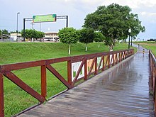
Bujari
| Município de Bujari Bujari |
|||
|---|---|---|---|
|
|
|||
| Coordinates | 9 ° 50 ′ S , 67 ° 57 ′ W | ||
 Bujari on the map of the state of Acre Bujari on the map of the state of Acre
|
|||
| Symbols | |||
|
|||
| founding | 1992 | ||
| Basic data | |||
| Country | Brazil | ||
| State | acre | ||
| ISO 3166-2 | BR-AC | ||
| Mesoregion | Vale do Acre (1989-2017) | ||
| Microregion | Rio Branco (1989-2017) | ||
| height | 238 m | ||
| surface | 3,034.9 km² | ||
| Residents | 8471 (2010) | ||
| density | 2.8 Ew. / km² | ||
| estimate | 10,266 Ew. (July 1, 2019) | ||
| Parish code | IBGE : 1200138 | ||
| Time zone | UTC -5 | ||
| Website | bujari.ac.gov.br (Brazilian Portuguese) | ||
| politics | |||
| City Prefect | Romualdo Araújo (2017-2020) | ||
| Political party | PCdoB | ||
| Culture | |||
| Patron saint | John the Baptist | ||
| economy | |||
| GDP | 145,973 thousand R $ 15,630 R $ per person (2015) |
||
| HDI | 0.589 (2010) | ||
Bujari , officially Portuguese Município de Bujari , is a small town in the northwest of the Brazilian state of Acre .
history
The establishment as an independent Município took place in 1992 through a spin-off from Rio Branco. The place has a border with the state of Amazonas in the north .
population
According to the 2010 census, the municipality had 8,471 inhabitants, who are called Bujarienser (Portuguese burjarienses ). According to the IBGE's estimate of July 1, 2019, the population was calculated to be 10,266. The area is 3034.869 km², the population density 2.8 people per km². The distance to the capital Rio Branco is 20 km.
Transport links
The diagonal BR-364 federal road runs through Bujari and connects to the northwest to Peru and to the southeast to São Paulo .
The international capital airport Rio Branco is around 10 km to the east.
Web links
- Bujari City Prefecture Website (Brazilian Portuguese)
Individual evidence
- ↑ a b c d IBGE : Cidades @ Acre: Bujari. Retrieved September 9, 2019 (Brazilian Portuguese).
- ↑ Eleições em Bujari / AC: Romualdo 65. In: com.br. Eleições 2016, accessed January 14, 2018 (Brazilian Portuguese).


