
Sena Madureira
| Município de Sena Madureira "Princesinha do Acre"
Sena Madureira
"Primeira Capital do Acre" |
|||
|---|---|---|---|
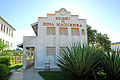
 View of Sena Madureira
|
|||
|
|||
| Coordinates | 9 ° 4 ′ S , 68 ° 39 ′ W | ||
 Location of Sena Madureira in Acre Location of Sena Madureira in Acre
|
|||
| Symbols | |||
|
|||
| founding | September 25, 1904 | ||
| Basic data | |||
| Country | Brazil | ||
| State | acre | ||
| ISO 3166-2 | BR-AC | ||
| Mesoregion | Vale do Acre (1989-2017) | ||
| Microregion | Sena Madureira (1989-2017) | ||
| structure | 1 multiple district | ||
| height | 150 m | ||
| Waters | Rio Iaco | ||
| surface | 23,753.1 km² | ||
| Residents | 38,029 (2010) | ||
| density | 1.6 Ew. / km² | ||
| estimate | 45,848 Ew. (July 1, 2019) | ||
| Time zone | UTC -5 | ||
| Website | www.senamadureira.ac.gov.br (Portuguese) | ||
| politics | |||
| City Prefect | Mazinho Serafim (2017-2020) | ||
| Political party | PMDB | ||
| economy | |||
| GDP | 9,615 thousand R $ 11,660 R $ per person (2014) |
||
| HDI | 0.603 (2010) | ||
| Climate: Af, tropical-equatorial | |||


Sena Madureira , officially Portuguese Município de Sena Madureira , is a city in the Brazilian state of Acre . It is 145 km away from the state capital Rio Branco . The population was estimated at 45,848 inhabitants in 2019 , called Sena-Madureirenser (Portuguese sena-madureirenses ). It is in the southwest border area with Peru .
Geography and climate
The landscape and climate are those of the Amazon rainforest . There is always a humid tropical rainforest climate , according to the Köppen and Geiger Af climate classification .

The area is 23,753.067 km² (2016), which results in a population density of 1.6 people per km².
The place is located on the banks of the Rio Iaco , large parts of the municipal area can be reached by rivers. The road connection is via the diagonal BR-364 federal road , so it is no longer isolated in the winter months due to previous poor road conditions. Until 1998 the place owned the Sena Madureira airport .
In the north, Sena Madureira borders on the state of Amazonas , in the south on the city of Assis Brasil , in the west on Bujari and in the east on Manoel Urbano . In the southwest it forms a green border with Peru . With Santa Rosa do Purus and Manoel Urbano it forms the microregion Sena Madureira (Portuguese Microrregião de Sena Madureira ), which in turn is part of the Mesoregion Vale do Acre (Portuguese Mesorregião do Vale do Acre ).
history
Acre did not become part of the Brazilian Republic until 1903 through the Treaty of Petrópolis , the area had the status of a territory ( Território Federal do Acre ) until 1962 . The city was founded on September 25, 1904 and received many immigrants from northeastern Brazil. During the rubber boom , the town grew and became the headquarters of the Departamento do Alto Puru and an important political center of the federal territory.

“Port” of Sena Madureira, early 20th century

Town hall, early 20th century

Rua Amazonas in Sena Madureira, early 20th century
City administration
The municipality forms a single administrative district with Sena Madureira as its seat. Mazinho Serafim (actually Osmar Serafim de Andrade), a member of the Partido do Movimento Democrático Brasileiro (PMDB), was elected as city prefect (mayor) for the executive branch .
Museu de Sena Madureira

Praça Sena Madureira

Avelino Chaves avenue


Population development
Source: IBGE (2018 figures are only estimates). 34.81% of the population in 2010 were children and adolescents up to 15 years. In 2010, 62.39% lived in the urban zone, 37.61% in extensive rural areas, mainly along rivers.

economy
| Share of GDP | ||||
|---|---|---|---|---|
| sector | Thousand real | |||
| Agriculture | 33.9 | |||
| service | 56.9 | |||
| Industry | 9.2 | |||
| Source: IBGE, 2014 | ||||
The human development index for cities, abbreviated HDI (Portuguese: IDH-M ) was in 1991 at the low value of 0.317, in 2010 at the medium high value of 0.603.
| HDI | ||||
|---|---|---|---|---|
| year | Points | |||
| 1991 | 0.317 | |||
| 2000 | 0.451 | |||
| 2010 | 0.603 | |||
education
Sena Madureira had an illiteracy rate of 56% in 1991 , which had already fallen to 32.3% in the 2010 census.
| Illiteracy rate | ||||
|---|---|---|---|---|
| year | percent | |||
| 1991 | 56.02 | |||
| 2000 | 42.2 | |||
| 2010 | 32.26 | |||
sons and daughters of the town
Born in Sena Madureira:
- Doka Madureira (* 1984), soccer player
Web links
- City Prefecture website , Prefeitura Municipal (Brazilian Portuguese)
- Sena Madureira: Panorama , Instituto Brasileiro de Geografia e Estatística (IBGE) with statistical information
Individual evidence
- ↑ a b IBGE : Cidades @ Acre: Sena Madureira. Retrieved September 9, 2019 (Brazilian Portuguese).
- ↑ a b Eleições 2016: Mazinho Serafim. Retrieved January 13, 2018 (Brazilian Portuguese).
- ↑ a b c Atlas do Desenvolvimento Humano do Brasil: Sena Madureira . Retrieved January 13, 2017 (Brazilian Portuguese).
Região geográfica intermediária and Região geográfica imediata
|
Rio Branco Code: 1201 |
|
|||||||
|
Cruzeiro do Sul Code: 1202 |
|

| Mesoregion Vale do Acre |
|
|||||||
| Mesoregion Vale do Juruá |
|