
Popovičky
Popovičky | |
|---|---|
 Church of Saint Bartholomew | |
 Flag  Coat of arms | |
 Popovičky Location in the Czech Republic | |
| Coordinates: 49°57′45″N 14°35′52″E / 49.96250°N 14.59778°E | |
| Country | |
| Region | Central Bohemian |
| District | Prague-East |
| First mentioned | 1352 |
| Area | |
| • Total | 5.20 km2 (2.01 sq mi) |
| Elevation | 377 m (1,237 ft) |
| Population (2022-01-01)[1] | |
| • Total | 433 |
| • Density | 83/km2 (220/sq mi) |
| Time zone | UTC+1 (CET) |
| • Summer (DST) | UTC+2 (CEST) |
| Postal code | 251 70 |
| Website | popovicky |
Popovičky is a municipality and village in Prague-East District in the Central Bohemian Region of the Czech Republic. It has approximately 400 inhabitants.
Administrative parts
Villages of Chomutovice and Nebřenice are administrative parts of Popovičky.
History
The first written mention of Popovičky is from 1352. Chomutovice was first mentioned in 1205 and Nebřenice in 1437.[2]
Gallery
-
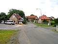
 Upper common
 -
 Lower common


References
- ^ "Population of Municipalities – 1 January 2022". Czech Statistical Office. 2022-04-29.
- ^ "Historie" (in Czech). Obec Popovičky. Retrieved 2022-03-19.
Wikimedia Commons has media related to Popovičky.
| Authority control databases: National |
|---|
This Central Bohemian Region location article is a stub. You can help Wikipedia by expanding it. |