Ahuriri Conservation Park
| Ahuriri Conservation Park | ||
| Geographical location | ||
|
|
||
| Coordinates | 44 ° 17 ′ S , 169 ° 43 ′ E | |
| Country : | New Zealand | |
| Region (s) : | Canterbury | |
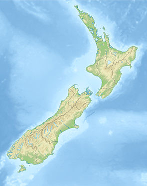
| Location: | west of Lake Ohau | |
| Protected area | ||
| Protected area type: | Conservation Park | |
| Founded: | March 2005 | |
| expansion | ||
| Number of areas: | 2 | |
| Length : | 36 km | |
| Width : | 22 km | |
| Area : | 490 km² | |
| Mountains : | Huxley Range , Barrier Range | |
| Lakes : | Lake Ohau | |
| Rivers : | Ahuriri River | |
| The Office Department of Conservation | ||
| Office: |
Te Manahuna / Twizel Office 15 Wairepo Road Twizel 7901 |
|
The Ahuriri Conservation Park is a nature park in the region Canterbury on the South Island of New Zealand . The park is subordinate to the Department of Conservation .
Origin of name
The Conservation Park was named after the chief of the Ngāi Tahu , Tu Ahuriri . The Māori used the Ahuriri River valley as a route to the west coast to collect pounamu .
geography
The over 49,000 hectares large Ahuriri Conservation Park is located west of Lake Ohau in the eastern part of Huxley Range and the southern and western part of the Barrier Range . The Ahuriri River divides the two mountain ranges and is part of the Conservation Park with its upper reaches . The park extends over a length of 36 km in north-south direction and measures 22 km at its widest point. To the west of the Ahuriri Conservation Park is the Hāwea Conservation Park . At the southern end of the park there is a small separate area around the 1713 m high Ben Avon , which is part of the Ahuriri Conservation Park . The highest peak in the park is the 2505 m high Mount Huxley , which is located on the northern border of the park.
history
From the late 1800s, the Ahuriri River valley was used as farmland by European immigrants, and from 1873 the higher regions were also used. In 2004, the Nature Heritage Fund acquired the farmland to protect nature and in March 2005 the land was established and protected by the Ahuriri Conservation Park with the publication in the New Zealand Gazette . There was a public hearing in 2017 about the park extension by another 4808 hectares of land.
Flora and fauna
The vegetation in the Ahuriri River valley consists of a mosaic of wetlands , fields of moss and short tussock grassland. Grow on the steep sides of the valley Mountain Book , in the language of the Māori Tawhai called. Scarlet mistletoe ( pikirangi ), matagouri , snow tōtara and snow tussock grasslands can also be found. Some typical bird species can be seen in the wetlands of the park. Among them is the endangered species of the black stilt .
free time activities
Hiking, mountain biking, camping, and fishing are allowed in the park. However, dogs that are brought along must be kept on a leash.
literature
- New Zealand Touring Atlas . 5th edition. Hema Maps , Brisbane 2015, ISBN 978-1-877302-92-3 (English).
Web links
- Ahuriri Conservation Park . Department of Conservation,accessed February 10, 2020.
- Ahuriri Conservation Park . (PDF; 3.1 MB)Department of Conservation, October 2013,accessed on February 10, 2020.
Individual evidence
- ↑ a b c Ahuriri Conservation Park . P. 2 , accessed on February 10, 2020 .
- ↑ a b Ahuriri Conservation Park . P. 6 , accessed on February 10, 2020 .
- ^ New Zealand Touring Atlas . 2015, p. Map 59 .
- ^ Proposal to Add Land to Ahuriri Conservation Park . (PDF; 293 kB) Department of Conservation , 2017, accessed on February 10, 2020 .
- ^ Ahuriri Conservation Park . P. 4 , accessed on February 10, 2020 .
- ^ Ahuriri Conservation Park . P. 3 , accessed on February 10, 2020 .
