Kaimai Mamaku Conservation Park
| Kaimai Mamaku Conservation Park | ||
| Geographical location | ||
|
|
||
| Coordinates | 37 ° 45 ′ S , 175 ° 55 ′ E | |
| Country : | New Zealand | |
| Region (s) : | Bay of Plenty , Waikato | |
| Location: | west of Tauranga Harbor and the city of Tauranga | |
| Protected area | ||
| Protected area type: | Conservation Park | |
| Founded: | May 2009 | |
| Precursor: | Kaimai Mamaku Forest Park | |
| expansion | ||
| Number of areas: | 1 | |
| Length : | 70 km | |
| Area : | approx. 370 km² | |
| Mountains : | Kaimai Range | |
| Rivers : | Waitawheta River , Aongatete River , Waipapa River , Ngamuwahine River , Opuiaki River | |
| The Office Department of Conservation | ||
| Office: |
Tauranga Office 253 Chadwick Road West Greerton West Tauranga 3112 |
|
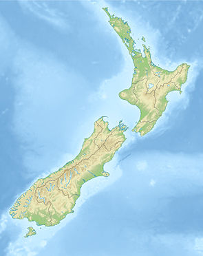
The Kaimai Mamaku Conservation Park is a nature park in the region Bay of Plenty on the North Island of New Zealand . The park is subordinate to the Department of Conservation .
geography
The Kaimai Mamaku Conservation Park extends over a length of 70 km, in a NNW-SSE direction, from the Karangahake Gorge , west of Waihi down to the Mamaku Plateau , northwest of Rotorua . The park, which has a size of approx. 37,000 hectares , is almost congruent with the mountain range of the Kaimai Range , which has its highest point in the 952 m high Te Aroha .
history
Gold discoveries in the northern part of the Kaimai Range meant that many trees of the original forest of the mountain range were cut down due to the great need for wood. In addition, in the 1960s the State Forest Service wanted to clear parts of the then Mamaku State Forest and planned to plant Monterey pines there . Conservationists protested and requested that the forest be designated as a national park for protection. As a partial success of the protest, the Kaimai Mamaku Forest Park was founded in 1975 , but the logging by the New Zealand Forestry Department continued. Further protests succeeded in the fact that in 1987 the Department of Conservation took over the park and thus the park benefited from more protection.
With the publication of the Crown Protected Area Names (names of the protected areas owned by the New Zealand Crown) on May 22, 2009 in the New Zealand Gazette , the park was finally upgraded to a Conservation Park .
Flora and fauna
The Kaimai Range has a wide range of vegetation, which is interspersed with dense, low-altitude forest, scrub and grassland shaped by sea winds. In the Kaimai Mamaku Conservation Park the common beech and silver beech as well as the kāmahi occur, the northern limit of their growth being the park. At the same time it is the southern limit of the Kauri tree .
Birds such as the endemic white-headed and kōkako , which is also considered endangered, can be seen in the park. You can also go to the Maori Falke ( Karearea ) sift frequently. However, it becomes more difficult with the nocturnal kiwi , which is considered to be very shy. Saumschnabelenten that in New Zealand under the Māori Whio are called and in English the name Blue Duck wear are just like the Maori Glockenhonigfresser more common. Small populations of the endangered Hochstetter frog can be found scattered across the northern half of Conservation Park .
literature
- New Zealand Touring Atlas . 5th edition. Hema Maps , Brisbane 2015, ISBN 978-1-877302-92-3 (English).
Web links
- Kaimai Mamaku Conservation Park . Department of Conservation,accessed February 12, 2020.
- Kaimai to coast . (PDF; 4.9 MB)Walks and tramps-Kaimai-Mamaku Forest park and surrounding areas. Department of Conservation, March 2014,accessed February 12, 2020(English,ISBN 978-0-478-14690-5).
Individual evidence
- ↑ Kaimai Mamaku Forest Park . In: newzealand.com . Tourism New Zealand , accessed February 12, 2020 .
- ^ Kaimai to coast . P. 2 , accessed on February 12, 2020 .
- ^ New Zealand Touring Atlas . 2015, p. Map 10, Map 12 .
- ^ Nancy Swarbrick : Waikato places - Te Aroha - Kaimai Mamaku Forest Park . In: Te Ara - the Encyclopedia of New Zealand . Ministry for Culture & Heritage , June 11, 2015, accessed February 12, 2020 .
- ^ Notice of Valid Crown Protected Area Names . In: New Zealand Gazette . Issue no.73 . Wellington May 21, 2009, p. 1701 (English, online [PDF; 142 kB ; accessed on February 12, 2020]).
- ^ Kaimai to coast . P. 4 , accessed on February 12, 2020 .
