Eyre Mountains / Taka Rā Haka Conservation Park
| Eyre Mountains / Taka Rā Haka Conservation Park | ||
| Geographical location | ||
|
|
||
| Coordinates | 45 ° 25 ′ S , 168 ° 18 ′ E | |
| Country : | New Zealand | |
| Region (s) : | Southland | |
| Location: | southwest of Lake Wakatipu | |
| Protected area | ||
| Protected area type: | Conservation Park | |
| Founded: | June 2005 | |
| expansion | ||
| Number of areas: | 1 | |
| Length : | approx. 52 km | |
| Width : | Max. 30 km | |
| Area : | 651.6 km² | |
| Mountains : | Eyre Mountains | |
| Rivers : | Oreti River , Windley River , Mataura River | |
| The Office Department of Conservation | ||
| Office: |
Murihiku / Invercargill Office 7th Floor CUE on Don 33 Don Street Invercargill 9810 |
|
| Photography from Conservation Park | ||
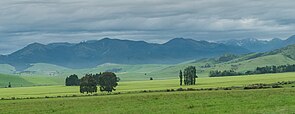
 Eyre Mountains as viewed west from New Zealand State Highway 6 |
||
The Eyre Mountains / Taka Rā Haka Conservation Park is a nature reserve in the Southland region on the South Island of New Zealand . The park is subordinate to the Department of Conservation .
geography
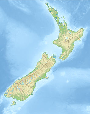
The Eyre Mountains / Taka Rā Haka Conservation Park is located around 5 km west of Lake Wakatipu with its north-eastern tip and around 32 km east of Te Anau with its south-westerly point . The largest town in the Southland region , Invercargill , is around 90 km south. The park, which extends over an area of 65,160 hectares , extends in a south-west-north-east direction over a length of around 52 km and measures around 30 km at its widest point. The Eyre Peak is located on the northern edge of the Conservation Park and with its 1,969 m still part of the park.
The Mavora Lakes Conservation Park is just a few kilometers northwest of the park.
history
The park was opened on June 15, 2005 by the Minister for Conservation, Chris Carter .
literature
- New Zealand Touring Atlas . 5th edition. Hema Maps , Brisbane 2015, ISBN 978-1-877302-92-3 (English).
Web links
- Eyre Mountains / Taka Rā Haka Conservation Park . Department of Conservation,accessed February 19, 2020.
- Eyre Mountains / Taka Rā Haka Conservation Park . (PDF; 774 kB)Department of Conservation, April 2007,accessed on February 19, 2020(English, flyer).
Individual evidence
- ↑ a b c New Zealand Touring Atlas . 2015, p. Map 71 .
- ↑ Eyre Mountains / Taka Rā Haka Conservation Park . Department of Conservation , accessed February 19, 2020 .
- ↑ Coordinates and longitudes were determined using Goggle Earth Pro Version 7.3.2.5776 on February 19, 2020
- ↑ Eyre Mountains / Taka Rā Haka Conservation Park . 2007, p. 5 , accessed on February 19, 2020 (Flyer).
