Whirinaki Te Pua-a-Tāne Conservation Park
| Whirinaki Te Pua-a-Tāne Conservation Park | ||
| Geographical location | ||
|
|
||
| Coordinates | 38 ° 44 ′ S , 176 ° 38 ′ E | |
| Country : | New Zealand | |
| Region (s) : | Bay of Plenty , Hawke's Bay | |
| Location: | southwest of Te Urewera National Park | |
| Protected area | ||
| Protected area type: | Conservation Park | |
| Founded: | May 2009 | |
| Precursor: | Whirinaki Forest Park | |
| expansion | ||
| Number of areas: | 2 | |
| Length : | approx. 35 km | |
| Width : | Max. 17 km | |
| Area : | 650 km² | |
| Rivers : | Whirinaki River , Te Hoe River | |
| The Office Department of Conservation | ||
| Office: |
Whakatane Office 1/100 Valley Road Whakatane |
|
| Photography from Conservation Park | ||
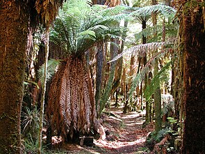
 Typical forest in Whirinaki Te Pua-a-Tāne Conservation Park |
||
The Whirinaki Te Pua-a-Tāne Conservation Park is a national park in the regions of Bay of Plenty and Hawke's Bay , on the North Island of New Zealand . The park is subordinate to the Department of Conservation .
geography
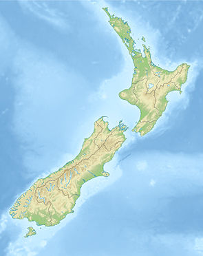
The Whirinaki Te Pua-a-Tāne Conservation Park is located southwest of the Te Urewera National Park , around 45 km east of Lake Taupo and directly east of the Kaingaroa Plateau . The 65,000 hectare park extends over a length of approx. 35 km in north-south direction and is around 17 km at its widest point in east-west direction. The park consists of two separate but close areas. Separated from the larger part, there is another smaller area of the park in the north around the 668 m high Tikorangi .
There are nine specially protected areas in the park, such as Otupaka Ecological Area , Oriuwaka Ecological Area , Tuwatawata Ecological Area , Te Kohu Ecological Area , Tauranga Basin Ecological Area , Te Whāiti-Nui-a-Toi Canyon Specially Protected Area , Tūwatawata Specially Protected Area , Te Whāiti and Whirinaki Forest Sanctuary .
history
The area of the valley of the Whirinaki River and the area of the Te Whāiti Nui-a-Toi were always home to the Māori tribe of the Ngāti Whare . The creation of the Conservation Park was of particular importance to them. The deforestation of parts of the forest and the reforestation with exotic pines from the late 1950s to the early 1980s led to the loss of the native stone vines and damage to the forest ecosystem. In the 1970s, conservation activists began to fight for the preservation of the forest, which led to the forest area being designated as a Forest Park in 1984 , which, however, could not stop the logging entirely. Only when the park was placed under protection under the Conservation Act 1987 in 1993 and the Department of Conservation was given responsibility for the park did the overexploitation with nature stop.
With the publication of the Crown Protected Area Names (names of the protected areas owned by the New Zealand Crown) on May 22, 2009 in the New Zealand Gazette , the park was finally upgraded to a Conservation Park .
Flora and fauna
In the area of the Whirinaki Te Pua-a-Tāne Conservation Park there are forest areas with stone beech plants , with the North Island ironwood , which is called among the Māori Rātā , and with beech and silver beech stocks . Furthermore, Rimu resin , Tōtara , Kahikatea , Mataī , Miro , Māhoe , Kāmahi , Kōtukutuku , Patē and fern trees as well as simpler ferns grow together in close proximity and form a rainforest typical of the area.
Among the animals are the Whio , in German literature under Saumschnabelente to find that New Zealand cloth bat , among Māori , Pekapeka called the Kōkako and a number of different addition to a variety of other animals skinks and geckos found. The lizard called Whirinaki Skink (Oligosoma 'Whirinaki') was only discovered in 2003, but has not yet been scientifically described.
literature
- New Zealand Touring Atlas . 5th edition. Hema Maps , Brisbane 2015, ISBN 978-1-877302-92-3 (English).
- Department of Conservation (Ed.): Whirinaki Te Pua-a-Tāne Conservation Park . Conservation Management Plan 2017 . Wellington 2017, ISBN 978-1-988514-21-5 (English, online [PDF; 15.5 MB ; accessed on February 7, 2020]).
Web links
- Whirinaki Te Pua-a-Tāne Conservation Park . Department of Conservation,accessed February 14, 2020.
Individual evidence
- ↑ Whirinaki Forest, Bay of Plenty . In: NZ Topo Map . Gavin Harriss , accessed February 14, 2020 .
- ↑ a b Conservation Management Plan . 2017, p. 7 .
- ↑ a b Conservation Management Plan . 2017, p. 6 .
- ↑ Coordinates and longitudes were determined using Goggle Earth Pro Version 7.3.2.5776 on February 14, 2020
- ↑ Conservation Management Plan . 2017, p. 3 .
- ^ Notice of Valid Crown Protected Area Names . In: New Zealand Gazette . Issue no.73 . Wellington May 21, 2009, p. 1701 (English, online [PDF; 142 kB ; accessed on February 12, 2020]).
- ↑ a b Conservation Management Plan . 2017, p. 20th ff .
