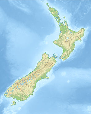
Kā Whata Tū o Rakihouia Conservation Park
| Kā Whata Tū o Rakihouia Conservation Park | ||
| Geographical location | ||
|
|
||
| Coordinates | 42 ° 12 ′ S , 173 ° 38 ′ E | |
| Country : | New Zealand | |
| Region (s) : | Canterbury | |
| Location: | northwest to north of Kaikoura | |
| Protected area | ||
| Protected area type: | Conservation Park | |
| Founded: | June 7, 2008 | |
| expansion | ||
| Number of areas: | 1 | |
| Length : | approx. 50 km | |
| Width : | Max. 21 km | |
| Area : | 880.65 km² | |
| Mountains : | Seaward Kaikoura Range | |
| Rivers : | Clarence River | |
| The Office Department of Conservation | ||
| Office: |
Wairau / Renwick Office Gee Street Renwick Marlborough 7204 |
|
| Photography from Conservation Park | ||
 Uwerau ( 2213 m ) |
||
The Kā Whata Tū o Rakihouia Conservation Park is a nature reserve in the Canterbury region of the South Island of New Zealand . The park is subordinate to the Department of Conservation .
geography
The 88,065 hectare large Kā whatâ TU o Rakihouia Conservation Park is located in the mountains of the oriented in southwest-northeast direction Seaward Kaikoura Range in the northeast of the South Island. The natural northwest boundary of the park is the Clarence River and to the southwest this is the Palmer Stream . To the northeast, the park, which extends over a length of approx. 50 km, extends to the Palmer Stream and the Mc Lean Stream and runs to the southeast on the slopes of the mountains. The largest city near the park is the city of Kaikoura, located in the southeast on the east coast .
history
In 1993 the Department of Conservation bought the land in question from the Forest Heritage Fund and in November 2007 an application was made to designate the area as a Conservation Park . This was done solemnly in the Takahanga Marae of the Māori tribe of the Ngāti Kuri on June 7, 2008.
literature
- New Zealand Touring Atlas . 5th edition. Hema Maps , Brisbane 2015, ISBN 978-1-877302-92-3 (English).
Individual evidence
- ↑ a b Nelson / Marlborough Conservation Board (ed.): Annual Report 2007/2008 . Nelson 2008, p. 7 (English, online [PDF; 798 kB ; accessed on February 14, 2020]).
- ^ New Zealand Touring Atlas . 2015, p. Map 48 .
- ↑ Seaward Kaikoura Range . In: NZ Topo Map . Gavin Harriss , accessed February 14, 2020 .
- ↑ Takahanga Marae . Te Rūnanga o Ngāi Tahu , accessed February 14, 2020 .
