Hāwea Conservation Park
| Hāwea Conservation Park | ||
| Geographical location | ||
|
|
||
| Coordinates | 44 ° 14 ′ S , 169 ° 31 ′ E | |
| Country : | New Zealand | |
| Region (s) : | Otago | |
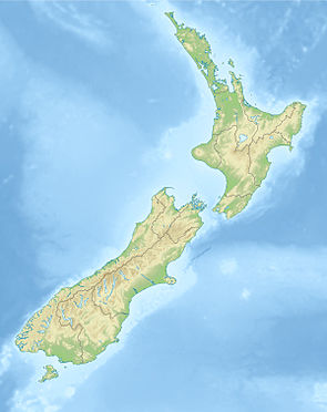
| Location: | east of Lake Wanaka and on both sides of Lake Hāwea | |
| Protected area | ||
| Protected area type: | Conservation Park | |
| Founded: | September 2008 | |
| expansion | ||
| Number of areas: | 1 | |
| Length : | approx. 66 km | |
| Width : | max 35 km | |
| Area : | over 1 050 km² | |
| Mountains : | partly McKerrow Range , Young Range , Huxley Range | |
| Lakes : | adjacent to Lake Wanaka and Lake Hāwea | |
| Rivers : | Hunter River , Timaru River | |
| The Office Department of Conservation | ||
| Office: |
Tititea / Mount Aspiring National Park Visitor Center 1 Ballantyne Road Wanaka 9305 |
|
| Photography from Conservation Park | ||
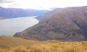
 View from 1,386 m high Isthmus Peak on Lake Wanaka and southwestern beginning of Hawea Conservation Park (right) |
||
The Hāwea Conservation Park is a nature reserve in the Otago region on the South Island of New Zealand . The park is subordinate to the Department of Conservation .
geography
The Hāwea Conservation Park is located adjacent to the northeastern part of Mount Aspiring National Park and east of Lake Wanaka , as well as on both sides of Lake Hāwea . In the east, the park borders on the Ahuriri Conservation Park and in the south it ends with the McKerrow Range and Huxley Range . With a total area of over 105,000 hectares , the park extends over a length of 66 km in a south-southwest-north-northeast direction and at its widest point measures 35 km in an east-west direction.
history
After the termination of the lease agreements for the Makarora , Ben Avon and Longslip farmland, the land was formed into the Hāwea Conservation Park in 2008, along with the already designated protected areas . The farmland at Birchwood Station , which was in the upper course of the small river Dingle Burn , was acquired by the Nature Heritage Fund and assigned to the park. The Hāwea Conservation Park was the ninth and at the time the largest conservation park that the New Zealand government had designated since the 2000s.
literature
- New Zealand Touring Atlas . 5th edition. Hema Maps , Brisbane 2015, ISBN 978-1-877302-92-3 (English).
Web links
- Hāwea Conservation Park . Department of Conservation,accessed February 18, 2020.
- Hāwea Conservation Park . (PDF; 727 kB)Department of Conservation, January 2012,accessed on February 18, 2020(English, flyer).
Individual evidence
- ^ New Zealand Touring Atlas . 2015, p. Map 58, Map 66 .
- ↑ Hawea Conservation Park . 2012, p. 1 , accessed on February 18, 2020 (Flyer).
- ↑ Coordinates and longitudes were determined using Goggle Earth Pro Version 7.3.2.5776 on February 18, 2020
- ↑ Hawea Conservation Park . Department of Conservation , accessed February 18, 2020 .
- ↑ Steve Chadwick : High country parks network another step closer . In: Beehive . New Zealand Government , September 12, 2008, accessed February 18, 2020 .
