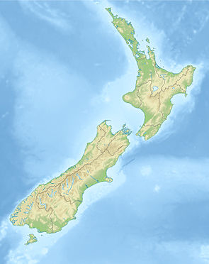
Raukumara Conservation Park
| Raukumara Conservation Park | ||
| Geographical location | ||
|
|
||
| Coordinates | 37 ° 45 ′ S , 178 ° 8 ′ E | |
| Country : | New Zealand | |
| Region (s) : | Gisborne , Bay of Plenty | |
| Location: | at the northeast end of the North Island | |
| Protected area | ||
| Protected area type: | Conservation Park | |
| Founded: | May 2009 | |
| Precursor: | Raukumara Forest Park | |
| expansion | ||
| Number of areas: | 2 | |
| Length : | approx. 60 km | |
| Width : | Max. 30 km | |
| Area : | 1 150 km² | |
| Mountains : | Raukumara Range | |
| Rivers : | Motu River , Takaputahi River , Haparapara River | |
| The Office Department of Conservation | ||
| Office: |
Turanganui-a-Kiwa / Gisborne Office 63 Carnarvon Street Gisborne 4010 |
|
The Raukumara Conservation Park is a nature reserve in the Gisborne District on the North Island of New Zealand . The park is subordinate to the Department of Conservation .
geography
The Raukumara Conservation Park is located around 60 km east of Whakatane and 60 km north-northwest of Gisborne , at the northeast end of the North Island of New Zealand. The park extends in a south-west-north-east direction over a length of approx. 60 km and at its widest point extends over a maximum of 30 km. With an area of 115,000 hectares, it is New Zealand's largest Conservation Park as of 2020 . The park covers most of the Raukumara Range , with the Hikurangi at 1752 m, the highest peak of the mountain range, located a little east outside the Conservation Park . At the northeast end of the park there is a smaller area that is separate from the park, but is counted as a protected area.
Within the park is the Raukumara Wilderness Area , a specially protected area that covers an area of 39,650 hectares.
Administratively, the Conservation Park is mostly in the Gisborne District and northwest smaller parts in the Bay of Plenty region .
history
The forest areas of the Raukumara Range were used for logging during the 20th century. In 1969 the government bought the area known as "The Rip" on the upper reaches of the Tapuaeroa River in order to plant trees there for forestry as part of the East Coast Project . The first conservation measures took place for the area of the Raukumara Range when the New Zealand government founded the Raukumara Forest Park in 1979 , but the park was still subject to forestry and forest management. It was not until the Conservation Act 1987 that the park was brought under protection and placed under the care of the Department of Conservation .
With the publication of the Crown Protected Area Names (names of the protected areas owned by the New Zealand Crown) on May 22, 2009 in the New Zealand Gazette , the park was finally upgraded to a Conservation Park .
literature
- Department of Conservation (Ed.): Conservation Management Strategy for East Coast Conservancy 1998 - 2008 . Gisborne 1998, ISBN 0-478-21801-X (English).
- New Zealand Touring Atlas . 5th edition. Hema Maps , Brisbane 2015, ISBN 978-1-877302-92-3 (English).
Web links
- Raukumara Conservation Park . Department of Conservation,accessed February 12, 2020.
Individual evidence
- ↑ a b Raukumara Conservation Park . Department of Conservation , accessed February 12, 2020 .
- ^ New Zealand Touring Atlas . 2015, p. Map 15, Map 16 .
- ↑ Conservation Management Strategy for East Coast Conservancy 1998 - 2008 . Volume I , 1998, pp. 51 .
- ^ Raukumara Forest Park, East Cape . In: Wilderness Magazine . November 30, 2011, accessed February 12, 2020 .
- ↑ Conservation Management Strategy for East Coast Conservancy 1998 - 2008 . Volume III , 1998, pp. 88 .
- ^ Notice of Valid Crown Protected Area Names . In: New Zealand Gazette . Issue no.73 . Wellington May 21, 2009, p. 1701 (English, online [PDF; 142 kB ; accessed on February 12, 2020]).
