Korowai / Torlesse Tussocklands Park
| Korowai / Torlesse Tussocklands Park | ||
| Geographical location | ||
|
|
||
| Coordinates | 43 ° 17 ′ S , 171 ° 45 ′ E | |
| Country : | New Zealand | |
| Region (s) : | Canterbury | |
| Location: | northeast of the Rakaia River and west of Oxford | |
| Protected area | ||
| Protected area type: | Conservation Park | |
| Founded: | 2001 | |
| expansion | ||
| Number of areas: | 2 | |
| Length : | approx. 27 km | |
| Width : | Max. 15 km | |
| Area : | 240 km² | |
| Mountains : | Torlesse Range , Big Ben Range | |
| Lakes : | Lake Lyndon | |
| Rivers : | Kowai River , Acheron River , Broken River | |
| The Office Department of Conservation | ||
| Office: |
Rangiora Office 32 River Road Rangiora 7400 |
|
The Korowai / Torlesse Tussocklands Park is a nature park in the region Canterbury on the South Island of New Zealand . The park is subordinate to the Department of Conservation .
geography
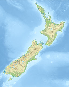
The 24,000 hectare large Korowai / Torlesse Tussocklands Park is the mountain ranges of Torlesse Range and the greater part of the Big Ben Range , 5 km east of Lake Coleridge . Christchurch , the largest city in the region, is around 60 km southeast of the park. The nature reserve extends over a length of approx. 27 km in a south-west-north-east direction and is approx. 15 km at its widest point. The small lake, Lake Lyndon , is not in the park, but it is bordered by it from the west and east. The Korowai / Torlesse Tussocklands Park consists of two parts, the smaller part being less than one kilometer northwest of the larger part of the park. Highest submission of the park is at 1963 m of Otarama peak , followed by only two meters lower Mount Torlesse represents.
history
The Korowai / Torlesse Tussocklands Park was founded in 2001 and was an initiative of the New Zealand conservation organization Royal Forest and Bird Protection Society of New Zealand . The park, which originally comprised around 21,000 hectares, was expanded by 3282 hectares of land through the purchase of the Nature Heritage Fund in 2018 and now has a size of around 24,000 hectares.
Flora and fauna
The area of the Conservation Park consists of high, dry mountain ranges in which snow- tussock landscapes, mountain beech forests and bushland are common. Plants such as Raoulia , which is called Vegetable Sheep in New Zealand , Porotaka , Montigena ( scree pea ) and a type of buttercup can also be found.
Native locusts, cockroaches, lizards, butterflies and the wētā inhabit the park where the kea , the pīhoihoi and the kārearea are found. Species like the Miromiro , the Tītipounamu and the Pīpipi live in the beech forests .
literature
- New Zealand Touring Atlas . 5th edition. Hema Maps , Brisbane 2015, ISBN 978-1-877302-92-3 (English).
Web links
- Korowai / Torlesse Tussocklands Park . Department of Conservation,accessed February 17, 2020.
- Korowai / Torlesse Tussocklands Park . (PDF; 842 kB)Department of Conservation, 2007,accessed on February 17, 2020(English, flyer).
Individual evidence
- ↑ a b Eugenie Sage : Major addition to conservation park . In: Beehive . New Zealand Government , December 11, 2018, accessed February 17, 2020 .
- ↑ Coordinates and longitudes were determined using Goggle Earth Pro Version 7.3.2.5776 on February 17th, 2020
- ^ New Zealand Touring Atlas . 2015, p. Map 55 .
- ^ Korowai / Torlesse Tussocklands Park . P. 3 , accessed on February 17, 2020 .
- ^ Korowai / Torlesse Tussocklands Park . P. 3 , accessed on February 17, 2020 .
- ↑ a b Korowai / Torlesse Tussocklands Park . Department of Conservation , accessed February 17, 2020 .
