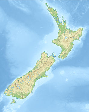
Te Kahui Kaupeka Conservation Park
| Te Kahui Kaupeka Conservation Park | ||
| Geographical location | ||
|
|
||
| Coordinates | 43 ° 41 ′ S , 170 ° 43 ′ E | |
| Country : | New Zealand | |
| Region (s) : | Canterbury | |
| Location: | southeast of the mountain ranges of the New Zealand Alps | |
| Protected area | ||
| Protected area type: | Conservation Park | |
| Founded: | Opening in April 2009 | |
| expansion | ||
| Number of areas: | 3 | |
| Length : | 65 km | |
| Width : | 28 km | |
| Area : | 938 km² | |
| Mountains : | Sibbald Range , Two Thumb Range , Richmond Range , Black Mountain Range , Brabazon Range , Sinclair Range , Sherwood Range , Ben McLeod Range | |
| Rivers : | Rangitata River , Godley River , Havelock River , Opuha River | |
| The Office Department of Conservation | ||
| Office: |
Raukapuka / Geraldine Office 15 North Terrace Geraldine 7930 |
|
| Photography from Conservation Park | ||
 Black Mountain Range with Brabazon Range |
||
The Te Kahui Kaupeka Conservation Park is a nature park in the region Canterbury on the South Island of New Zealand . The park is subordinate to the Department of Conservation .
geography
The 93,800 hectare large Te Kahui Kaupeka Conservation Park is located southeast of the mountain ranges of the Southern Alps , between the Godley River to the west and Havelock River and the Rangitata River to the east. The protected area includes the mountain ranges of the Sibbald Range , the largest and northern and middle parts of the Two Thumb Range , the Richmond Range , the Black Mountain Range , the Brabazon Range , the Sinclair Range and two smaller parts of the Sherwood Range and the Ben McLeod Range . At the southern end of Te Kahui Kaupeka Conservation Park there is a small separate area with the Mount Dobson Ski Area, which is part of the park, as well as the small area around the Spurs Hut , which is located in the southeast of the park , which forms the area of a triangle .
Flora and fauna
Before the settlement of New Zealand at lower altitudes, the vegetation in the mountains consisted of tussock grasslands with Tōtara and Tauhairauriki , a kind of mountain beech , and rocky landscapes at higher altitudes. Slash and burn has destroyed most of this landscape. Only in the steeper valleys on the east side of the Sinclair Range are the remains of the mountain beech forest and in the upper area of the Rangitata River there are still the Tōtara , the Celery Pine Mountain Toatoa , Pāhautea , a kind of cedar . Large areas of the park are now covered by snow tussock, which gives the landscape a golden yellow color when the sun is shining. The endemic spear grass "Aciphylla dobsonii" and "Hebe buchananii" can also be found in the large areas of the park.
The Haastadler , known among the Māori Pouākai , the flightless giant Moa , the South Island Goose , the Adzebill , the Takahe , the Kākāpō , of which the first four are already extinct , once lived among native birds . Today an exotic mix of native birds have their habitat in the Te Kahui Kaupeka Conservation Park . They include the endemic black stilt ( kaki ), the Saumschnabelente that in New Zealand Blue Duck and under the Māori Whio is called the Maori Falke ( Karearea ), the rock panties ( Pīwauwau ), the wrybill ( Ngutu ) and Kea .
Three different types of lizards ( Ngārara ) and eight different types of grasshoppers ( Kōwhitiwhiti ) can also be found in the park. Among them is the largest but rare grasshopper in New Zealand, Sigaus villosus . Two different species of Wētā , the Stone Wētā (Hemideina maori) and the Alpine Scree Wētā (Deinacrida sp.) Have their habitat in the park.
free time activities
In the park, it is allowed to hike, fish, to practice winter sports in two ski areas, to hunt and to ride a mountain bike. It is also allowed to bring dogs. All of these activities must follow the instructions of the Department of Conservation , which oversees the park and looks after the area.
literature
- Department of Conservation (Ed.): Te Kahui Kaupeka Conservation Park . Twizel May 2014 (English, Online [PDF; 1.4 MB ; accessed on February 4, 2020]).
- New Zealand Touring Atlas . 5th edition. Hema Maps , Brisbane 2015, ISBN 978-1-877302-92-3 (English).
Web links
- Te Kahui Kaupeka Conservation Park . Department of Conservation,accessed February 4, 2020.
Individual evidence
- ↑ Kate Wilkinson : New conservation park ready for visitors . In: Beehive . New Zealand Government , April 22, 2009, accessed February 10, 2020 .
- ^ New Zealand Touring Atlas . 2015, p. Map 50, Map 60 .
- ↑ a b c Department of Conservation (ed.): Te Kahui Kaupeka Conservation Park . 2014, p. 3 .
- ↑ a b c Department of Conservation (ed.): Te Kahui Kaupeka Conservation Park . 2014, p. 2 .
