Hakatere Conservation Park
| Hakatere Conservation Park | ||
| Geographical location | ||
|
|
||
| Coordinates | 43 ° 27 ′ S , 171 ° 18 ′ E | |
| Country : | New Zealand | |
| Region (s) : | Canterbury | |
| Location: | southeast of the New Zealand Alps , between Rangitata River and Rakaia River | |
| Protected area | ||
| Protected area type: | Conservation Park | |
| Founded: | 2007 | |
| Precursor: | Hakatere Station farmland | |
| expansion | ||
| Number of areas: | 19th | |
| Area : | over 680 km² | |
| Mountains : | Dividers of the Cloudy Peak Range , Froude Range, Jollie Range , Big Hill Range , Taylor Range , Black Hill Range , Winterslow Range and Mount Hutt Range | |
| Lakes : | Lake Emma , Lake Heron | |
| Rivers : | Havelock River , Clyde River , Lawrence River , Potts River , Ashburton River South Branch , Ashburton River North Branch | |
| The Office Department of Conservation | ||
| Office: |
Ōtautahi / Christchurch Visitor Center 28 Worcester Boulevard Christchurch 8013 and Raukapuka / Geraldine Office 13 - 15 North Terrace Geraldine 7930 |
|
| Photography from Conservation Park | ||
 Black Hill Range from Potts hat track as seen from |
||
The Hakatere Conservation Park is a nature reserve in the Canterbury region of the South Island of New Zealand . The park is subordinate to the Department of Conservation .
geography
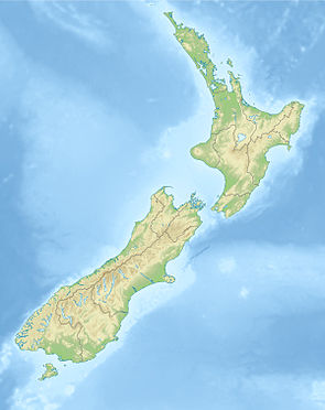
The Hakatere Conservation Park consists of three large individual areas and 16 smaller adjacent areas, none of which are in direct contact with one another. The park's areas are located southeast of the New Zealand Alps , between the Havelock River and Rangitata Rivers to the west and southwest and the Rakaia River to the northeast to east. Considered all individual areas together, they are scattered over a length of around 75 km in an east-west direction and almost 50 km in a north-south direction.
The park, which consists of 19 individual areas, has a total area of over 68,000 hectares .
history
As early as 1987, some of the smaller areas of today's park were placed under nature protection and the Department of Conservation was responsible for the care. In November 2007, a private individual then acquired the farmland at Hakatere Station and had it designated as a Conservation Park . In July 2008, the Nature Heritage Fund subsequently acquired the farmland for NZ $ 7.2 million and handed over the responsibility for enforcing conservation in the area to the Department of Conservation , which was managed by the Hakatere Heritage Committee , a local group of conservationists is supported. Around 10,000 hectares of land around Clent Hills were also acquired by the Nature Heritage Fund and assigned to the park.
literature
- New Zealand Touring Atlas . 5th edition. Hema Maps , Brisbane 2015, ISBN 978-1-877302-92-3 (English).
Web links
- Hakatere Conservation Park . Department of Conservation,accessed February 17, 2020.
- Hakatere Conservation Park . (PDF; 2.1 MB)Department of Conservation, May 2013,accessed on February 17, 2020(English, flyer).
- Hakatere Conservation Park . (PDF; 1.3 MB)Department of Conservation, 2009,accessed on February 17, 2020(English, flyer (older version)).
Individual evidence
- ^ New Zealand Touring Atlas . 2015, p. Map 51, Map 52, Map 61 .
- ↑ a b c d Chris Carter : Spectacular new park largest created in decades . In: Beehive . New Zealand Government , October 27, 2007, accessed February 17, 2020 .
- ↑ Hakatere Station buildings . Department of Conservation , accessed February 17, 2020 .
