Oteake Conservation Park
| Otaeke Conservation Park | ||
| Geographical location | ||
|
|
||
| Coordinates | 44 ° 48 ′ S , 170 ° 0 ′ E | |
| Country : | New Zealand | |
| Region (s) : | Otago | |
| Location: | southwest of Lake Benmore and Lake Aviemore | |
| Protected area | ||
| Protected area type: | Conservation Park | |
| Founded: | 2009 | |
| expansion | ||
| Number of areas: | 3 | |
| Mountains : | Parts of the Wether Range , Saint Bathans Range , Hawkdun Range , Ida Range , Saint Marys Range | |
| Rivers : | Manuherikia River , Otematata River , Otekaieke River | |
| The Office Department of Conservation | ||
| Office: |
Kā Moana Haehae / Alexandra Office 43 Dunstan Road Alexandra 9320 |
|
The Otaeke Conservation Park is a nature park in the region Otago on the South Island of New Zealand . The park is subordinate to the Department of Conservation .
geography
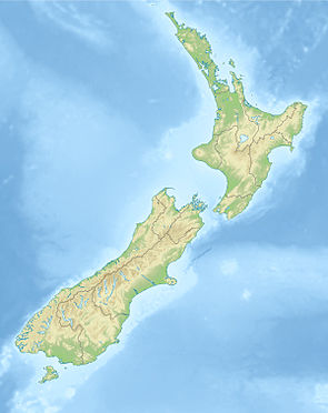
The 67,000 hectare large Otaeke Conservation Park is located southwest of Lake Benmore and Lake Aviemore , in parts of the mountain ranges of the Wether Range , the Saint Bathans Range , the Hawkdun Range , the Ida Range and Saint Marys Range . Oamaru , the next largest city, is around 50 km to the southeast. The Conservation Park is divided into three over the aforementioned mountain ranges, with the longer part, which extends over the Hawkdun Range , in the north having a connection to the western part of the park in the Saint Bathans Range . The eastern part in the Saint Marys Range has no connection to the area to the west. A very small individual area is located at the foot of the Hawkdun Range towards the Manuherikia River . The individual parts of the park, which all have a north-north-west-south-south-east orientation, extend over areas of approx. 20 × 15 km, of approx. 44 × 12 km and of approx. 30 × 16 km.
history
The Otaeke Conservation Park was founded in 2009 with a total area of around 67,000 hectares and was initially reduced to an area of 64,805 hectares in April 2009. A year later, in May 2010, the park was officially opened by the responsible minister for nature conservation, Kate Wilkinson . As of December 2019, the Department of Conservation identified the park with an area of 67,000 hectares.
literature
- New Zealand Touring Atlas . 5th edition. Hema Maps , Brisbane 2015, ISBN 978-1-877302-92-3 (English).
Web links
- Otaeke Conservation Park . Department of Conservation,accessed February 18, 2020.
- Otaeke Conservation Park . (PDF; 4.6 MB)Department of Conservation, December 2019,accessed on February 18, 2020(English, flyer).
Individual evidence
- ↑ a b Otaeke Conservation Park . 2019, p. 1 , accessed on February 18, 2020 (Flyer).
- ^ New Zealand Touring Atlas . 2015, p. Map 67 .
- ↑ Coordinates and longitudes were determined using Goggle Earth Pro Version 7.3.2.5776 on February 18, 2020
- ↑ Tim Groser : Boundary change for Otaeke Conservation Park officially opened . In: Beehive . New Zealand Government , April 22, 2009, accessed February 18, 2020 .
- ↑ Kate Wilkinson : Otaeke Conservation Park officially opened . In: Beehive . New Zealand Government , May 14, 2010, accessed February 18, 2020 .
