Albens
| Albens | ||
|---|---|---|
|
|
||
| local community | Entrelacs | |
| region | Auvergne-Rhône-Alpes | |
| Department | Savoie | |
| Arrondissement | Chambery | |
| Coordinates | 45 ° 47 ' N , 5 ° 57' E | |
| Post Code | 73410 | |
| Former INSEE code | 73010 | |
| Incorporation | January 1, 2016 | |
| status | Commune déléguée | |
 Main street of Albens |
||
Albens is a commune Déléguée with 3,940 inhabitants (at January 1, 2017) in the town of Entrelacs in the department of Savoie in the region of Auvergne Rhône-Alpes . It belonged to the Arrondissement of Chambéry and the canton of Aix-les-Bains-1 . The local residents of Albens are called Albanais (es) in French .
With effect from January 1, 2016, the former municipalities of Albens , Cessens , Épersy , Mognard , Saint-Germain-la-Chambotte and Saint-Girod were merged into a commune nouvelle with the name Entrelacs.
geography
Albens is located at 353 m , about 25 kilometers north of the city of Chambéry (as the crow flies). The village extends in the southwestern Albanais , in the foothills of the Alps, on both sides of the Albenche brook on the western edge of the broad depression that connects the Rumilly basin with the Lac du Bourget .
In addition to the actual town center, Albens also included various villages, hamlet settlements and farms, including:
- Braille ( 368 m ) in the valley southwest of the Étang de Crosagne
- Pégis ( 390 m ) on the western edge of the valley
- Ansigny ( 501 m ) on a ridge west of the valley
- Dressy ( 590 m ) in the hill area west of the valley basin
- Pouilly ( 460 m ) on a terrace above the village
- Collonge ( 530 m ) on the eastern slope of the hill zone
- Lépau ( 460 m ) north of the Albenche valley
- Marline ( 410 m ) on the plateau west of the valley
- Orly ( 350 m ) on the western edge of the valley
Neighboring towns of Albens are Massingy and Bloye in the north, Saint-Félix and Saint-Girod in the east, Mognard and La Biolle in the south and Saint-Germain-la-Chambotte and Cessens in the west.
history
The former municipality of Albens was already settled during Roman times. At that time the place was called Albinnum or Albinum and was located on an important traffic route that led from Aquae (Aix-les-Bains) to Boutae (today's Annecy). Various wall foundations, ceramics and tombs have been preserved from this time. Over time, the name changed via Albinno , Albenno , Albinnenses (before the 11th century), Villa Albensi (1355), Prioratus de Albenco (14th century) and Arbensi castellania (1451) to today's Albens. The place name probably goes back to the Celtic tribe of the Albani.
Under Count Amadeus V of Geneva , the new town of Albens was founded next to a settlement that already existed in the High Middle Ages. In the 15th century it belonged to the Montfalcon dominion as a fief . In 1451 Albens received certain liberties. The area changed in 1972 when the previously independent municipality of Ansigny was incorporated into Albens. From 1837 to 2015 the municipality was the capital of the canton of Albens .
Attractions
The three-aisled parish church was rebuilt from 1867. The Notre Dame de Tout Pouvoir chapel in Ansigny dates from the 19th century. The Sacré-Cœur Chapel in Dressy was built in 1882. A small museum is housed in the Office du Tourisme, which shows finds from Roman times.
population
| year | Residents |
|---|---|
| 1962 | 1,628 |
| 1968 | 1,588 |
| 1975 | 1,661 |
| 1982 | 2,150 |
| 1990 | 2,439 |
| 1999 | 2,650 |
| 2006 | 2,939 |
| 2011 | 3,371 |
Since the early 1970s, thanks to the attractive residential area and good transport links between the centers of Aix-les-Bains, Annecy and Rumilly, there has been a steady increase in population.
Economy and Infrastructure
For a long time Albens was primarily a town characterized by agriculture and retail trade. In addition, various small and medium-sized businesses have developed since the 1970s. An industrial and commercial zone was established east of the settlement area near the train station. In the meantime the village has also developed into a residential community. Many workers are commuters who work in the larger towns in the area and in the Chambéry and Annecy area.
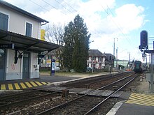
The place is well developed in terms of traffic. It lies on the secondary road D1201, the former national road N201 which runs from Chambery to Annecy. From this main road, the D910 branches off to Rumilly. There are other road connections with Saint-Girod, Massingy and Saint-Germain-la-Chambotte. The closest connection to the A41 motorway is around seven kilometers away. Albens has a train station on the Aix-les-Bains – Annemasse railway line .
education
In Albens there is a pre-school ( école maternelle ), a primary school ( école primaire ) and a comprehensive school ( collège ).
Community partnerships
There was a partnership with the Italian municipality of Ceneselli in the Veneto region.
Web links
Individual evidence
- ↑ a b Historique. In: Albens on the website of the community association. Archived from the original on August 19, 2014 ; accessed on December 3, 2019 (French).
- ↑ A. Gros: Dictionnaire étymologique des noms de lieu de la Savoie . Belley, Imprimerie Aimé Chaduc, 1937, p. 23–24 (French, limited preview in Google Book Search).
- ↑ a b c Albens - notice communale. In: cassini.ehess.fr. Retrieved on August 18, 2014 (French, INSEE population from 1968 ).


