Amitié (Mauritius)
Coordinates: 20 ° 7 ′ S , 57 ° 40 ′ E
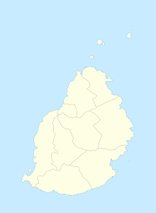
Amitié is a place ("Village") on Mauritius .
The eastern part of Amitié belongs to the Rivière du Rempart district , the western part is in the Pamplemousses district . At the 2011 census, the place had 2,256 inhabitants. Both parts administratively belong to the Village Council Area Amitié.
L'Amitié was created as a sugar cane plantation. This originally had a size of 760 arpents . In 1821 the owners, Alexandre de Sornay, Charles Edward and Thomy Pitot built a sugar factory here, but it was only in operation until 1826. Since then, the sugar cane harvest has been processed in neighboring factories. Today's population are predominantly descendants of Indian contract workers who worked on this plantation.
One of the oldest Hindu temples on the island is located in the municipality. It was built in 1863.
literature
- Benjamin Moutou: Pamplemousses - Rivière du Rempart - Quatre siècles d'histoire , 2006, ISBN 978-99903-992-9-5 , SS 324-325
Individual evidence
- ↑ Statistics Mauritius: Housing and population census 2011 , Volume II: Demographic and fertility characteristics , p. 71, statsmauritius.govmu.org (PDF): Only the population figures in the eastern part are given, the western part seems to be uninhabited.
