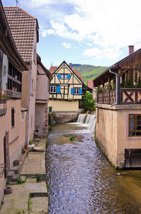
Andlau (Ill)
| Andlau | ||
|
The Andlau near Fegersheim |
||
| Data | ||
| Water code | FR : A25-0200 | |
| location |
France
|
|
| River system | Rhine | |
| Drain over | Ill → Rhine → North Sea | |
| source | in the Vosges on the eastern slope of the Champ du Feu 48 ° 24 ′ 23 ″ N , 7 ° 16 ′ 36 ″ E |
|
| Source height | 1010 m | |
| muzzle | north of Fegersheim -Ohnheim in the Ill Coordinates: 48 ° 29 '55 " N , 7 ° 41' 54" E 48 ° 29 '55 " N , 7 ° 41' 54" E |
|
| Mouth height | 143 m | |
| Height difference | 867 m | |
| Bottom slope | 21 ‰ | |
| length | 42 km | |
| Catchment area | 306.7 km² | |
| Drain at the mouth |
MQ |
1.74 m³ / s |
The Andlau is an approximately 42 km long left tributary of the Ill in Alsace ( Grand Est region ).
geography
course
The Andlau rises in the Central Vosges at an altitude of 1010 m on the eastern slope of the Champ du Feu in the Forêt de la Ville de Strasbourg .
It initially flows in a narrow valley in a south-easterly direction and after about one kilometer is fed by the Dreiangelbach on its right side . It now rushes westwards and shortly before Neumelkerei forms the Hohwalder waterfall ( Cascade de l'Andlau ), which is well worth seeing .

After the waterfall, the valley widens noticeably. At Neumelkerei the Kaltenbaechel flows from the left and the Rohrbach a little later . It reaches Le Hohwald and is strengthened there by the Großer Breitenbach . The Andlau will now be accompanied by the Hochstraße D 425 for a longer period of time . About half a kilometer east of Le Hohwald, it takes the Luttenbaechel coming from the north on its left . Your run now leads south-east through a narrow, forested valley. At Sperberbaechel, where it reaches the stream of the same name, it turns its course to the west and is fed by the Lilsbach on its right-hand side just before the hamlet of Eftermatten . The Hasselbach flows a little further downstream . It now meanders through a wild and romantic landscape and takes on the Steinbach , Totenbach and Fischbach on its way to the village named after it .
She passes Andlau and there leaves the mountains and enters a wide plain. Your path now leads eastwards through the wine towns of Eichhoffen and Saint Pierre . It crosses under the A35 autoroute , then flows north past Stotzheim and then south past Zellwiller . It is now moving northeast through a wide agricultural area. South of the Bois de Valff , it is strengthened by the ruisseau la Scheer neuve, a branch of the Scheer . The Kirneck flows further north towards it. It flows through Hindisheim , runs south past Lipsheim , then reaches Fegersheim , where it is fed by the Scheer on its right side .
It finally flows into the Ill at a height of 143 m north of Fegersheim-Ohnheim.
Catchment area
The Zorn catchment area is 306.7 km² and consists of 57.64% agricultural area, 34.89% forest and 7.52% built-up areas.

Tributaries
- Dreiangelbach ( right )
- Kaltenbaechel ( left ), 1.5 km
- Großer Rohrbach ( left ), 1.9 km
- Andlaubach ( Ruisseau l'Andlau ), ( right ), 3.7 km
- Großer Breitenbach ( grand Breitenbach ) ( left ), 3.1 km
- Frischbächel ( right )
- Luttenbaechel ( left ), 2.0 km
- Sparrowhawk Baechel ( left )
- Lilsbach ( Liesbach ) ( right ), 1.6 miles
- Hasselbach ( Haselbach ) ( right ), 2.8 km
- Steinbach ( Steinbächel ) ( left ), 1.3 km
- Totenbach ( Dudenbach ) ( right ), 1.6 km
- Fischbach ( left )
- Weierbach ( right )
- Muehlbach ( right junction )
- Neue Scheer ( ruisseau la Scheer neuve ) ( right ), 4.7 km
- Kirneck ( ruisseau la kirneck ) ( left ), 18.4 km, 27.5 km², 0.24 m³ / s
- Dachsbach ( ruisseau le Darsbach ) ( left ), 14.3 km
- Neugraben ( right ), 5.2 km
- Scheer ( rivière la Scheer ) ( right ), 40.0 km, 132.7 km², 0.36 m³ / s
Individual evidence
- ↑ a b geoportail.fr (1: 16,000)
- ↑ a b Andlau at SANDRE (French)
- ↑ a b see web link: Débits caractéristiques d'Andlau
- ^ A junction of the Scheer
Web links
- Débits caractéristiques d'Andlau (French; PDF; 17 kB)
- Catchment area of the Andlau
- Course of the Andlau on SANDRE
- Map of the Vosges (12) Mont Sainte-Odile 1: 50,000 (February 1902)
- Map of the Vosges (12) Mont Sainte-Odile and Hochwald 1: 50,000 , (September 1913)


