Aniwa (city)
| city
Aniwa
Анива
|
||||||||||||||||||||||||||||||||||||||||||||
|
||||||||||||||||||||||||||||||||||||||||||||
|
||||||||||||||||||||||||||||||||||||||||||||
| List of cities in Russia | ||||||||||||||||||||||||||||||||||||||||||||
Aniwa ( Russian Ани́ва ) is a small town in the Sakhalin Oblast ( Russia ) with 9115 inhabitants (as of October 14, 2010).
geography
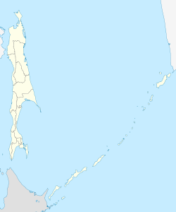
The city is located in the south of the Sakhalin Island near the mouth of the Lyutoga River in the Aniva Bay , about 40 km south of the Oblast capital Yuzhno-Sakhalinsk .
The city of Aniwa is the administrative center of the Rajon of the same name .
history
Founded in 1886 as the village of Ljutoga (Russian Лю́тога , after the river of the same name), Aniwa belonged to the entire southern part of the Sakhalin Island as Rūtaka ( Japanese 留 多加 町 , - chō , from Ainu rut for sea ice ) since 1905 under the Treaty of Portsmouth and ak (k) a for water ) to Japan .
During the Second World War , the place was captured by the Red Army on August 26, 1945 and from then on belonged again to the Soviet Union . On June 5, 1946, he was given the Soviet town charter under the new name Aniwa (after the bay).
Population development
| year | Residents |
|---|---|
| 1941 | 7295 |
| 1959 | 5545 |
| 1970 | 5859 |
| 1979 | 6826 |
| 1989 | 8905 |
| 2002 | 8084 |
| 2010 | 9115 |
Note: census data
Economy and Infrastructure
Aniwa is mainly the center of the fishing industry ( pink salmon , ketal salmon ). There are also companies in the food industry based on the agricultural area surrounding the city of local importance.
The city has been connected to the island's narrow-gauge railway network via a branch line since 1926 (currently out of service, previously only freight traffic). There is a road connection to the oblast center.
Individual evidence
- ↑ a b Itogi Vserossijskoj perepisi naselenija 2010 goda. Tom 1. Čislennostʹ i razmeščenie naselenija (Results of the All-Russian Census 2010. Volume 1. Number and distribution of the population). Tables 5 , pp. 12-209; 11 , pp. 312–979 (download from the website of the Federal Service for State Statistics of the Russian Federation)
Web links
- City administration website (Russian)
- Aniwa on mojgorod.ru (Russian)


