Shakhtyorsk
| Urban-type settlement
Shakhtarsk
Shakhthrsk
|
||||||||||||||||||||||||||||||||||||||
|
||||||||||||||||||||||||||||||||||||||
|
||||||||||||||||||||||||||||||||||||||
Shakhtyorsk ( Russian Шахтёрск , Japanese 塔路町 , Toro chō ) is an urban-type settlement in the Sakhalin Oblast ( Russia ) with 8382 inhabitants (as of October 14, 2010).
geography
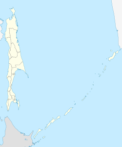
The settlement is located a few kilometers from the west coast of Sakhalin Island , about 350 km northwest of the Oblast capital Yuzhno-Sakhalinsk , on the Tatar Sound between the Sea of Japan and Sea of Okhotsk .
The Shakhtyorsk settlement is administratively part of Uglegorsk Raion . It is located about 10 km north of the Rajon center. The southern settlement of Udarnoje (also known as "Udarny") is administratively subordinate to Shakhtyorsk.
history
The place was created under the name Tōro-chō after 1905, while the southern part of the island (up to the 50th parallel) was part of Japan (according to the Treaty of Portsmouth , which ended the Russo-Japanese War 1904-1905). As a result of the Second World War , the place came to the Soviet Union and received city rights in 1947 under the name Shakhtyorsk (from Russian shakhtyor for miner , which refers to the coal mining in the area). By law of the Sakhalin Oblast of December 19, 2016, Shakhtyorsk lost its town charter and since then has had the status of an urban-type settlement.
Population development
| year | Residents |
|---|---|
| 1959 | 12,069 |
| 1970 | 11,476 |
| 1979 | 11,543 |
| 1989 | 12,945 |
| 2002 | 10,643 |
| 2010 | 8,382 |
Note: census data
economy
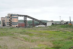
The economy of Shakhtyorsk is determined by coal mining , on the basis of which an electricity station is operated. There is also a construction industry here.
traffic
In 1937, under Japanese administration, the construction of a Cape-gauge railway line from Ilyinskoye via Uglegorsk to Shakhtyorsk began. Although the construction with numerous bridges was already well advanced, it was canceled in 1942. Even after that, Shakhtyorsk was not connected to the railway. A narrow-gauge factory railway operated by OOO Lokomotiw (formerly Shakhtyorkoje pogrusochno-transportnoje uprawlenie) is only used to transport coal between Urdarnoje and the central processing plant in the west of Shakhtyorsk.
There is an airport north of Shakhtyorsk, which in 2011 was served twice a week by SAT Airlines with flights to Yuzhno-Sakhalinsk.
Local traffic in Shakhtyorsk is carried out by the Shakhtyorskoye passaschirskoje ATP bus company (a subsidiary of Sakhavtotrans ). In addition, the connection to Uglegorsk is operated jointly with Uglegorskoje passaschirskoje ATP. There is also sparse bus traffic to Boschnjakowo and a daily connection to Yuzhno-Sakhalinsk.
Sons and daughters of the place
- Yuri Jakimow (* 1953), rower
- Alexander Medvedev (* 1955), manager
photos
Individual evidence
- ↑ a b Itogi Vserossijskoj perepisi naselenija 2010 goda. Tom 1. Čislennostʹ i razmeščenie naselenija (Results of the All-Russian Census 2010. Volume 1. Number and distribution of the population). Tables 5 , pp. 12-209; 11 , pp. 312–979 (download from the website of the Federal Service for State Statistics of the Russian Federation)


