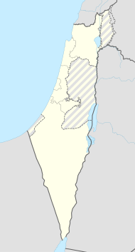
Atlit
| Atlit | ||
|---|---|---|
| Basic data | ||
| hebrew : | עתלית | |
| State : |
|
|
| District : | Haifa | |
| Coordinates : | 32 ° 41 ′ N , 34 ° 56 ′ E | |
| Residents : | 8047 (as of 2018) | |
| Community code : | 0053 | |
| Time zone : | UTC + 2 | |
| Postal code : | 30350 | |
|
|
||
Atlit ( Hebrew עתלית[at'lit]) is a small agricultural town south of Haifa on the Israeli Mediterranean coast . The village was founded in 1903 on land owned by Baron Edmond de Rothschild . In 2018 it had 8,047 inhabitants. Atlit had the status of a local association from 1950 to 2004 .
geography
Atlit is located on the Carmel coast at the foot of the Carmel Mountains ; The kibbutzim Neve Jam and En Karmel are in the immediate vicinity . The artist village of En Hod is only a few kilometers away.
history
Prehistoric settlement
At Atlit there was a fishing settlement in the pre-ceramic Neolithic , which the archaeologists named Atlit-Yam .
When around 7,000 BC BC the coastal strip was flooded by the sea, the residents gave up their settlement. Archaeologists are divided on whether this was caused by the slowly rising sea level as a result of the melting ice masses at the end of the Ice Age or by sudden events such as tsunamis such as the Etna tsunami . Today the area is about 300 meters off the coast in about 10 meters water depth.
Extensive underwater excavations have taken place in Atlit-Yam, which have revealed a huge amount of extremely well-preserved settlement finds from the period 8180 to 7550 BC. To days. The remains of the settlement include the world's oldest so far excavated well and a ritual place with altars and a stone circle, which is reminiscent of the buildings of the megalithic cultures . The findings are the preceramic Neolithikum B assigned. Within a site, they document the transition from first settling down to domestication of domestic and farm animals and flourishing arable farming. In addition to countless bones of pigs, sheep, goats, dogs, etc. v. m. Agricultural products such as lentils and flax as well as grains produced locally by hybridization were found. The evaluation of the numerous skeleton finds made it possible to draw conclusions about living conditions. Signs of wear and tear on the skeletons as well as the bones of deep-sea fish in the find horizon indicate that the residents of the settlement already sailed the sea and did fishing from boats. Symptoms such as malaria and tuberculosis could also be detected in the deceased. There were also indications of an ancestral cult : three skulls overmodeled with clay were deposited at an elevated point, in whose eye sockets, like the skulls of Jericho, sea snails were embedded.
Crusader Citadel
The ruins of Château Pèlerin - once one of the largest crusader fortresses in the Holy Land and the last to resist Baibars - are still visible on the coast at Atlit. Further inland are the ruins of the older Le Destroit castle .
Atlit more recently
In 1909 the botanist Aaron Aaronsohn from Zichron Ja'akow founded an agricultural research station. Aaronsohn was one of the founders of the NILI spy ring , which supported the British against the Turks during the First World War . The experimental station served as camouflage and was used as an exchange for British warships. In 1917 the net was uncovered when a carrier pigeon was caught by chance.
During World War II , Britain established the Atlit refugee camp , where the authorities interned illegal Jewish immigrants to Palestine . Gitta Horowitz Fajerstein-Walchirk, who was interned in Atlit from Basri in 1945, described the situation in the camp as follows:
“There were barracks and huge tents. The food, the barracks, the latrines and the washing facilities felt like a concentration camp. We were never hit or anything, but it was pretty bad. We had never been to a camp before and now we were here after all that! "
On October 10, 1945, the Hagana liberated the internees in an action planned by Yitzchak Rabin .
The headquarters of the Shayetet 13 special unit , the combat swimmer of the Israeli Navy, is located in Atlit .
literature
- Ehud Galili, V. Eshed, Avi Gopher, I. Hershkovitz: Burial Practices at the Submerged Pre-Pottery Neolithic C Site of Atlit-Yam, Northern Coast of Israel. In: BASOR , 339, 2005, pp. 1-19.
Web links
- Aviva Buchennino, Ehud Galili: Atlit - Final Report . In: Hadashot Arkheologiyot , 119, 2007.
- The Pre-Pottery Neolithic Site of Atlit-Yam . Israel Antiquities Authority
- Archeology - Atlantis in the Mediterranean . Spiegel Online - Wissenschaft
Individual evidence
- ↑ אוכלוסייה ביישובים 2018 (population of the settlements 2018). (XLSX; 0.13 MB) Israel Central Bureau of Statistics , August 25, 2019, accessed May 11, 2020 .
- ↑ אוכלוסייה ביישובים 2018 (population of the settlements 2018). (XLSX; 0.13 MB) Israel Central Bureau of Statistics , August 25, 2019, accessed May 11, 2020 .
- ↑ Ehud Galili, Baruch Rosen: Marine Archeology In Israel, recent discoveries . ( Memento of February 15, 2012 on the Internet Archive ) Israel Antiquities Authority
- ^ The Pre-Pottery Neolithic Site of Atlit-Yam . Israel Antiquities Authority
- ^ Chaya H. Roth: The Fate of Holocaust Memories. Transmission and Family Dialogues , Palgrave Macmillan, New York, 2008, ISBN 978-0-230-60607-4 , p. 83
