Atterode
|
Atterode
City of Bad Liebenstein
Coordinates: 50 ° 49 ′ 19 ″ N , 10 ° 23 ′ 14 ″ E
|
|
|---|---|
| Height : | 470 m above sea level NN |
| Residents : | 16 (Jun 30, 2009) |
| Incorporated into: | Steinbach |
| Postal code : | 36448 |
| Area code : | 036961 |
|
Location of Atterode in Bad Liebenstein
|
|
|
Partial view from the north (2014)
|
|
Atterode is a small settlement belonging to the Steinbach district of Bad Liebenstein in the Wartburg district in Thuringia . Today's settlement site Atterode is located to the south-east, about 2500 m as the crow flies from the center of Steinbach at the entrance to the Thuringian Valley at about 470 m above sea level. NN . Atterode can be reached via Steinbach or Bad Liebenstein. On June 30, 2009, 16 residents lived in the district.
history
The medieval settlement of Atterode
Since the early Middle Ages , ores such as brown iron stone ( iron ore ), spades and other rock containing minerals have been searched for in the Ruhla - Brotterode area . Forest farmers settled with the miners and charcoal burners, who built a chapel, first mentioned in a document in 1183, near the Ottinrode settlement with ownership rights of the Frauenbreitungen monastery . The place was originally owned by the Lords of Frankenstein , came to the Counts of Henneberg in 1330 and from them to the House of Wettin in 1353 . A mine is mentioned in 1460. As owners of the Altenstein office , the knights Hund von Wenkheim took over the village of Atterode as a fief in 1492 .
At some point during the Thirty Years' War , the village was likely destroyed by Croats and deserted , while the area was still sporadically mining. Remains of the churchyard wall should still have been found in the 18th century.
Atterode mining settlement
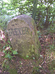
The second settlement of Atterode is due to the efforts of Joseph Meyer , who in 1837 acquired the concession for the mining of minerals in the Duchy of Saxony-Meiningen and reopened iron stone mines in the Steinbach area. The Meyer stones as border markings date from this time . At the entrance to the mining area, Meyer had company buildings built on Platz der Wüstung Atterode. Meyer's plans, however, met with little success. In addition, after the end of the Franco-Prussian War , better ore was available from Alsace from 1871 , so mining in Atterode was temporarily suspended.
During the First World War , mining began again and the Arminius mine of the Krupp company was opened. A mine train, the Steinbacher Bergwerksbahn , connected Atterode with the Liebenstein-Schweina train station and later with the Steinbach train station. In the 1930s, the mining was increased again and maintained until the final closure in 1958. The ore was later brought to Laudenbach for washing via the Klinger tunnel. Since it was assumed that dismantling would resume on site, a large part of the equipment - including an electric hoist - remained in the mountain. The Atterode mine field with numerous tunnels extends under the Hohe Klinge and extends to the villages of Laudenbach and Trusetal . The location and number of all tunnels built since the Middle Ages is no longer traceable, the most famous is the Friedrichstollen , its mouth hole is on the left of the path to the Krätzersrasen .
After mining was stopped, the above-ground buildings were converted to residential purposes. The remaining tunnel was not kept until the 1990s.
Politically, Atterode belonged to the municipality of Steinbach, which became part of the city of Bad Liebenstein on December 31, 2012.
literature
- Between Ruhla, Bad Liebenstein and Schmalkalden. Results of the local history inventory in the areas of Ruhla and Schmalkalden (= values of our homeland . 48). Akademie-Verlag, Berlin 1989, ISBN 3-05-000378-2 , p. 96 f.
- Eduard Fritze: History about Bad Liebenstein, Schweina, Steinbach and Atterode. Emphasis. Bad Liebenstein, Elch Verlag 1999, ISBN 3-933566-09-6 .
- Fritz Kühnemund: Small geological consideration of the mining of fluorspar in Atterode-Steinbach. In: Altensteiner Blätter. Yearbook. 2001/2002, ZDB -ID 1432089-7 , pp. 72-77.
- Roland Geißler : hiking guide to Bad Liebenstein and the Inselsberg. Hikes and bike tours between Bad Salzungen, Ruhla, Eisenach, Trusetal, Brotterode and the Rennsteig. Rockstuhl, Bad Langensalza 2007, ISBN 978-3-938997-79-6 .
Individual evidence
- ↑ Circle Journal. Official Journal of the Wartburg District. Vol. 3, No. 13, 2010, ZDB -ID 2460166-4 , p. 14, ( digital version (PDF; 5.39 MB) ).
- ↑ Gerd Schäfer: About the origin of iron processing in Steinbach. In: Altensteiner Blätter. Yearbook. 1992, p. 42 f.
- ↑ Between Ruhla, Bad Liebenstein and Schmalkalden. Results of the local history inventory in the areas of Ruhla and Schmalkalden (= values of our homeland. 48). Akademie-Verlag, Berlin 1989, ISBN 3-05-000378-2 , p. 96 f.
- ↑ Gunnar Möller, Gernot Malsch, Günter Paulik: up the Hockelhans. The history of the railway line from Immelborn to Liebenstein-Schweina, its extension to Steinbach and an attachment to the Steinbacher Bergwerksbahn. Wachsenburgverlag, Arnstadt 2002, ISBN 3-935795-04-1 .
- ↑ H. Robus: Steinbach - “Ein dorff, do die smyde wonen”. In: Altensteiner Blätter. Yearbook. 1992, p. 39 ff.
- ^ Thuringian law on the voluntary restructuring of municipalities belonging to the district in 2012 of December 11, 2012 (GVBl. P. 446).


